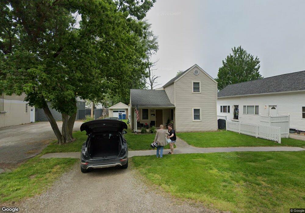
711 E State St Port Clinton, OH 43452
Estimated Value: $125,000 - $186,000
3
Beds
1
Bath
1,274
Sq Ft
$124/Sq Ft
Est. Value
About This Home
This home is located at 711 E State St, Port Clinton, OH 43452 and is currently estimated at $158,429, approximately $124 per square foot. 711 E State St is a home located in Ottawa County with nearby schools including Bataan Memorial Primary School, Bataan Memorial Intermediate School, and Port Clinton Middle School.
Ownership History
Date
Name
Owned For
Owner Type
Purchase Details
Closed on
Jul 1, 2010
Sold by
Ohm Jeffrey J and Ciacelli Maria A
Bought by
Ciacelli Maria A and Ohm Maria A
Current Estimated Value
Purchase Details
Closed on
Feb 15, 2002
Sold by
Hensley Jane
Bought by
Ohm Jeffrey J and Ohm Maria A
Home Financials for this Owner
Home Financials are based on the most recent Mortgage that was taken out on this home.
Original Mortgage
$31,500
Interest Rate
7.23%
Mortgage Type
New Conventional
Purchase Details
Closed on
Aug 7, 1995
Sold by
Wilburn Jerry T
Bought by
Hensley Thomas R and Hensley Janet K
Create a Home Valuation Report for This Property
The Home Valuation Report is an in-depth analysis detailing your home's value as well as a comparison with similar homes in the area
Home Values in the Area
Average Home Value in this Area
Purchase History
| Date | Buyer | Sale Price | Title Company |
|---|---|---|---|
| Ciacelli Maria A | -- | Attorney | |
| Ohm Jeffrey J | $16,500 | -- | |
| Hensley Thomas R | $26,000 | -- |
Source: Public Records
Mortgage History
| Date | Status | Borrower | Loan Amount |
|---|---|---|---|
| Closed | Ohm Jeffrey J | $31,500 |
Source: Public Records
Tax History
| Year | Tax Paid | Tax Assessment Tax Assessment Total Assessment is a certain percentage of the fair market value that is determined by local assessors to be the total taxable value of land and additions on the property. | Land | Improvement |
|---|---|---|---|---|
| 2024 | $1,326 | $38,108 | $11,466 | $26,642 |
| 2023 | $1,353 | $28,053 | $6,552 | $21,501 |
| 2022 | $1,115 | $28,053 | $6,552 | $21,501 |
| 2021 | $1,114 | $28,050 | $6,550 | $21,500 |
| 2020 | $866 | $22,800 | $4,420 | $18,380 |
| 2019 | $858 | $22,800 | $4,420 | $18,380 |
| 2018 | $856 | $22,800 | $4,420 | $18,380 |
| 2017 | $840 | $22,020 | $4,420 | $17,600 |
| 2016 | $842 | $22,020 | $4,420 | $17,600 |
| 2015 | $845 | $22,020 | $4,420 | $17,600 |
| 2014 | $820 | $21,160 | $4,420 | $16,740 |
| 2013 | $907 | $21,160 | $4,420 | $16,740 |
Source: Public Records
Map
Nearby Homes
- 801 E 3rd St
- 218 Elm St
- 525 E 2nd St
- 521 E 2nd St
- 1011 E 2nd St
- 232 Beech St
- 35 N Beach St
- 29 N Beach St
- 122 Washington St
- 311 Walnut St
- 116 Walnut St
- 2621 N Peachtree Lane # Sublot 1
- 2453 N Peachtree Lane # Sublot 7
- 2481 N Peachtree Lane # Sublot 6
- 2565 N Peachtree Lane # Sublot 3
- 0 Mouse Island Unit 20252634
- 2369 N Peachtree Lane # Sublot 10
- 2397 N Peachtree Lane # Sublot 9
- 2509 N Peachtree Lane # Sublot 5
- 0 Mouse Island Unit 5139279
- 715 E State St
- 311 Lincoln Dr
- 315 Lincoln Dr
- 719 E State St
- 710 E 3rd St
- 706 E 3rd St
- 714 E 3rd St
- 716 W Third (3rd) St
- 305 Lincoln Dr
- 718 E 3rd St
- 721 E State St
- 722 E 3rd St
- 725 E State St
- 716 E 3rd St
- 304 Lincoln Dr
- 726 E 3rd St
- 729 E State St
- 729 E State St Unit SI ID1496030P
- 729 E State St Unit ID1061034P
- 231 Lincoln Dr
Your Personal Tour Guide
Ask me questions while you tour the home.