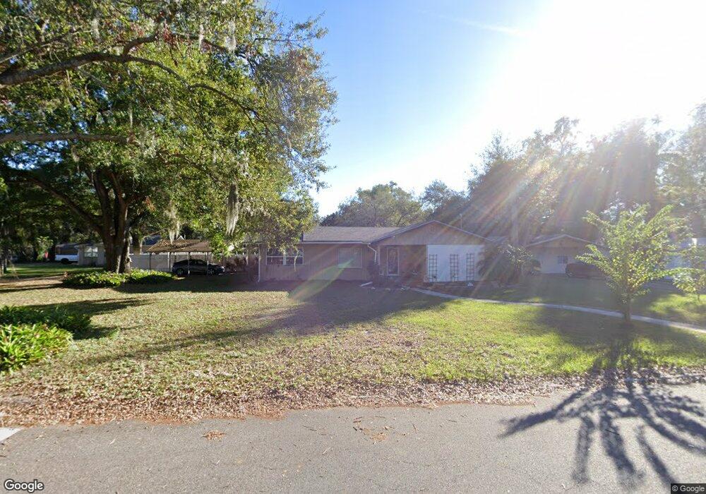
711 Elizabeth Ln Auburndale, FL 33823
Estimated Value: $285,000 - $305,000
2
Beds
2
Baths
1,842
Sq Ft
$161/Sq Ft
Est. Value
About This Home
This home is located at 711 Elizabeth Ln, Auburndale, FL 33823 and is currently estimated at $296,078, approximately $160 per square foot. 711 Elizabeth Ln is a home located in Polk County with nearby schools including Auburndale Central Elementary School, Auburndale Senior High School, and Jewett School of the Arts.
Ownership History
Date
Name
Owned For
Owner Type
Purchase Details
Closed on
Mar 30, 2022
Sold by
Victor Roy Daniel
Bought by
George Laura Kay
Current Estimated Value
Home Financials for this Owner
Home Financials are based on the most recent Mortgage that was taken out on this home.
Original Mortgage
$144,500
Outstanding Balance
$135,147
Interest Rate
3.85%
Mortgage Type
New Conventional
Estimated Equity
$160,932
Purchase Details
Closed on
Dec 6, 2015
Sold by
Scholl Robert L and Scholl Nancy J
Bought by
Kay Roy Daniel Victor and Kay Roy Laura
Home Financials for this Owner
Home Financials are based on the most recent Mortgage that was taken out on this home.
Original Mortgage
$119,000
Interest Rate
3.83%
Purchase Details
Closed on
Dec 6, 2012
Sold by
Scholl Robert T and Scholl Nancy J
Bought by
Scholl Robert T and Scholl Nancy J
Purchase Details
Closed on
Jul 5, 2006
Sold by
Workman Paul and Workman Jean
Bought by
Scholl Robert L and Scholl Nancy J
Purchase Details
Closed on
Jun 28, 2004
Sold by
Delaney Donna
Bought by
Workman Paul and Workman Jean
Home Financials for this Owner
Home Financials are based on the most recent Mortgage that was taken out on this home.
Original Mortgage
$65,000
Interest Rate
6.25%
Purchase Details
Closed on
Feb 10, 2003
Sold by
Russell Carol T
Bought by
Delaney Donna
Home Financials for this Owner
Home Financials are based on the most recent Mortgage that was taken out on this home.
Original Mortgage
$92,150
Interest Rate
5.89%
Purchase Details
Closed on
Dec 6, 1996
Sold by
Merritt Joseph W and Merritt Shelly R
Bought by
Russell William D and Russell Carol T
Home Financials for this Owner
Home Financials are based on the most recent Mortgage that was taken out on this home.
Original Mortgage
$79,448
Interest Rate
7.83%
Purchase Details
Closed on
Jun 2, 1994
Sold by
Bush John W and Bush Lynda L
Bought by
Merritt Joseph W and Merritt Shelly R
Home Financials for this Owner
Home Financials are based on the most recent Mortgage that was taken out on this home.
Original Mortgage
$53,000
Interest Rate
8.46%
Create a Home Valuation Report for This Property
The Home Valuation Report is an in-depth analysis detailing your home's value as well as a comparison with similar homes in the area
Home Values in the Area
Average Home Value in this Area
Purchase History
| Date | Buyer | Sale Price | Title Company |
|---|---|---|---|
| George Laura Kay | -- | Reed Mawhinney & Link Pllc | |
| Kay Roy Daniel Victor | $129,000 | Integrity First Title Llc | |
| Scholl Robert T | -- | Attorney | |
| Scholl Robert L | $189,000 | Sunbelt Title Agency | |
| Workman Paul | $105,000 | -- | |
| Delaney Donna | $95,000 | Polk Professional Title Ins | |
| Russell William D | $79,800 | -- | |
| Merritt Joseph W | $80,000 | -- |
Source: Public Records
Mortgage History
| Date | Status | Borrower | Loan Amount |
|---|---|---|---|
| Open | George Laura Kay | $144,500 | |
| Previous Owner | Kay Roy Daniel Victor | $119,000 | |
| Previous Owner | Workman Paul | $65,000 | |
| Previous Owner | Delaney Donna | $92,150 | |
| Previous Owner | Russell William D | $79,448 | |
| Previous Owner | Merritt Joseph W | $53,000 |
Source: Public Records
Tax History Compared to Growth
Tax History
| Year | Tax Paid | Tax Assessment Tax Assessment Total Assessment is a certain percentage of the fair market value that is determined by local assessors to be the total taxable value of land and additions on the property. | Land | Improvement |
|---|---|---|---|---|
| 2025 | $1,369 | $129,190 | -- | -- |
| 2024 | $1,325 | $125,549 | -- | -- |
| 2023 | $1,325 | $121,892 | $0 | $0 |
| 2022 | $1,279 | $118,342 | $0 | $0 |
| 2021 | $1,264 | $114,895 | $0 | $0 |
| 2020 | $1,247 | $113,309 | $0 | $0 |
| 2018 | $1,210 | $108,696 | $0 | $0 |
| 2017 | $1,172 | $106,460 | $0 | $0 |
| 2016 | $1,156 | $104,270 | $0 | $0 |
| 2015 | $559 | $63,306 | $0 | $0 |
| 2014 | $538 | $62,804 | $0 | $0 |
Source: Public Records
Map
Nearby Homes
- 721 Pilaklakaha Ave
- 155 Pearl St
- 714 Great Barford St
- 132 Mckean St Unit A,B
- 605 Alberta Ave
- 227 Mckean St
- 1311 U S 92 Unit 117
- 1311 U S 92 Unit 42
- 1311 U S 92 Unit 107
- 1311 U S 92 Unit 119
- 1311 U S 92 Unit 36
- 1311 U S 92 Unit 80
- 1311 U S 92 Unit 129
- 1311 U S 92 Unit 115
- 1311 U S 92 Unit 28
- 1311 U S 92 Unit 34
- 1311 U S 92 Unit 67
- 1311 U S 92 Unit 103
- 1311 U S 92 Unit 83
- 1311 U S 92 Unit 141
- 130 Margate Rd
- 715 Elizabeth Ln
- 710 Pilaklakaha Ave
- 712 Pilaklakaha Ave
- 700 Elizabeth Ln
- 714 Pilaklakaha Ave
- 708 Pilaklakaha Ave
- 712 Elizabeth Ln
- 704 Pilaklakaha Ave
- 129 Tempsford Rd
- 716 Pilaklakaha Ave
- 123 Tempsford Rd
- 719 Elizabeth Ln
- 102 Ramsgate Rd
- 119 Tempsford Rd
- 718 Pilaklakaha Ave
- 126 Pearl St
- 711 Pilaklakaha Ave
- 709 Chestnut Rd
- 120 Pearl St