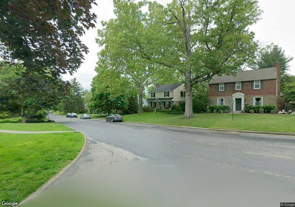
711 Glendalough Rd Glenside, PA 19038
Estimated Value: $495,000 - $669,000
4
Beds
2
Baths
1,856
Sq Ft
$333/Sq Ft
Est. Value
About This Home
This home is located at 711 Glendalough Rd, Glenside, PA 19038 and is currently estimated at $618,896, approximately $333 per square foot. 711 Glendalough Rd is a home located in Montgomery County with nearby schools including Erdenheim Elementary School, Enfield Elementary School, and Springfield Township Middle School.
Ownership History
Date
Name
Owned For
Owner Type
Purchase Details
Closed on
Mar 22, 2016
Sold by
Agnew Lisa and Agnew Agnew
Bought by
Agnew Lisa
Current Estimated Value
Home Financials for this Owner
Home Financials are based on the most recent Mortgage that was taken out on this home.
Original Mortgage
$273,000
Outstanding Balance
$215,863
Interest Rate
3.62%
Mortgage Type
New Conventional
Estimated Equity
$403,034
Purchase Details
Closed on
Nov 20, 2015
Sold by
Agnew Lisa
Bought by
Agnew Christopher and Agnew Lisa
Purchase Details
Closed on
Sep 26, 2002
Sold by
Moessner James T
Bought by
Agnew Lisa
Create a Home Valuation Report for This Property
The Home Valuation Report is an in-depth analysis detailing your home's value as well as a comparison with similar homes in the area
Home Values in the Area
Average Home Value in this Area
Purchase History
| Date | Buyer | Sale Price | Title Company |
|---|---|---|---|
| Agnew Lisa | -- | None Available | |
| Agnew Christopher | -- | Attorney | |
| Agnew Lisa | $190,000 | -- |
Source: Public Records
Mortgage History
| Date | Status | Borrower | Loan Amount |
|---|---|---|---|
| Open | Agnew Lisa | $273,000 |
Source: Public Records
Tax History Compared to Growth
Tax History
| Year | Tax Paid | Tax Assessment Tax Assessment Total Assessment is a certain percentage of the fair market value that is determined by local assessors to be the total taxable value of land and additions on the property. | Land | Improvement |
|---|---|---|---|---|
| 2025 | $7,748 | $164,490 | $49,040 | $115,450 |
| 2024 | $7,748 | $164,490 | $49,040 | $115,450 |
| 2023 | $7,478 | $164,490 | $49,040 | $115,450 |
| 2022 | $7,264 | $164,490 | $49,040 | $115,450 |
| 2021 | $7,074 | $164,490 | $49,040 | $115,450 |
| 2020 | $6,909 | $164,490 | $49,040 | $115,450 |
| 2019 | $6,803 | $164,490 | $49,040 | $115,450 |
| 2018 | $6,803 | $164,490 | $49,040 | $115,450 |
| 2017 | $6,494 | $164,490 | $49,040 | $115,450 |
| 2016 | $6,429 | $164,490 | $49,040 | $115,450 |
| 2015 | $6,286 | $164,490 | $49,040 | $115,450 |
| 2014 | $6,111 | $164,490 | $49,040 | $115,450 |
Source: Public Records
Map
Nearby Homes
- 5 Erdenheim Rd
- 402 Longfield Rd
- 106 Montgomery Ave
- 1104 Cromwell Rd
- 21 Franklin Ave
- 32 Jones Ave
- 303 Glenway Rd
- 21 Jones Ave
- 1005 Harston Ln
- 200 Hillcrest Ave
- 8612 Trumbauer Dr
- 9402 Meadowbrook Ave
- 180 Hillcrest Ave
- 118 E Hillcrest Ave
- 8705 Patton Rd
- 418 Glenway Rd
- 8550 Trumbauer Dr Unit L35
- 404 Pennybrook Ct Unit 15 REDFORD INTERIOR
- 401 Pennybrook Ct Unit 1 REDFORD END
- 403 Pennybrook Ct Unit 2 REDFORD INTERIOR
- 709 Glendalough Rd
- 713 Glendalough Rd
- 707 Glendalough Rd
- 715 Glendalough Rd
- 147 Erdenheim Rd
- 149 Erdenheim Rd
- 143 Erdenheim Rd
- 151 Erdenheim Rd
- 708 Glendalough Rd
- 705 Glendalough Rd
- 710 Glendalough Rd
- 706 Glendalough Rd
- 150 Terminal Ave Unit 25
- 153 Erdenheim Rd
- 139 Erdenheim Rd
- 704 Glendalough Rd
- 712 Glendalough Rd
- 120 Terminal Ave
- 703 Glendalough Rd
- 157 Erdenheim Rd