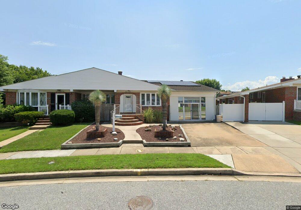
711 Margo Rd Dundalk, MD 21222
Estimated Value: $230,000 - $298,000
3
Beds
2
Baths
1,173
Sq Ft
$224/Sq Ft
Est. Value
About This Home
This home is located at 711 Margo Rd, Dundalk, MD 21222 and is currently estimated at $262,534, approximately $223 per square foot. 711 Margo Rd is a home located in Baltimore County with nearby schools including Berkshire Elementary School, Holabird Middle School, and Dundalk High School.
Ownership History
Date
Name
Owned For
Owner Type
Purchase Details
Closed on
Oct 27, 2014
Sold by
Marston Robert E and Marston Katherine C
Bought by
Marston Katherine C
Current Estimated Value
Home Financials for this Owner
Home Financials are based on the most recent Mortgage that was taken out on this home.
Original Mortgage
$132,000
Outstanding Balance
$44,751
Interest Rate
3.93%
Mortgage Type
New Conventional
Estimated Equity
$217,783
Purchase Details
Closed on
May 12, 1992
Sold by
Marston Robert L
Bought by
Marston Robert E and Marston Katherine C
Create a Home Valuation Report for This Property
The Home Valuation Report is an in-depth analysis detailing your home's value as well as a comparison with similar homes in the area
Home Values in the Area
Average Home Value in this Area
Purchase History
| Date | Buyer | Sale Price | Title Company |
|---|---|---|---|
| Marston Katherine C | -- | Sage Title Group Llc | |
| Marston Robert E | $110,000 | -- |
Source: Public Records
Mortgage History
| Date | Status | Borrower | Loan Amount |
|---|---|---|---|
| Open | Marston Katherine C | $132,000 |
Source: Public Records
Tax History
| Year | Tax Paid | Tax Assessment Tax Assessment Total Assessment is a certain percentage of the fair market value that is determined by local assessors to be the total taxable value of land and additions on the property. | Land | Improvement |
|---|---|---|---|---|
| 2025 | $3,104 | $235,700 | -- | -- |
| 2024 | $3,104 | $218,100 | $0 | $0 |
| 2023 | $1,484 | $200,500 | $38,000 | $162,500 |
| 2022 | $2,923 | $192,200 | $0 | $0 |
| 2021 | $2,122 | $183,900 | $0 | $0 |
| 2020 | $2,691 | $175,600 | $38,000 | $137,600 |
| 2019 | $2,071 | $170,900 | $0 | $0 |
| 2018 | $2,679 | $166,200 | $0 | $0 |
| 2017 | $2,616 | $161,500 | $0 | $0 |
| 2016 | $2,704 | $161,500 | $0 | $0 |
| 2015 | $2,704 | $161,500 | $0 | $0 |
| 2014 | $2,704 | $168,800 | $0 | $0 |
Source: Public Records
Map
Nearby Homes
- 7404 Poplar Ave
- 7406 Poplar Ave
- 7412 Poplar Ave
- 7416 Poplar Ave
- 7428 Poplar Ave
- 7412 Belmont Ave
- 0 Hillshire Rd
- 1220 Hillshire Rd
- 7506 Belmont Ave
- 7503 Cypress Ave
- 874 Mildred Ave
- 7503 Riddle Ave
- 7627 Carson Ave
- 900 N Point Rd
- 1214 S 48th St
- 1502 Vesper Ave
- 1237 Willow Rd
- 619 N Point Rd
- 1213 Willow Rd
- 1708 Rita Rd
Your Personal Tour Guide
Ask me questions while you tour the home.