Estimated Value: $680,000 - $759,000
5
Beds
4
Baths
3,831
Sq Ft
$188/Sq Ft
Est. Value
About This Home
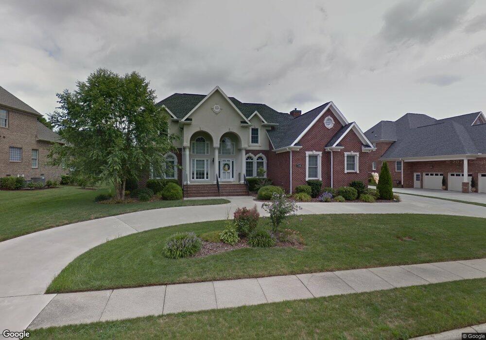
This home is located at 711 Mill Pointe Way, Elon, NC 27244 and is currently estimated at $722,106, approximately $188 per square foot. 711 Mill Pointe Way is a home located in Alamance County with nearby schools including Western Alamance Middle School, Western Alamance High School, and The Burlington School.
Ownership History
Date
Name
Owned For
Owner Type
Purchase Details
Closed on
Sep 26, 2007
Sold by
Empire Homes Inc
Bought by
Blank David L
Current Estimated Value
Home Financials for this Owner
Home Financials are based on the most recent Mortgage that was taken out on this home.
Original Mortgage
$351,200
Outstanding Balance
$221,541
Interest Rate
6.41%
Mortgage Type
New Conventional
Estimated Equity
$500,565
Create a Home Valuation Report for This Property
The Home Valuation Report is an in-depth analysis detailing your home's value as well as a comparison with similar homes in the area
Home Values in the Area
Average Home Value in this Area
Purchase History
| Date | Buyer | Sale Price | Title Company |
|---|---|---|---|
| Blank David L | $439,000 | -- |
Source: Public Records
Mortgage History
| Date | Status | Borrower | Loan Amount |
|---|---|---|---|
| Open | Blank David L | $351,200 |
Source: Public Records
Tax History Compared to Growth
Tax History
| Year | Tax Paid | Tax Assessment Tax Assessment Total Assessment is a certain percentage of the fair market value that is determined by local assessors to be the total taxable value of land and additions on the property. | Land | Improvement |
|---|---|---|---|---|
| 2025 | $3,243 | $656,419 | $60,000 | $596,419 |
| 2024 | $3,079 | $656,419 | $60,000 | $596,419 |
| 2023 | $5,108 | $656,419 | $60,000 | $596,419 |
| 2022 | $4,977 | $454,698 | $65,000 | $389,698 |
| 2021 | $5,022 | $454,698 | $65,000 | $389,698 |
| 2020 | $5,067 | $454,698 | $65,000 | $389,698 |
| 2019 | $5,082 | $454,698 | $65,000 | $389,698 |
| 2018 | $0 | $454,698 | $65,000 | $389,698 |
| 2017 | $4,683 | $454,698 | $65,000 | $389,698 |
| 2016 | $4,625 | $462,543 | $65,000 | $397,543 |
| 2015 | $2,669 | $462,543 | $65,000 | $397,543 |
| 2014 | -- | $462,543 | $65,000 | $397,543 |
Source: Public Records
Map
Nearby Homes
- 509 Fieldstone Dr
- 2915 Truitt Dr
- 3232 Hiddenwood Ln
- 400 Brickwalk Ct
- 622-624 S Williamson Ave
- 115 Coachlight Trail
- 2821 Edgewood Ave
- 1246 Jamestowne Dr
- 2804 Edgewood Ave
- 2616 Amherst Ct
- 3487 Forestdale Dr Unit 1C
- 3489 Forestdale Dr Unit 1C
- 3475 Forestdale Dr Unit 2a
- 302 Green Ct
- 2511 Hickory Ave
- 240 Coachlight Trail
- 818 Colonial Dr
- 2407 Saddle Club Rd
- 106 Timberlake Dr
- 420 Collinwood Dr
- 713 Mill Pointe Way
- 709 Mill Pointe Way
- 5008 Gleneagles Ct
- 2000 Muirfield Ct
- 715 Mill Pointe Way
- 5009 Gleneagles Ct
- 2002 Muirfield Ct
- 712 Mill Pointe Way
- 710 Mill Pointe Way
- 5006 Gleneagles Ct
- 2004 Muirfield Ct
- 714 Mill Pointe Way
- 3001 Sunningdale Ct
- 716 Mill Pointe Way
- 901 Mill Pointe Way
- 5007 Gleneagles Ct
- 3003 Sunningdale Ct
- 3003 Sunningdale Ct Unit 22
- 5004 Gleneagles Ct
- 706 Mill Pointe Way