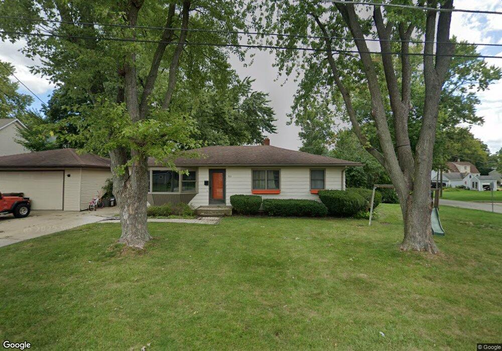
711 Mitchell St Woodstock, IL 60098
Estimated Value: $226,000 - $274,000
3
Beds
1
Bath
1,092
Sq Ft
$233/Sq Ft
Est. Value
About This Home
This home is located at 711 Mitchell St, Woodstock, IL 60098 and is currently estimated at $253,926, approximately $232 per square foot. 711 Mitchell St is a home located in McHenry County with nearby schools including Dean Street Elementary School, Creekside Middle School, and Woodstock High School.
Ownership History
Date
Name
Owned For
Owner Type
Purchase Details
Closed on
Dec 19, 2016
Sold by
Woodward Michael F
Bought by
Ingeman Christopher W and Ingeman Jaime K
Current Estimated Value
Purchase Details
Closed on
Dec 12, 2003
Sold by
Rodig Sue A and Lewis Evan W
Bought by
Woodward Dorothy C
Purchase Details
Closed on
Mar 22, 1995
Sold by
Rodig Paul H
Bought by
Rodig Sue A
Create a Home Valuation Report for This Property
The Home Valuation Report is an in-depth analysis detailing your home's value as well as a comparison with similar homes in the area
Home Values in the Area
Average Home Value in this Area
Purchase History
| Date | Buyer | Sale Price | Title Company |
|---|---|---|---|
| Ingeman Christopher W | -- | Attorney | |
| Woodward Michael F | -- | None Available | |
| Woodward Dorothy C | $157,500 | Ticor | |
| Rodig Sue A | -- | -- |
Source: Public Records
Tax History Compared to Growth
Tax History
| Year | Tax Paid | Tax Assessment Tax Assessment Total Assessment is a certain percentage of the fair market value that is determined by local assessors to be the total taxable value of land and additions on the property. | Land | Improvement |
|---|---|---|---|---|
| 2024 | $5,524 | $67,955 | $7,951 | $60,004 |
| 2023 | $5,229 | $61,453 | $7,190 | $54,263 |
| 2022 | $5,004 | $54,538 | $6,381 | $48,157 |
| 2021 | $4,744 | $50,956 | $5,962 | $44,994 |
| 2020 | $4,558 | $48,419 | $5,665 | $42,754 |
| 2019 | $4,412 | $46,219 | $5,408 | $40,811 |
| 2018 | $3,988 | $41,783 | $6,169 | $35,614 |
| 2017 | $3,898 | $39,325 | $5,806 | $33,519 |
| 2016 | $4,595 | $36,412 | $5,376 | $31,036 |
| 2013 | -- | $39,127 | $9,452 | $29,675 |
Source: Public Records
Map
Nearby Homes
- 104 Stewart Ave
- 125 Forest Ave
- 421 W Kimball Ave
- 415 Dean St
- 908 Bunker St
- 331 Chestnut St
- 155 Lee Ann Ln
- 3824 Riverwoods Dr
- 3902 Riverwoods Dr
- 1249 Prairie Ridge Trail
- 4022 Meadowridge Rd
- 3857 Riverwoods Dr
- 3917 Riverwoods Dr
- 3905 Riverwoods Dr
- 3839 Riverwoods Dr
- 3845 Riverwoods Dr
- 1288 Prairie Ridge Trail
- 1253 Prairie Ridge Trail
- 1245 Prairie Ridge Trail
- Brighton Plan at Clublands of Antioch - Horizon Series
- 318 Stewart Ave
- 312 Stewart Ave
- 400 Stewart Ave
- 323 Forrest Ave
- 319 Forrest Ave
- 319 Forest Ave
- 315 Forrest Ave
- 708 Mitchell St
- 406 Stewart Ave
- 313 Stewart Ave
- 302 Stewart Ave
- 309 Forrest Ave
- 802 Mitchell St
- 412 Stewart Ave
- 804 Gould St
- 407 Forrest Ave
- 303 Forrest Ave
- 405 Stewart Ave
- 000 Dean St
- 418 Stewart Ave