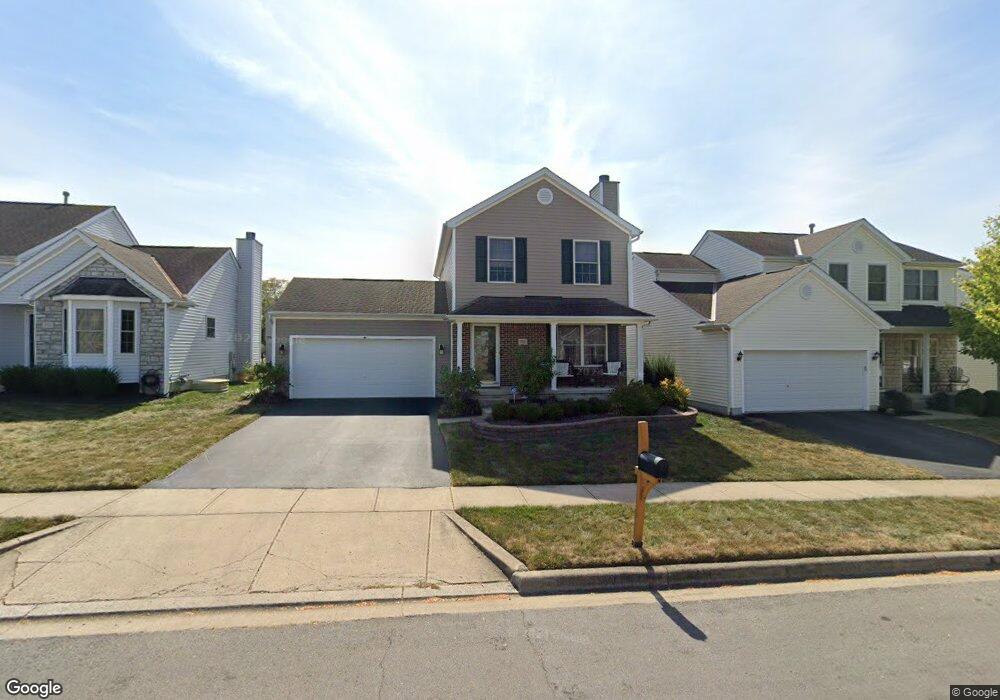
711 Orwell St Lithopolis, OH 43136
Bloom NeighborhoodEstimated Value: $288,574 - $374,000
3
Beds
3
Baths
1,360
Sq Ft
$253/Sq Ft
Est. Value
About This Home
This home is located at 711 Orwell St, Lithopolis, OH 43136 and is currently estimated at $343,644, approximately $252 per square foot. 711 Orwell St is a home located in Fairfield County with nearby schools including Bloom Carroll Primary School, Bloom Carroll Intermediate School, and Bloom-Carroll Middle School.
Ownership History
Date
Name
Owned For
Owner Type
Purchase Details
Closed on
Sep 15, 2006
Sold by
Dominion Homes Inc
Bought by
Camp Edward S and Camp Cheryl L
Current Estimated Value
Home Financials for this Owner
Home Financials are based on the most recent Mortgage that was taken out on this home.
Original Mortgage
$144,130
Interest Rate
6.59%
Mortgage Type
FHA
Create a Home Valuation Report for This Property
The Home Valuation Report is an in-depth analysis detailing your home's value as well as a comparison with similar homes in the area
Home Values in the Area
Average Home Value in this Area
Purchase History
| Date | Buyer | Sale Price | Title Company |
|---|---|---|---|
| Camp Edward S | $162,200 | None Available |
Source: Public Records
Mortgage History
| Date | Status | Borrower | Loan Amount |
|---|---|---|---|
| Closed | Camp Edward S | $144,130 |
Source: Public Records
Tax History
| Year | Tax Paid | Tax Assessment Tax Assessment Total Assessment is a certain percentage of the fair market value that is determined by local assessors to be the total taxable value of land and additions on the property. | Land | Improvement |
|---|---|---|---|---|
| 2025 | $5,725 | $87,010 | $32,240 | $54,770 |
| 2024 | $5,725 | $72,100 | $8,740 | $63,360 |
| 2023 | $3,025 | $72,100 | $8,740 | $63,360 |
| 2022 | $3,049 | $72,100 | $8,740 | $63,360 |
| 2021 | $2,675 | $57,490 | $6,510 | $50,980 |
| 2020 | $2,695 | $57,490 | $6,510 | $50,980 |
| 2019 | $2,713 | $57,490 | $6,510 | $50,980 |
| 2018 | $2,457 | $48,600 | $6,510 | $42,090 |
| 2017 | $2,184 | $50,050 | $5,480 | $44,570 |
| 2016 | $2,151 | $50,050 | $5,480 | $44,570 |
| 2015 | $2,123 | $48,090 | $5,480 | $42,610 |
| 2014 | $2,052 | $48,090 | $5,480 | $42,610 |
| 2013 | $2,052 | $48,090 | $5,480 | $42,610 |
Source: Public Records
Map
Nearby Homes
- 146 Poe Ave
- 94 Sandburg Dr
- 891 Orwell St
- 197 Faulkner Dr
- 248 Faulkner Dr
- 1375 Hansberry Dr
- 89 Wheatley St
- 557 Eastman Ave
- 607 Eastman Ave
- 777 Faulkner Dr
- 0 Columbus St Unit 225023784
- 290 Jonathan Trail
- 5225 Lithopolis Winchester Nw Rd
- 6495 Saylor St
- 5795 Lithopolis Winchester Rd NW
- 19 W Columbus St
- 678 Green Forest Place
- 680 Crestview Dr
- 631 Rolling Acre Dr
- 6065 Wilson Dr
- 721 Orwell St
- 701 Orwell St
- 731 Orwell St
- 687 Orwell St
- 710 Salinger Dr
- 700 Salinger Dr
- 720 Salinger Dr
- 720 Salinger Dr Unit 36
- 684 Salinger Dr
- 684 Salinger Dr Unit 33
- 741 Orwell St
- 730 Salinger Dr
- 730 Salinger Dr Unit 37
- 133 Salinger Dr
- 133 Salinger Dr Unit 31
- 708 Orwell St
- 718 Orwell St
- 718 Orwell St
- 718 Orwell St Unit 67
- 728 Orwell St
Your Personal Tour Guide
Ask me questions while you tour the home.