Estimated Value: $903,644 - $977,000
4
Beds
3
Baths
2,826
Sq Ft
$333/Sq Ft
Est. Value
About This Home
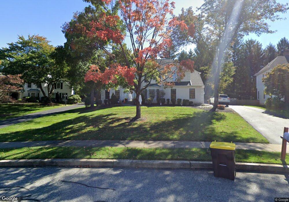
This home is located at 711 Outpost Cir, Wayne, PA 19087 and is currently estimated at $940,911, approximately $332 per square foot. 711 Outpost Cir is a home located in Montgomery County with nearby schools including Roberts Elementary School, Upper Merion Middle School, and Upper Merion High School.
Ownership History
Date
Name
Owned For
Owner Type
Purchase Details
Closed on
Mar 31, 2011
Sold by
Delcane James and Dicastelnuovo Anna Lisa
Bought by
Bhasin Oberoi Kinsi and Oberoi Raman Raj
Current Estimated Value
Home Financials for this Owner
Home Financials are based on the most recent Mortgage that was taken out on this home.
Original Mortgage
$306,000
Outstanding Balance
$211,900
Interest Rate
4.88%
Estimated Equity
$729,011
Purchase Details
Closed on
Feb 14, 2011
Sold by
Dicastelnuovo Anna Lisa and Dicastelnuovo Anthony F
Bought by
Delcane James and Dicastelnuovo Anna Lisa
Home Financials for this Owner
Home Financials are based on the most recent Mortgage that was taken out on this home.
Original Mortgage
$306,000
Outstanding Balance
$211,900
Interest Rate
4.88%
Estimated Equity
$729,011
Create a Home Valuation Report for This Property
The Home Valuation Report is an in-depth analysis detailing your home's value as well as a comparison with similar homes in the area
Home Values in the Area
Average Home Value in this Area
Purchase History
| Date | Buyer | Sale Price | Title Company |
|---|---|---|---|
| Bhasin Oberoi Kinsi | $612,000 | None Available | |
| Delcane James | -- | None Available |
Source: Public Records
Mortgage History
| Date | Status | Borrower | Loan Amount |
|---|---|---|---|
| Open | Bhasin Oberoi Kinsi | $306,000 | |
| Previous Owner | Delcane James | $120,000 |
Source: Public Records
Tax History Compared to Growth
Tax History
| Year | Tax Paid | Tax Assessment Tax Assessment Total Assessment is a certain percentage of the fair market value that is determined by local assessors to be the total taxable value of land and additions on the property. | Land | Improvement |
|---|---|---|---|---|
| 2025 | $9,398 | $304,970 | $97,470 | $207,500 |
| 2024 | $9,398 | $304,970 | $97,470 | $207,500 |
| 2023 | $9,066 | $304,970 | $97,470 | $207,500 |
| 2022 | $8,677 | $304,970 | $97,470 | $207,500 |
| 2021 | $8,409 | $304,970 | $97,470 | $207,500 |
| 2020 | $8,035 | $304,970 | $97,470 | $207,500 |
| 2019 | $7,898 | $304,970 | $97,470 | $207,500 |
| 2018 | $7,898 | $304,970 | $97,470 | $207,500 |
| 2017 | $7,614 | $304,970 | $97,470 | $207,500 |
| 2016 | $7,495 | $304,970 | $97,470 | $207,500 |
| 2015 | $7,218 | $304,970 | $97,470 | $207,500 |
| 2014 | $7,218 | $304,970 | $97,470 | $207,500 |
Source: Public Records
Map
Nearby Homes
- 356 King of Prussia Rd
- 897 Croton Rd
- 569 Kingwood Rd
- 545 Kingwood Rd
- 679 Crestwood Rd
- 501 W Dekalb Pike
- 359 Valley View Rd
- 906 Bismark Way
- 424 Weadley Rd
- 691 Twin Bridge Dr
- 1141 Lafayette Rd
- 612 Brewster Alley Unit 74
- 608 Brewster Alley
- 301 Hughes Rd
- 394 Stonybrook Rd
- 401 Lakeview Ct
- 330 Crossfield Rd
- 200 Prince Frederick St Unit J3
- 400 Highview Dr
- 345 W Signal Hill Rd