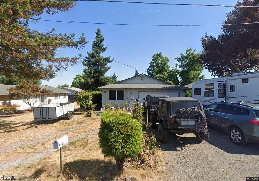
711 Patrol St Molalla, OR 97038
Estimated Value: $407,000 - $451,000
3
Beds
1
Bath
1,263
Sq Ft
$341/Sq Ft
Est. Value
About This Home
This home is located at 711 Patrol St, Molalla, OR 97038 and is currently estimated at $431,238, approximately $341 per square foot. 711 Patrol St is a home located in Clackamas County with nearby schools including Molalla River Academy, Country Christian School, and Oregon Outreach - Molalla Pride.
Ownership History
Date
Name
Owned For
Owner Type
Purchase Details
Closed on
Apr 11, 2008
Sold by
May Vincent C and May Barbara J
Bought by
Wallender Jason and Wallender Heidi
Current Estimated Value
Home Financials for this Owner
Home Financials are based on the most recent Mortgage that was taken out on this home.
Original Mortgage
$204,300
Outstanding Balance
$128,974
Interest Rate
5.99%
Mortgage Type
VA
Estimated Equity
$302,264
Purchase Details
Closed on
Dec 19, 1997
Sold by
Plunkett Brian A and Plunkett Carmen E
Bought by
May Vincent C and May Barbara J
Home Financials for this Owner
Home Financials are based on the most recent Mortgage that was taken out on this home.
Original Mortgage
$108,000
Interest Rate
7.23%
Create a Home Valuation Report for This Property
The Home Valuation Report is an in-depth analysis detailing your home's value as well as a comparison with similar homes in the area
Home Values in the Area
Average Home Value in this Area
Purchase History
| Date | Buyer | Sale Price | Title Company |
|---|---|---|---|
| Wallender Jason | $200,000 | Transnation Title Agency Or | |
| May Vincent C | $120,000 | Stewart Title |
Source: Public Records
Mortgage History
| Date | Status | Borrower | Loan Amount |
|---|---|---|---|
| Open | Wallender Jason | $204,300 | |
| Previous Owner | May Vincent C | $108,000 |
Source: Public Records
Tax History Compared to Growth
Tax History
| Year | Tax Paid | Tax Assessment Tax Assessment Total Assessment is a certain percentage of the fair market value that is determined by local assessors to be the total taxable value of land and additions on the property. | Land | Improvement |
|---|---|---|---|---|
| 2025 | $3,652 | $190,640 | -- | -- |
| 2024 | $3,530 | $185,088 | -- | -- |
| 2023 | $3,530 | $179,698 | $0 | $0 |
| 2022 | $2,911 | $174,465 | $0 | $0 |
| 2021 | $2,791 | $169,384 | $0 | $0 |
| 2020 | $2,713 | $164,451 | $0 | $0 |
| 2019 | $2,634 | $159,662 | $0 | $0 |
| 2018 | $2,561 | $155,012 | $0 | $0 |
| 2017 | $2,455 | $150,497 | $0 | $0 |
| 2016 | $2,328 | $146,114 | $0 | $0 |
| 2015 | $2,262 | $141,858 | $0 | $0 |
| 2014 | $2,171 | $137,726 | $0 | $0 |
Source: Public Records
Map
Nearby Homes
- 704 Patrol St
- 122 N Cole Ave
- 207 Finneys Ave
- 619 E Heintz St
- 162 Fenton Ave Unit C
- 820 E 3rd St
- 118 Engle Ave
- 225 N Molalla Ave
- 123 Shirley St
- 121 W Ross St
- 821 E 7th St
- 206 S Molalla Ave
- 416 Kennel Ave
- 15160 S Highway 211
- 208 W Heintz St Unit 2
- 205 W Heintz St Unit 708
- 3 Revilot Ct
- 227 Hauser Ct
- 1341 Rachel Ln
- 1101 Rachel Ln