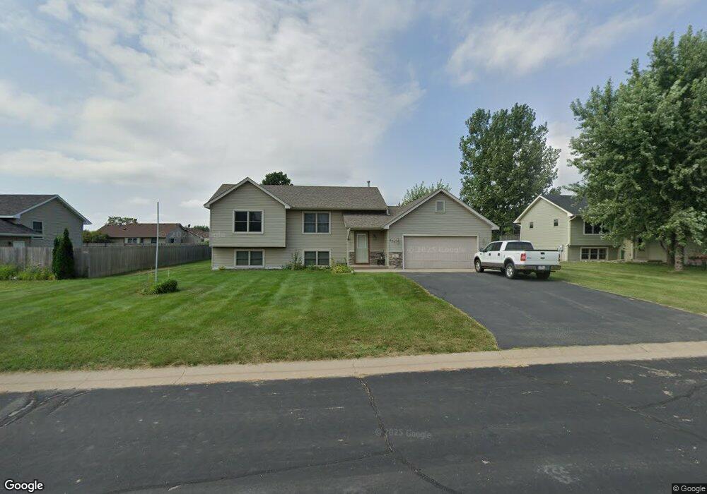
711 Ryan Ronald Rd Roberts, WI 54023
Warren NeighborhoodEstimated Value: $330,000 - $349,000
3
Beds
2
Baths
1,892
Sq Ft
$180/Sq Ft
Est. Value
About This Home
This home is located at 711 Ryan Ronald Rd, Roberts, WI 54023 and is currently estimated at $340,661, approximately $180 per square foot. 711 Ryan Ronald Rd is a home located in St. Croix County with nearby schools including Saint Croix Central Elementary School, Saint Croix Central Middle School, and St. Croix Central High School.
Ownership History
Date
Name
Owned For
Owner Type
Purchase Details
Closed on
Aug 17, 2016
Sold by
Beaver Matthew M and Bever Tanya B
Bought by
Repper Thomas R
Current Estimated Value
Home Financials for this Owner
Home Financials are based on the most recent Mortgage that was taken out on this home.
Original Mortgage
$171,330
Outstanding Balance
$136,480
Interest Rate
3.43%
Mortgage Type
New Conventional
Estimated Equity
$204,181
Purchase Details
Closed on
Mar 20, 2009
Sold by
Korbel Daniel and Difronzo Lisa
Bought by
Bever Matthew M
Home Financials for this Owner
Home Financials are based on the most recent Mortgage that was taken out on this home.
Original Mortgage
$132,554
Interest Rate
5.11%
Mortgage Type
FHA
Create a Home Valuation Report for This Property
The Home Valuation Report is an in-depth analysis detailing your home's value as well as a comparison with similar homes in the area
Home Values in the Area
Average Home Value in this Area
Purchase History
| Date | Buyer | Sale Price | Title Company |
|---|---|---|---|
| Repper Thomas R | $175,000 | Attorney | |
| Bever Matthew M | $135,000 | None Available |
Source: Public Records
Mortgage History
| Date | Status | Borrower | Loan Amount |
|---|---|---|---|
| Open | Repper Thomas R | $171,330 | |
| Previous Owner | Bever Matthew M | $132,554 |
Source: Public Records
Tax History Compared to Growth
Tax History
| Year | Tax Paid | Tax Assessment Tax Assessment Total Assessment is a certain percentage of the fair market value that is determined by local assessors to be the total taxable value of land and additions on the property. | Land | Improvement |
|---|---|---|---|---|
| 2024 | $39 | $303,300 | $62,900 | $240,400 |
| 2023 | $3,900 | $178,800 | $31,500 | $147,300 |
| 2022 | $3,658 | $178,800 | $31,500 | $147,300 |
| 2021 | $3,680 | $178,800 | $31,500 | $147,300 |
| 2020 | $3,726 | $178,800 | $31,500 | $147,300 |
| 2019 | $3,628 | $178,800 | $31,500 | $147,300 |
| 2018 | $3,498 | $178,800 | $31,500 | $147,300 |
| 2017 | $2,964 | $178,800 | $31,500 | $147,300 |
| 2016 | $2,964 | $126,300 | $27,100 | $99,200 |
| 2015 | $2,947 | $126,300 | $27,100 | $99,200 |
| 2014 | $2,773 | $126,300 | $27,100 | $99,200 |
| 2013 | $2,613 | $126,300 | $27,100 | $99,200 |
Source: Public Records
Map
Nearby Homes
- xxx N Division St
- 1224 US Highway 12
- 403 N Cheyenne St
- 256 Dakota Ave
- 249 (Lot 240) Dakota Ave
- 241 (Lot 241) Dakota Ave
- 1108 Susan Ln
- 278 Eagle Ridge Dr
- 239 (Lot 254) Eagle Ridge Dr
- 262 (Lot 247) Eagle Ridge Dr
- 254 (Lot 246) Eagle Ridge Dr
- 246 (Lot 245) Eagle Ridge Dr
- 247 (Lot 253) Eagle Ridge Dr
- 222 (Lot 242) Eagle Ridge Dr
- 223 Eagle Ridge Dr
- 270 Eagle Ridge Dr
- 254 Eagle Ridge Dr
- 270 (Lot 248) Eagle Ridge Dr
- 255 Eagle Ridge Dr
- 230 Eagle Ridge Dr
- 709 Ryan Ronald Rd
- 713 Ryan Ronald Rd
- 710 Lacie D Ln
- 712 Lacie D Ln
- 708 Lacie D Ln
- 710 Ryan Ronald Rd
- 707 Ryan Ronald Rd
- 708 Ryan Ronald Rd
- 712 Ryan Ronald Rd
- 133 Jennifer Rae Jct S
- 706 Lacie D Ln
- 706 Ryan Ronald Rd
- 705 Ryan Ronald Rd
- 711 Robert Phillip Rd
- 709 Lacie D Ln
- 704 Lacie D Ln
- 709 Robert Phillip Rd
- 709 Robert Phillip Place
- 711 Lacie D Ln
- 713 Robert Phillip Rd