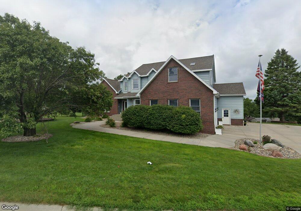
711 S Washington St Bloomfield, NE 68718
Estimated Value: $268,000 - $420,000
4
Beds
4
Baths
2,777
Sq Ft
$124/Sq Ft
Est. Value
About This Home
This home is located at 711 S Washington St, Bloomfield, NE 68718 and is currently estimated at $343,648, approximately $123 per square foot. 711 S Washington St is a home located in Knox County with nearby schools including Bloomfield Elementary School and Bloomfield Junior/Senior High School.
Ownership History
Date
Name
Owned For
Owner Type
Purchase Details
Closed on
Jun 18, 2015
Sold by
Kersten Allan A and Kersten Leann M
Bought by
Davis Brian L and Davis Brenda
Current Estimated Value
Home Financials for this Owner
Home Financials are based on the most recent Mortgage that was taken out on this home.
Original Mortgage
$200,000
Outstanding Balance
$155,730
Interest Rate
3.9%
Mortgage Type
VA
Estimated Equity
$187,918
Create a Home Valuation Report for This Property
The Home Valuation Report is an in-depth analysis detailing your home's value as well as a comparison with similar homes in the area
Home Values in the Area
Average Home Value in this Area
Purchase History
| Date | Buyer | Sale Price | Title Company |
|---|---|---|---|
| Davis Brian L | -- | None Available |
Source: Public Records
Mortgage History
| Date | Status | Borrower | Loan Amount |
|---|---|---|---|
| Open | Davis Brian L | $200,000 |
Source: Public Records
Tax History Compared to Growth
Tax History
| Year | Tax Paid | Tax Assessment Tax Assessment Total Assessment is a certain percentage of the fair market value that is determined by local assessors to be the total taxable value of land and additions on the property. | Land | Improvement |
|---|---|---|---|---|
| 2024 | $3,857 | $336,635 | $22,185 | $314,450 |
| 2023 | $4,315 | $300,090 | $22,185 | $277,905 |
| 2022 | $4,197 | $280,220 | $10,255 | $269,965 |
| 2021 | $4,160 | $274,525 | $10,255 | $264,270 |
| 2020 | $4,187 | $274,525 | $10,255 | $264,270 |
| 2019 | $4,319 | $274,525 | $10,255 | $264,270 |
| 2018 | $4,090 | $263,690 | $10,255 | $253,435 |
| 2017 | $4,143 | $261,320 | $7,885 | $253,435 |
| 2016 | $3,755 | $261,320 | $7,885 | $253,435 |
| 2015 | $3,569 | $236,710 | $6,465 | $230,245 |
| 2014 | $3,823 | $230,070 | $6,465 | $223,605 |
| 2013 | $3,614 | $207,255 | $6,465 | $200,790 |
Source: Public Records
Map
Nearby Homes
- 709 S Washington St
- 707 S Pierce St
- 705 S Pierce St
- 714 S Washington St
- 707 S Washington St
- 703 S Pierce St
- 811 S Broadway St
- 903 S Broadway St
- 805 S Broadway St
- 109 W Ciro St
- 905 S Broadway St
- 702 S Pierce St
- 201 W Park St
- 207 W Park St
- 803 S Broadway St
- 706 S Washington St
- 704 S Washington St
- 707 S Broadway St
- 709 S Broadway St
- 705 S Broadway St