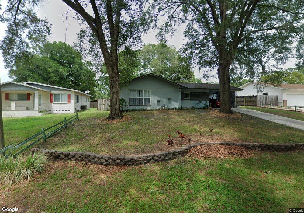
711 Swarthmore Dr Deland, FL 32724
Estimated Value: $191,000 - $320,000
3
Beds
2
Baths
1,782
Sq Ft
$149/Sq Ft
Est. Value
About This Home
This home is located at 711 Swarthmore Dr, Deland, FL 32724 and is currently estimated at $265,300, approximately $148 per square foot. 711 Swarthmore Dr is a home located in Volusia County with nearby schools including Freedom Elementary School, Deland High School, and Deland Middle School.
Ownership History
Date
Name
Owned For
Owner Type
Purchase Details
Closed on
Aug 5, 2015
Sold by
Lafrance Puckett Michelle
Bought by
Puckett Michael Freeman and La France Puckett Michelle
Current Estimated Value
Purchase Details
Closed on
Jan 19, 2012
Sold by
Fannie Mae
Bought by
Hamo Ahron Ben
Purchase Details
Closed on
Aug 26, 2010
Sold by
Puckett Marshall Craig
Bought by
Lafrance Puckett Michelle
Purchase Details
Closed on
Jul 1, 2010
Sold by
Hsbc Bank Usa National Association
Bought by
Puckett Marshall Craig and Lafrance Puckett Michelle
Purchase Details
Closed on
Apr 22, 2010
Sold by
Webb Lowell Anthony
Bought by
Hsbc Bank Usa National Association
Purchase Details
Closed on
Aug 1, 2005
Sold by
Deloach Maria Anjeanette and Graves Maria Anjeanette Deloach
Bought by
Webb Lowell Anthony
Home Financials for this Owner
Home Financials are based on the most recent Mortgage that was taken out on this home.
Original Mortgage
$120,000
Interest Rate
5.77%
Mortgage Type
Fannie Mae Freddie Mac
Purchase Details
Closed on
Nov 17, 1999
Sold by
Webb Lowell Anthony and Deloach Maria Anjeanette
Bought by
Webb Lowell Anthony and Deloach Maria Anjeanette
Home Financials for this Owner
Home Financials are based on the most recent Mortgage that was taken out on this home.
Original Mortgage
$69,700
Interest Rate
7.89%
Mortgage Type
Purchase Money Mortgage
Purchase Details
Closed on
Oct 8, 1997
Sold by
Coml & Residential Ent Inc
Bought by
Webb Lowell Anthony
Home Financials for this Owner
Home Financials are based on the most recent Mortgage that was taken out on this home.
Original Mortgage
$67,500
Interest Rate
7.6%
Purchase Details
Closed on
Aug 15, 1979
Bought by
Puckett Michael Freeman
Purchase Details
Closed on
Jul 15, 1970
Bought by
Puckett Michael Freeman
Create a Home Valuation Report for This Property
The Home Valuation Report is an in-depth analysis detailing your home's value as well as a comparison with similar homes in the area
Home Values in the Area
Average Home Value in this Area
Purchase History
| Date | Buyer | Sale Price | Title Company |
|---|---|---|---|
| Puckett Michael Freeman | -- | Attorney | |
| Hamo Ahron Ben | $37,500 | Title & Abstract Agency Of A | |
| Lafrance Puckett Michelle | -- | None Available | |
| Puckett Marshall Craig | $67,300 | Rels Title | |
| Hsbc Bank Usa National Association | -- | Attorney | |
| Webb Lowell Anthony | -- | Westside Title Services Inc | |
| Webb Lowell Anthony | -- | -- | |
| Webb Lowell Anthony | $75,000 | -- | |
| Coml & Residential Ent Inc | $62,500 | -- | |
| Puckett Michael Freeman | $44,000 | -- | |
| Puckett Michael Freeman | $18,000 | -- |
Source: Public Records
Mortgage History
| Date | Status | Borrower | Loan Amount |
|---|---|---|---|
| Previous Owner | Webb Lowell Anthony | $120,000 | |
| Previous Owner | Webb Lowell Anthony | $69,700 | |
| Previous Owner | Coml & Residential Ent Inc | $67,500 |
Source: Public Records
Tax History Compared to Growth
Tax History
| Year | Tax Paid | Tax Assessment Tax Assessment Total Assessment is a certain percentage of the fair market value that is determined by local assessors to be the total taxable value of land and additions on the property. | Land | Improvement |
|---|---|---|---|---|
| 2025 | $2,371 | $196,725 | $38,180 | $158,545 |
| 2024 | $2,371 | $197,646 | $38,180 | $159,466 |
| 2023 | $2,371 | $194,905 | $33,200 | $161,705 |
| 2022 | $2,178 | $173,383 | $33,200 | $140,183 |
| 2021 | $2,052 | $144,524 | $22,825 | $121,699 |
| 2020 | $1,920 | $134,436 | $18,675 | $115,761 |
| 2019 | $1,896 | $128,095 | $16,600 | $111,495 |
| 2018 | $1,751 | $111,830 | $14,525 | $97,305 |
| 2017 | $1,640 | $100,686 | $14,525 | $86,161 |
| 2016 | $1,540 | $96,386 | $0 | $0 |
| 2015 | $1,491 | $92,492 | $0 | $0 |
| 2014 | $1,322 | $75,755 | $0 | $0 |
Source: Public Records
Map
Nearby Homes
- 2438 Dartmouth Rd
- 810 E Yorkshire Dr
- 2337 Oxmoor Dr
- 2368 Oxmoor Dr
- 2401 Oxmoor Dr
- 204 Wellington Woods Ave
- 2094 Penn Dr
- 2032 Yorkshire Dr
- 2412 Regency Park Dr
- 218 Wellington Woods Ave
- 2400 S Glen Eagles Dr
- 2450 S Glen Eagles Dr
- 2480 S Glen Eagles Dr
- 201 Dyson Dr
- 205 Merlot St
- 316 Nowell Loop
- 929 Torchwood Dr
- 511 Baroness Way
- 257 Huntington Dr
- 307 Tammie Sue Ln
- 723 Swarthmore Dr
- 703 Swarthmore Dr
- 712 Vassar Rd
- 729 Swarthmore Dr
- 685 Swarthmore Dr
- 700 Swarthmore Dr
- 700 Swarthmore Rd
- 736 Vassar Rd
- 2421 Harvard Rd
- 2425 Princeton Rd
- 2438 Harvard Rd
- 2371 Princeton Rd
- 735 Swarthmore Dr
- 735 Swarthmore Dr
- 744 Vassar Rd
- 2429 Princeton Rd
- 709 Vassar Rd
- 686 Vassar Rd
- 2445 Harvard Rd
- 735 Vassar Rd