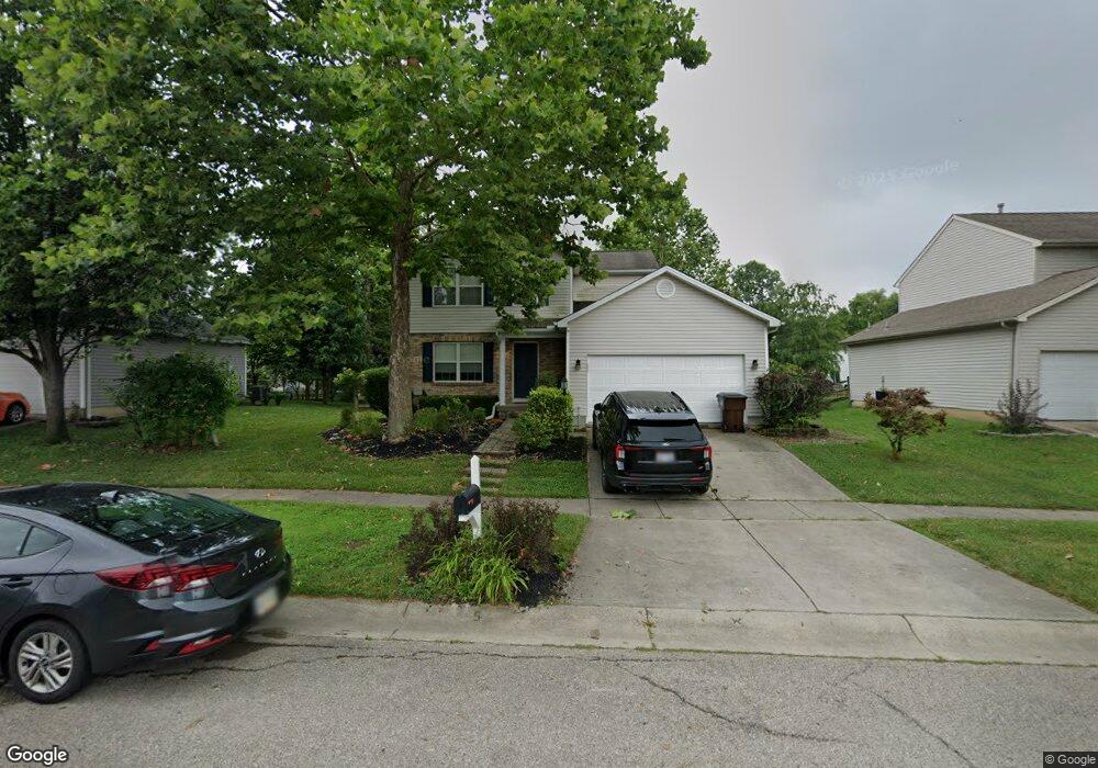
711 Thornton Dr Morrow, OH 45152
Estimated Value: $307,000 - $341,000
3
Beds
3
Baths
1,424
Sq Ft
$227/Sq Ft
Est. Value
About This Home
This home is located at 711 Thornton Dr, Morrow, OH 45152 and is currently estimated at $323,293, approximately $227 per square foot. 711 Thornton Dr is a home located in Warren County with nearby schools including Little Miami Early Childhood Center, Little Miami Intermediate Middle School, and Little Miami Middle School.
Ownership History
Date
Name
Owned For
Owner Type
Purchase Details
Closed on
Mar 15, 2022
Sold by
Mcbreen Amy C
Bought by
Powers Shawn
Current Estimated Value
Home Financials for this Owner
Home Financials are based on the most recent Mortgage that was taken out on this home.
Original Mortgage
$137,300
Outstanding Balance
$108,011
Interest Rate
3.09%
Mortgage Type
New Conventional
Estimated Equity
$215,282
Purchase Details
Closed on
Sep 3, 2020
Sold by
Mcbreen Shawn M and Stehlin Amy C
Bought by
Mcbreen Amy C
Purchase Details
Closed on
Oct 16, 2000
Sold by
Ryland Group Inc
Bought by
Mcbreen Shawn M and Stehlin Amy C
Home Financials for this Owner
Home Financials are based on the most recent Mortgage that was taken out on this home.
Original Mortgage
$143,277
Interest Rate
8.03%
Mortgage Type
New Conventional
Purchase Details
Closed on
May 1, 2000
Sold by
Towne Dev Group Ltd
Bought by
Ryland Group Inc
Create a Home Valuation Report for This Property
The Home Valuation Report is an in-depth analysis detailing your home's value as well as a comparison with similar homes in the area
Home Values in the Area
Average Home Value in this Area
Purchase History
| Date | Buyer | Sale Price | Title Company |
|---|---|---|---|
| Powers Shawn | $250,000 | Elam Jenni B | |
| Mcbreen Amy C | -- | None Available | |
| Mcbreen Shawn M | $146,730 | -- | |
| Ryland Group Inc | $177,000 | -- |
Source: Public Records
Mortgage History
| Date | Status | Borrower | Loan Amount |
|---|---|---|---|
| Open | Powers Shawn | $137,300 | |
| Previous Owner | Mcbreen Shawn M | $143,277 |
Source: Public Records
Tax History
| Year | Tax Paid | Tax Assessment Tax Assessment Total Assessment is a certain percentage of the fair market value that is determined by local assessors to be the total taxable value of land and additions on the property. | Land | Improvement |
|---|---|---|---|---|
| 2025 | $3,916 | $88,270 | $28,000 | $60,270 |
| 2024 | $3,916 | $88,270 | $28,000 | $60,270 |
| 2023 | $3,301 | $66,388 | $12,915 | $53,473 |
| 2022 | $3,346 | $66,388 | $12,915 | $53,473 |
| 2021 | $3,189 | $66,388 | $12,915 | $53,473 |
| 2020 | $2,962 | $53,974 | $10,500 | $43,474 |
| 2019 | $3,012 | $53,974 | $10,500 | $43,474 |
| 2018 | $2,950 | $53,974 | $10,500 | $43,474 |
| 2017 | $2,406 | $44,251 | $9,177 | $35,074 |
| 2016 | $2,465 | $44,251 | $9,177 | $35,074 |
| 2015 | $2,463 | $44,251 | $9,177 | $35,074 |
| 2014 | $2,788 | $44,250 | $9,180 | $35,070 |
| 2013 | $2,732 | $50,630 | $10,500 | $40,130 |
Source: Public Records
Map
Nearby Homes
- 668 Thornton Dr
- 6143 Maple Grove
- 792 Oak Forest Dr
- 767 Elm Tree Dr
- 723 Grande Oaks Dr
- 616 Crabapple Ct
- 1065 Dunstan Ct
- 161 Arbor Glen Ct
- 5546 Wetherly Dr
- 5530 Windsor Ct
- 5234 Highmeadow Place
- 437 Crossbow Dr
- 5079 Ross Ridge Rd
- 6595 Thistle Grove
- 920 Pondside Ln
- 742 Dorney Ct
- 669 Fredericks Pass
- 936 Pondside Ln
- BEACHWOOD Plan at Highmeadow
- SARASOTA Plan at Highmeadow
- 699 Thornton Dr
- 719 Thornton Dr
- 640 Linden Creek
- 630 Linden Creek
- 650 Linden Creek
- 710 Thornton Dr
- 620 Linden Creek
- 735 Thornton Dr
- 700 Thornton Dr
- 677 Thornton Dr
- 662 Linden Creek
- 732 Thornton Dr
- 688 Thornton Dr
- 610 Linden Creek
- 745 Thornton Dr
- 667 Thornton Dr
- 678 Thornton Dr
- 744 Thornton Dr
- 598 Linden Creek
- 684 Linden Creek
Your Personal Tour Guide
Ask me questions while you tour the home.