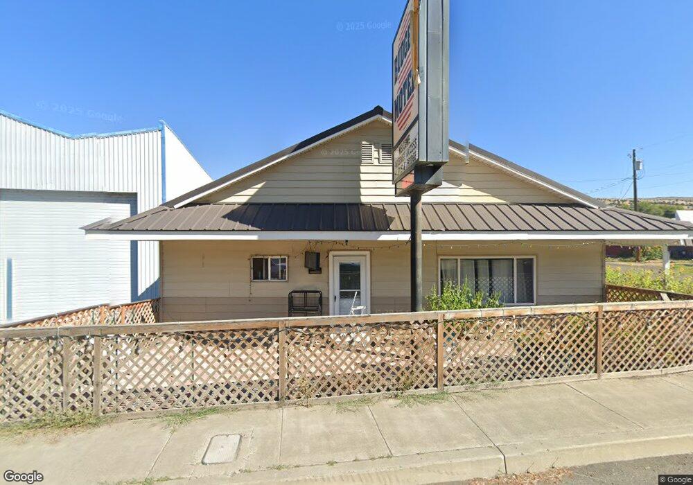
711 W Main St John Day, OR 97845
Estimated Value: $549,343
--
Bed
--
Bath
7,870
Sq Ft
$70/Sq Ft
Est. Value
About This Home
This home is located at 711 W Main St, John Day, OR 97845 and is currently estimated at $549,343, approximately $69 per square foot. 711 W Main St is a home located in Grant County with nearby schools including Grant Union Junior/Senior High School.
Ownership History
Date
Name
Owned For
Owner Type
Purchase Details
Closed on
Oct 1, 2018
Sold by
Shree Yogeshwar Inc
Bought by
Maha Gauri Inc
Current Estimated Value
Home Financials for this Owner
Home Financials are based on the most recent Mortgage that was taken out on this home.
Original Mortgage
$334,000
Outstanding Balance
$250,392
Interest Rate
4.5%
Mortgage Type
Commercial
Estimated Equity
$298,951
Create a Home Valuation Report for This Property
The Home Valuation Report is an in-depth analysis detailing your home's value as well as a comparison with similar homes in the area
Home Values in the Area
Average Home Value in this Area
Purchase History
| Date | Buyer | Sale Price | Title Company |
|---|---|---|---|
| Maha Gauri Inc | $375,000 | None Available |
Source: Public Records
Mortgage History
| Date | Status | Borrower | Loan Amount |
|---|---|---|---|
| Open | Maha Gauri Inc | $334,000 |
Source: Public Records
Tax History Compared to Growth
Tax History
| Year | Tax Paid | Tax Assessment Tax Assessment Total Assessment is a certain percentage of the fair market value that is determined by local assessors to be the total taxable value of land and additions on the property. | Land | Improvement |
|---|---|---|---|---|
| 2024 | $5,156 | $341,187 | $60,272 | $280,915 |
| 2023 | $5,009 | $331,250 | $58,508 | $272,742 |
| 2022 | $4,868 | $321,602 | $56,814 | $264,788 |
| 2021 | $4,764 | $312,235 | $55,157 | $257,078 |
| 2020 | $4,992 | $303,141 | $53,551 | $249,590 |
| 2019 | $4,835 | $294,312 | $70,466 | $223,846 |
| 2018 | $4,394 | $273,110 | $65,390 | $207,720 |
| 2017 | $4,415 | $273,110 | $65,390 | $207,720 |
| 2016 | $4,420 | $273,110 | $65,390 | $207,720 |
| 2015 | $4,631 | $285,740 | $68,416 | $217,324 |
| 2014 | $4,631 | $285,740 | $68,416 | $217,324 |
| 2013 | $4,421 | $277,418 | $85,604 | $191,814 |
Source: Public Records
Map
Nearby Homes
- 0 W Seventh St
- 314 NW 3rd Ave
- 111 Valley View Dr
- 213 NW 4th Ave
- 227 NW 2nd Ave
- 212 NW 5th Ave
- 410 NW Bridge St
- 212 NW Bridge St
- 434 NW Charolais Heights
- 219 Valley View Dr
- 128 SW Canton St
- 312 N Canyon Blvd
- 310 N Canyon Blvd
- 227 Valley View Dr
- 229 Valley View Dr
- 173 N Canyon Blvd
- 250 NE Dayton St
- 0 SW 4th Ave Unit 24562517
- 0 NE 7th St
- 679 W Main St
- 661 W Main St
- 677 W Main St Unit 137
- 741 W Main St
- 660 W Main St
- 651 W Main St
- 637 W Main St
- 635 W Main St
- 608 W Main St
- 200 Ford Rd
- 60940 Highway 26
- 542 W Main St
- 430 NW 4th Ave
- 590 NW Brent Dr
- 550 NW Brent Dr
- 318 NW 3rd Ave
- 318 NW 3rd Ave
- 314 NW 4th Ave
- 0 Volny View Unit 2909369
- 313 NW 4th Ave