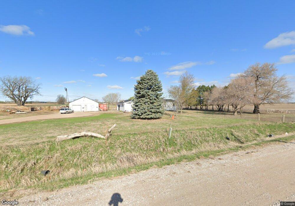
711 Wann Rd Ashland, NE 68003
Estimated Value: $437,590 - $551,000
--
Bed
--
Bath
1,704
Sq Ft
$286/Sq Ft
Est. Value
About This Home
This home is located at 711 Wann Rd, Ashland, NE 68003 and is currently estimated at $486,898, approximately $285 per square foot. 711 Wann Rd is a home located in Saunders County with nearby schools including Ashland-Greenwood Elementary School, Ashland-Greenwood Middle School, and Ashland-Greenwood High School.
Ownership History
Date
Name
Owned For
Owner Type
Purchase Details
Closed on
Dec 7, 2020
Sold by
Ruff Carsten R
Bought by
Ruff Carsten R and Ruff Cody L
Current Estimated Value
Purchase Details
Closed on
Aug 29, 2016
Sold by
Ruff Kay A and Ruff Carsten R
Bought by
Ruff Kay A
Home Financials for this Owner
Home Financials are based on the most recent Mortgage that was taken out on this home.
Original Mortgage
$363,000
Interest Rate
3.48%
Mortgage Type
Reverse Mortgage Home Equity Conversion Mortgage
Create a Home Valuation Report for This Property
The Home Valuation Report is an in-depth analysis detailing your home's value as well as a comparison with similar homes in the area
Home Values in the Area
Average Home Value in this Area
Purchase History
| Date | Buyer | Sale Price | Title Company |
|---|---|---|---|
| Ruff Carsten R | -- | None Available | |
| Ruff Kay A | -- | None Available |
Source: Public Records
Mortgage History
| Date | Status | Borrower | Loan Amount |
|---|---|---|---|
| Previous Owner | Ruff Kay A | $363,000 | |
| Previous Owner | Ruff Kay A | $363,000 |
Source: Public Records
Tax History Compared to Growth
Tax History
| Year | Tax Paid | Tax Assessment Tax Assessment Total Assessment is a certain percentage of the fair market value that is determined by local assessors to be the total taxable value of land and additions on the property. | Land | Improvement |
|---|---|---|---|---|
| 2024 | $2,572 | $283,851 | $102,200 | $181,651 |
| 2023 | $2,771 | $231,840 | $83,000 | $148,840 |
| 2022 | $2,740 | $212,141 | $83,000 | $129,141 |
| 2021 | $2,536 | $198,748 | $83,000 | $115,748 |
| 2020 | $2,479 | $194,461 | $83,000 | $111,461 |
| 2019 | $624 | $174,728 | $83,000 | $91,728 |
| 2018 | $660 | $171,200 | $83,000 | $88,200 |
| 2017 | $68 | $167,330 | $83,000 | $84,330 |
| 2016 | $674 | $167,330 | $83,000 | $84,330 |
| 2015 | $708 | $167,330 | $83,000 | $84,330 |
| 2014 | $2,256 | $150,770 | $69,400 | $81,370 |
| 2012 | $2,486 | $150,770 | $69,400 | $81,370 |
Source: Public Records
Map
Nearby Homes
- 336 N Marina Way
- 716 Timberstone Dr
- 335 S Marina Way
- 723 Firestone Pointe
- 676 Waterford Pointe
- 314 Driftwood Ln
- 660 Red Tail Ln
- 627 Kingfisher Cir
- 1075 Wann Rd
- 0 County Road 5
- 380 County Road F
- 872 Big Wake Point
- 451 County Road B
- 1007 Bluejay Cir
- 2606 Bluejay Way
- 2208 Reagan Rd
- 2202 Bluejay Way
- 2402 Bluejay Way
- 2214 Bluejay Way
- 374 County Road G
- 718 Timberstone Dr
- 684 Timberstone Dr
- 720 Timberstone Dr
- 682 Timberstone Dr
- 680 Timberstone
- 722 Timberstone Dr
- 334 N Marina Way
- 678 Timberstone Dr
- 724 Timberstone Dr
- 676 Timberstone Dr
- 332 N Marina Way
- 674 Timberstone Dr
- 726 Timberstone Dr
- 330 N Marina Way
- 672 Timberstone Dr
- 341 Timberstone Dr
- 670 Timberstone Dr
- 331 S Marina Way
- 328 N Marina Way
- 44 Thomas Lake Rd