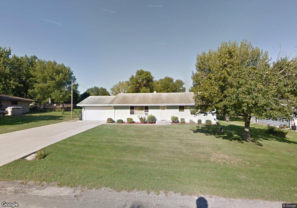
7111 Cindy Dr Rockford, IL 61109
Estimated Value: $191,000 - $238,000
4
Beds
2
Baths
1,500
Sq Ft
$139/Sq Ft
Est. Value
About This Home
This home is located at 7111 Cindy Dr, Rockford, IL 61109 and is currently estimated at $208,005, approximately $138 per square foot. 7111 Cindy Dr is a home located in Winnebago County with nearby schools including Arthur Froberg Elementary School, Bernard W. Flinn Middle School, and Jefferson High School.
Ownership History
Date
Name
Owned For
Owner Type
Purchase Details
Closed on
Sep 3, 2015
Sold by
Butler Morris D and Butler Myra G
Bought by
Humphries Robert L and Lorai Humphries
Current Estimated Value
Home Financials for this Owner
Home Financials are based on the most recent Mortgage that was taken out on this home.
Original Mortgage
$78,551
Outstanding Balance
$62,648
Interest Rate
4.37%
Mortgage Type
FHA
Estimated Equity
$145,357
Create a Home Valuation Report for This Property
The Home Valuation Report is an in-depth analysis detailing your home's value as well as a comparison with similar homes in the area
Home Values in the Area
Average Home Value in this Area
Purchase History
| Date | Buyer | Sale Price | Title Company |
|---|---|---|---|
| Humphries Robert L | $80,000 | Lakeshore Title Agency |
Source: Public Records
Mortgage History
| Date | Status | Borrower | Loan Amount |
|---|---|---|---|
| Open | Humphries Robert L | $78,551 |
Source: Public Records
Tax History Compared to Growth
Tax History
| Year | Tax Paid | Tax Assessment Tax Assessment Total Assessment is a certain percentage of the fair market value that is determined by local assessors to be the total taxable value of land and additions on the property. | Land | Improvement |
|---|---|---|---|---|
| 2024 | $2,748 | $49,473 | $6,080 | $43,393 |
| 2023 | $2,490 | $43,623 | $5,361 | $38,262 |
| 2022 | $2,346 | $38,991 | $4,792 | $34,199 |
| 2021 | $2,224 | $35,752 | $4,394 | $31,358 |
| 2020 | $2,113 | $33,799 | $4,154 | $29,645 |
| 2019 | $2,041 | $32,214 | $3,959 | $28,255 |
| 2018 | $2,138 | $32,550 | $3,731 | $28,819 |
| 2017 | $2,081 | $31,152 | $3,571 | $27,581 |
| 2016 | $2,094 | $30,568 | $3,504 | $27,064 |
| 2015 | $2,129 | $30,568 | $3,504 | $27,064 |
| 2014 | $2,893 | $33,075 | $4,374 | $28,701 |
Source: Public Records
Map
Nearby Homes
- 2460 New Milford Church Rd
- 2640 Sioux Ct
- 1826 Leonard Rd
- 3329 Halverson Ct
- 3302 Chick Charney Dr
- 2721 Cascade Dr
- 3621 Baxter Rd
- 2924 Cascade Dr
- 3579 S Bend Rd
- 3976 Rotary Rd
- 6130 Lockwood Dr
- 2556 Revelation Ln Unit 16
- 6444 Abraham Dr
- 1008 40th Ave
- 4120 Mallard Dr
- 1209 39th Ave
- 3342 Citadel Dr
- 3838 Golden Prairie Ave