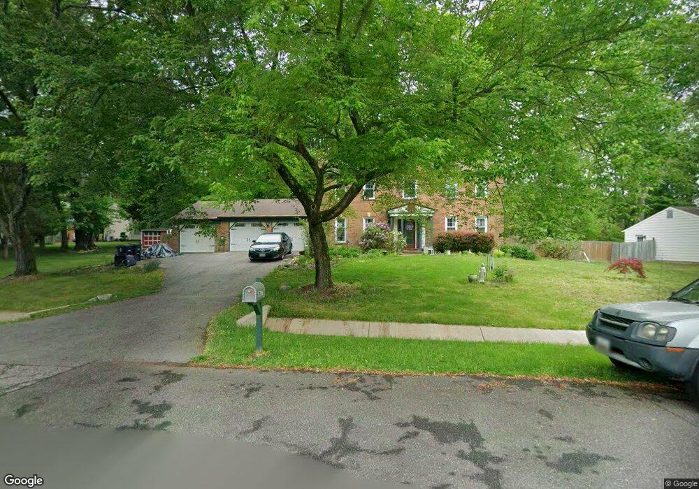
7111 Victoria Place Upper Marlboro, MD 20772
Melwood NeighborhoodEstimated Value: $457,603 - $529,000
--
Bed
3
Baths
2,150
Sq Ft
$225/Sq Ft
Est. Value
About This Home
This home is located at 7111 Victoria Place, Upper Marlboro, MD 20772 and is currently estimated at $483,651, approximately $224 per square foot. 7111 Victoria Place is a home located in Prince George's County with nearby schools including Melwood Elementary School, James Madison Middle School, and Dr. Henry A. Wise Jr. High School.
Ownership History
Date
Name
Owned For
Owner Type
Purchase Details
Closed on
Apr 25, 1994
Sold by
Stewart Carlin O
Bought by
Belmonte Rocco J
Current Estimated Value
Home Financials for this Owner
Home Financials are based on the most recent Mortgage that was taken out on this home.
Original Mortgage
$166,250
Interest Rate
7.6%
Purchase Details
Closed on
Jun 4, 1976
Sold by
Halle Enterprises
Bought by
Stewart Carlin O and Stewart Margaret B
Create a Home Valuation Report for This Property
The Home Valuation Report is an in-depth analysis detailing your home's value as well as a comparison with similar homes in the area
Home Values in the Area
Average Home Value in this Area
Purchase History
| Date | Buyer | Sale Price | Title Company |
|---|---|---|---|
| Belmonte Rocco J | $175,000 | -- | |
| Stewart Carlin O | $67,800 | -- |
Source: Public Records
Mortgage History
| Date | Status | Borrower | Loan Amount |
|---|---|---|---|
| Closed | Belmonte Rocco J | $166,250 |
Source: Public Records
Tax History Compared to Growth
Tax History
| Year | Tax Paid | Tax Assessment Tax Assessment Total Assessment is a certain percentage of the fair market value that is determined by local assessors to be the total taxable value of land and additions on the property. | Land | Improvement |
|---|---|---|---|---|
| 2025 | $5,402 | $421,400 | $103,200 | $318,200 |
| 2024 | $5,402 | $393,100 | $0 | $0 |
| 2023 | $5,174 | $364,800 | $0 | $0 |
| 2022 | $4,893 | $336,500 | $103,200 | $233,300 |
| 2021 | $4,690 | $322,767 | $0 | $0 |
| 2020 | $4,597 | $309,033 | $0 | $0 |
| 2019 | $4,477 | $295,300 | $101,600 | $193,700 |
| 2018 | $4,347 | $284,333 | $0 | $0 |
| 2017 | $4,243 | $273,367 | $0 | $0 |
| 2016 | -- | $262,400 | $0 | $0 |
| 2015 | $3,694 | $254,767 | $0 | $0 |
| 2014 | $3,694 | $247,133 | $0 | $0 |
Source: Public Records
Map
Nearby Homes
- 7100 Victoria Place
- 9101 Sherwood Forest Way
- 9521 Woodyard Cir
- 9705 Woodyard Cir
- 9708 Woodyard Cir
- 9807 Woodyard Cir
- 9103 Columbine Ln
- 7005 Copper Sky Ct
- 7107 Dower House Rd
- 6306 Leapley Rd
- 9802 Healy Ct
- 6616 Pepin Dr
- 7800 Locris Dr
- 7807 Colonial Ln
- 9414 Stream Valley Ln
- 10607 Chickory Ct
- 9706 Green Apple Turn
- 5810 S Marwood Blvd
- 9702 Green Apple Turn
- 8304 Cedarview Ct
- 7109 Victoria Place
- 9416 Victoria Dr
- 9418 Victoria Dr
- 9414 Victoria Dr
- 7107 Victoria Place
- 7112 Victoria Place
- 7108 Victoria Place
- 7114 Victoria Place
- 7106 Shield Ct
- 7105 Victoria Place
- 7106 Victoria Place
- 9410 Victoria Dr
- 9424 Victoria Dr
- 9402 Victoria Ct
- 9417 Victoria Dr
- 7108 Shield Ct
- 9415 Victoria Dr
- 9421 Victoria Dr
- 9403 Victoria Ct
- 7104 Victoria Place