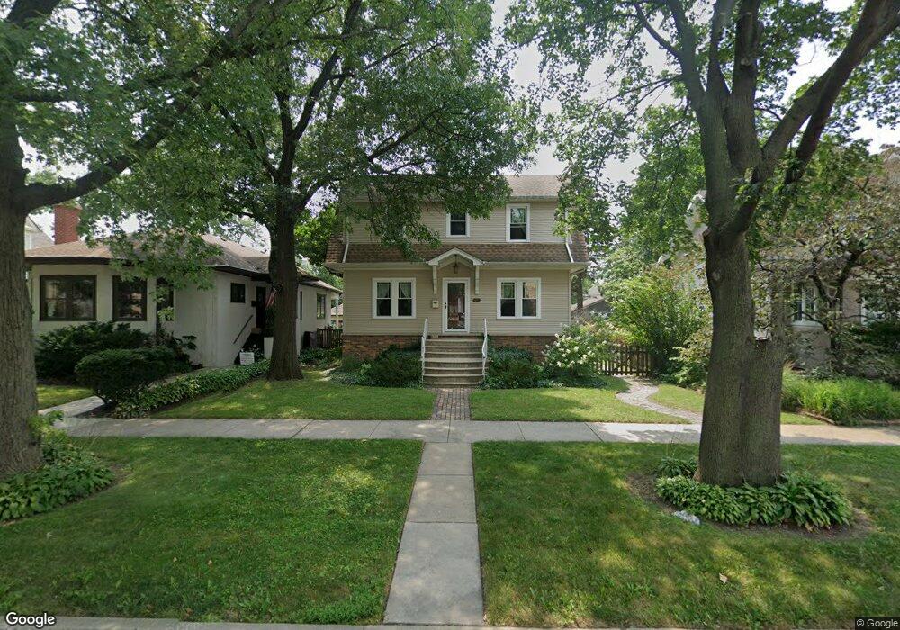
7112 34th St Berwyn, IL 60402
Estimated Value: $357,228 - $418,000
3
Beds
2
Baths
1,591
Sq Ft
$244/Sq Ft
Est. Value
About This Home
This home is located at 7112 34th St, Berwyn, IL 60402 and is currently estimated at $387,807, approximately $243 per square foot. 7112 34th St is a home located in Cook County with nearby schools including Irving Elementary School, Heritage Middle School, and J. Sterling Morton High School West.
Ownership History
Date
Name
Owned For
Owner Type
Purchase Details
Closed on
May 22, 2006
Sold by
Vomacka Frank J
Bought by
Barrett Jennifer A
Current Estimated Value
Home Financials for this Owner
Home Financials are based on the most recent Mortgage that was taken out on this home.
Original Mortgage
$220,000
Outstanding Balance
$129,300
Interest Rate
6.66%
Mortgage Type
Fannie Mae Freddie Mac
Estimated Equity
$258,507
Purchase Details
Closed on
Apr 29, 2005
Sold by
Lange Jeffrey D
Bought by
Vomacka Frank J and Lawton Investment Trust
Purchase Details
Closed on
May 12, 2000
Sold by
Podgorski Terry
Bought by
Lange Jeffrey D
Home Financials for this Owner
Home Financials are based on the most recent Mortgage that was taken out on this home.
Original Mortgage
$149,517
Interest Rate
8.18%
Mortgage Type
FHA
Purchase Details
Closed on
Jul 31, 1999
Sold by
Podgorski Phyllis E
Bought by
Phyllis E Podgorski Revocable Trust
Create a Home Valuation Report for This Property
The Home Valuation Report is an in-depth analysis detailing your home's value as well as a comparison with similar homes in the area
Home Values in the Area
Average Home Value in this Area
Purchase History
| Date | Buyer | Sale Price | Title Company |
|---|---|---|---|
| Barrett Jennifer A | $400,000 | Pntn | |
| Vomacka Frank J | $205,000 | First American Title | |
| Lange Jeffrey D | $151,000 | -- | |
| Phyllis E Podgorski Revocable Trust | -- | -- |
Source: Public Records
Mortgage History
| Date | Status | Borrower | Loan Amount |
|---|---|---|---|
| Open | Barrett Jennifer A | $220,000 | |
| Previous Owner | Lange Jeffrey D | $149,517 |
Source: Public Records
Tax History Compared to Growth
Tax History
| Year | Tax Paid | Tax Assessment Tax Assessment Total Assessment is a certain percentage of the fair market value that is determined by local assessors to be the total taxable value of land and additions on the property. | Land | Improvement |
|---|---|---|---|---|
| 2024 | $8,477 | $25,660 | $6,250 | $19,410 |
| 2023 | $8,102 | $29,797 | $6,250 | $23,547 |
| 2022 | $8,102 | $21,252 | $5,469 | $15,783 |
| 2021 | $7,900 | $21,251 | $5,468 | $15,783 |
| 2020 | $8,084 | $22,506 | $5,468 | $17,038 |
| 2019 | $6,588 | $18,046 | $5,000 | $13,046 |
| 2018 | $6,198 | $18,046 | $5,000 | $13,046 |
| 2017 | $7,019 | $19,542 | $5,000 | $14,542 |
| 2016 | $7,127 | $18,931 | $4,218 | $14,713 |
| 2015 | $6,933 | $18,931 | $4,218 | $14,713 |
| 2014 | $6,709 | $18,931 | $4,218 | $14,713 |
| 2013 | $6,420 | $20,239 | $4,218 | $16,021 |
Source: Public Records
Map
Nearby Homes
- 3515 S Harlem Ave Unit 1B
- 3302 Kenilworth Ave
- 3212 Clinton Ave
- 3548 Clinton Ave
- 3420 Grove Ave
- 3330 Grove Ave Unit 1S
- 475 Shenstone Rd Unit 303
- 3107 Wenonah Ave
- 3142 Kenilworth Ave
- 3731 Maple Ave
- 3032 Wisconsin Ave
- 3416 Euclid Ave
- 3742 Clinton Ave
- 3636 Oak Park Ave
- 727 Selborne Rd
- 3816 Wisconsin Ave
- 339 Eastgrove Rd
- 3829 Wisconsin Ave
- 3729 Grove Ave
- 3731 Grove Ave