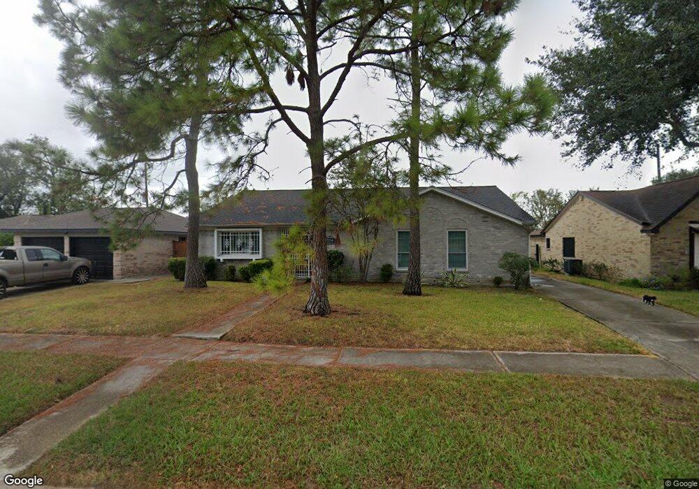
7114 Northleaf Dr Houston, TX 77086
North Houston NeighborhoodEstimated Value: $226,220 - $248,000
3
Beds
2
Baths
1,825
Sq Ft
$130/Sq Ft
Est. Value
About This Home
This home is located at 7114 Northleaf Dr, Houston, TX 77086 and is currently estimated at $238,055, approximately $130 per square foot. 7114 Northleaf Dr is a home located in Harris County with nearby schools including Kujawa EC/Pre-K/K School, Carmichael Elementary School, and Shotwell Middle School.
Ownership History
Date
Name
Owned For
Owner Type
Purchase Details
Closed on
May 22, 1996
Sold by
Sockwell Clarence Leon and Sockwell Mary L
Bought by
Howard Cherster J and Howard Rosa Lee
Current Estimated Value
Home Financials for this Owner
Home Financials are based on the most recent Mortgage that was taken out on this home.
Original Mortgage
$66,467
Outstanding Balance
$3,763
Interest Rate
7.93%
Mortgage Type
FHA
Estimated Equity
$234,292
Create a Home Valuation Report for This Property
The Home Valuation Report is an in-depth analysis detailing your home's value as well as a comparison with similar homes in the area
Home Values in the Area
Average Home Value in this Area
Purchase History
| Date | Buyer | Sale Price | Title Company |
|---|---|---|---|
| Howard Cherster J | -- | Stewart Title |
Source: Public Records
Mortgage History
| Date | Status | Borrower | Loan Amount |
|---|---|---|---|
| Open | Howard Cherster J | $66,467 |
Source: Public Records
Tax History Compared to Growth
Tax History
| Year | Tax Paid | Tax Assessment Tax Assessment Total Assessment is a certain percentage of the fair market value that is determined by local assessors to be the total taxable value of land and additions on the property. | Land | Improvement |
|---|---|---|---|---|
| 2025 | $1,033 | $227,370 | $39,474 | $187,896 |
| 2024 | $1,033 | $230,786 | $39,474 | $191,312 |
| 2023 | $1,033 | $209,770 | $39,474 | $170,296 |
| 2022 | $3,883 | $176,000 | $33,453 | $142,547 |
| 2021 | $3,553 | $164,343 | $33,453 | $130,890 |
| 2020 | $3,591 | $155,439 | $33,453 | $121,986 |
| 2019 | $3,394 | $142,762 | $17,053 | $125,709 |
| 2018 | $1,219 | $141,319 | $17,053 | $124,266 |
| 2017 | $2,704 | $113,857 | $15,313 | $98,544 |
| 2016 | $2,459 | $119,909 | $15,313 | $104,596 |
| 2015 | $1,741 | $111,401 | $15,313 | $96,088 |
| 2014 | $1,741 | $82,000 | $15,313 | $66,687 |
Source: Public Records
Map
Nearby Homes
- 7218 Winding Trace Dr
- 7222 Northleaf Dr
- 7227 Greenyard Dr
- 11007 Tobasa Ct
- 7002 Sandswept Ln
- 7023 Sandswept Ln
- 10711 Heather Hill Dr
- 10614 Mackenzie Dr
- 11006 Crinkleawn Dr
- 10723 Mackenzie Dr
- 6722 Winding Trace Dr
- 5010 Kale Ct
- 6654 Brownie Campbell Rd
- 10307 Bammel North Houston Rd
- 11021 Crenchrus Ct
- 11009 Panicum Ct
- 5103 Dartmoor Ridge Trail
- 6630 Brownie Campbell Rd
- 6911 Silver Star Dr
- 6610 Northleaf Dr
- 7110 Northleaf Dr
- 7118 Northleaf Dr
- 7106 Northleaf Dr
- 7122 Northleaf Dr
- 7134 Canyon Way Dr
- 7102 Northleaf Dr
- 7126 Northleaf Dr
- 7107 Northleaf Dr
- 7126 Canyon Way Dr
- 7135 Canyon Way Dr
- 7103 Northleaf Dr
- 7121 Greenyard Dr
- 7022 Northleaf Dr
- 7119 Greenyard Dr
- 7123 Greenyard Dr
- 7117 Greenyard Dr
- 7125 Greenyard Dr
- 7115 Greenyard Dr
- 7127 Greenyard Dr
- 7131 Canyon Way Dr