Estimated Value: $421,510 - $589,000
3
Beds
3
Baths
1,456
Sq Ft
$354/Sq Ft
Est. Value
About This Home
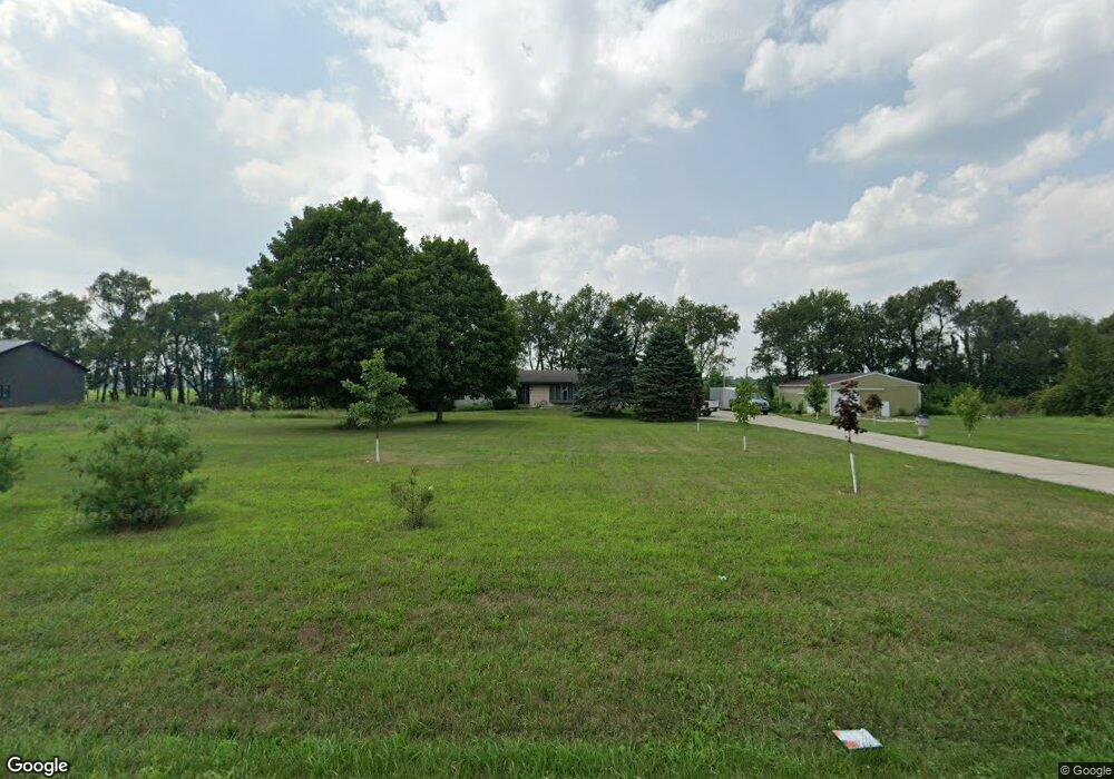
This home is located at 71154 Conrad Rd, Niles, MI 49120 and is currently estimated at $514,837, approximately $353 per square foot. 71154 Conrad Rd is a home located in Cass County with nearby schools including Edwardsburg Primary School, Eagle Lake Elementary School, and Edwardsburg Intermediate School.
Ownership History
Date
Name
Owned For
Owner Type
Purchase Details
Closed on
Dec 9, 2025
Sold by
Mcfarland Sean M
Bought by
Mcfarland Sean M and Gorby Kasondra
Current Estimated Value
Purchase Details
Closed on
Aug 18, 2017
Sold by
Majewski Kathryn A
Bought by
Mcfarland Sean M
Home Financials for this Owner
Home Financials are based on the most recent Mortgage that was taken out on this home.
Original Mortgage
$212,121
Interest Rate
4.03%
Purchase Details
Closed on
Sep 12, 2013
Sold by
Majewski John J and Majewski Kathryn A
Bought by
Majewski John J and Majewski A
Create a Home Valuation Report for This Property
The Home Valuation Report is an in-depth analysis detailing your home's value as well as a comparison with similar homes in the area
Purchase History
We collect this data history from publicly available records. To have your information removed, we recommend requesting removal directly through your county’s website.
| Date | Buyer | Sale Price | Title Company |
|---|---|---|---|
| Mcfarland Sean M | -- | Meridian Title | |
| Mcfarland Sean M | $218,000 | Mtc | |
| Majewski John J | -- | Mtc | |
| Majewski John J | -- | None Available |
Source: Public Records
Mortgage History
We collect this data history from publicly available records. To have your information removed, we recommend requesting removal directly through your county’s website.
| Date | Status | Borrower | Loan Amount |
|---|---|---|---|
| Previous Owner | Majewski John J | $212,121 |
Source: Public Records
Tax History
| Year | Tax Paid | Tax Assessment Tax Assessment Total Assessment is a certain percentage of the fair market value that is determined by local assessors to be the total taxable value of land and additions on the property. | Land | Improvement |
|---|---|---|---|---|
| 2025 | $2,715 | $236,700 | $236,700 | $0 |
| 2024 | $1,232 | $157,400 | $157,400 | $0 |
| 2023 | $1,175 | $145,600 | $0 | $0 |
| 2022 | $1,119 | $122,400 | $0 | $0 |
| 2021 | $2,397 | $105,600 | $0 | $0 |
| 2020 | $2,378 | $106,200 | $0 | $0 |
| 2019 | $2,289 | $104,400 | $0 | $0 |
| 2018 | $1,030 | $95,900 | $0 | $0 |
| 2017 | $783 | $90,700 | $0 | $0 |
| 2016 | $776 | $89,400 | $0 | $0 |
| 2015 | -- | $92,300 | $0 | $0 |
| 2011 | -- | $98,600 | $0 | $0 |
Source: Public Records
Map
Nearby Homes
- 12044 Secluded Trail
- 11704 Madison County Cir
- 11532 Catlin Bridge Ct
- 12064 Adams Rd
- 51272 Bittersweet Rd
- 51150 Mason James Dr
- 11500 Greyson Alan Dr
- 11781 Old Oak Dr
- 51222 Crooked Oak Dr
- 50728 Indiana 23
- 51275 Crooked Oak Dr
- 27532 May St
- 50590 Tecumseh Dr
- 11540 Greyson Alan Dr
- 50985 Sturdy Oak Ln
- 11559 Split Oak Dr
- 50605 Mohawk Dr
- 51060 Broken Wood Ct
- 70163 M 62
- 13702 Broken Wood Dr
- 71074 Conrad Rd
- 28031 Redfield St
- 3398 Redfield Rd
- 305 Conrad Rd
- 27910 Redfield St
- 28054 Redfield St
- 28223 Redfield St
- 27906 Camelot Ln
- 70922 Conrad Rd
- 27973 Clancy Ln
- 27896 Redfield Rd
- 27907 Camelot Ln
- 27929 Clancy Ln
- 70867 Conrad Rd
- 27900 Clancy Ln
- 27900 Clancy Ln
- 12333 Rocky Ridge Trail
- 70824 Conrad Rd
- 230 Conrad Rd
- 70813 Conrad Rd
Your Personal Tour Guide
Ask me questions while you tour the home.