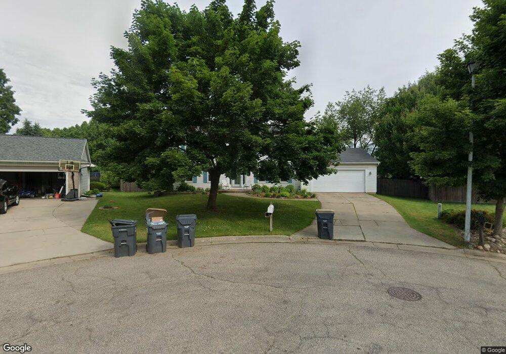
7116 Crown Pointe Cir Portage, MI 49024
Estimated Value: $394,000 - $457,000
4
Beds
3
Baths
2,359
Sq Ft
$177/Sq Ft
Est. Value
About This Home
This home is located at 7116 Crown Pointe Cir, Portage, MI 49024 and is currently estimated at $416,511, approximately $176 per square foot. 7116 Crown Pointe Cir is a home located in Kalamazoo County with nearby schools including Moorsbridge Elementary School, Portage West Middle School, and Portage Northern High School.
Ownership History
Date
Name
Owned For
Owner Type
Purchase Details
Closed on
May 25, 2006
Sold by
Curtiss Steven A and Curtiss Shari L
Bought by
Curtiss Steven A and Curtiss Shari L
Current Estimated Value
Purchase Details
Closed on
Nov 12, 2002
Sold by
Holfinger Michael S and Holfinger Margaret J
Bought by
Curtiss Steven A and Curtiss Shari L
Home Financials for this Owner
Home Financials are based on the most recent Mortgage that was taken out on this home.
Original Mortgage
$174,400
Outstanding Balance
$74,980
Interest Rate
6.38%
Estimated Equity
$341,531
Create a Home Valuation Report for This Property
The Home Valuation Report is an in-depth analysis detailing your home's value as well as a comparison with similar homes in the area
Home Values in the Area
Average Home Value in this Area
Purchase History
| Date | Buyer | Sale Price | Title Company |
|---|---|---|---|
| Curtiss Steven A | -- | Attorney | |
| Curtiss Steven A | $218,000 | Metro |
Source: Public Records
Mortgage History
| Date | Status | Borrower | Loan Amount |
|---|---|---|---|
| Open | Curtiss Steven A | $174,400 |
Source: Public Records
Tax History Compared to Growth
Tax History
| Year | Tax Paid | Tax Assessment Tax Assessment Total Assessment is a certain percentage of the fair market value that is determined by local assessors to be the total taxable value of land and additions on the property. | Land | Improvement |
|---|---|---|---|---|
| 2025 | $5,705 | $190,200 | $0 | $0 |
| 2024 | $5,023 | $190,100 | $0 | $0 |
| 2023 | $4,788 | $157,600 | $0 | $0 |
| 2022 | $5,173 | $136,900 | $0 | $0 |
| 2021 | $5,000 | $132,200 | $0 | $0 |
| 2020 | $4,891 | $121,300 | $0 | $0 |
| 2019 | $440 | $112,800 | $0 | $0 |
| 2018 | $0 | $108,100 | $0 | $0 |
| 2017 | $0 | $105,900 | $0 | $0 |
| 2016 | -- | $110,600 | $0 | $0 |
| 2015 | -- | $102,600 | $0 | $0 |
| 2014 | -- | $101,100 | $0 | $0 |
Source: Public Records
Map
Nearby Homes
- 7160 Crown Pointe Cir
- 2604 Radcliffe Ave
- 1819 Woodland Dr
- 6748 Trotwood St
- 7104 Rockford St
- 6803 Bluegrass St
- 2801 Daventry Ave
- 6636 Trotwood St
- 7403 Rockford St
- 6827 Marlow St
- 1524 Greenview Ave
- 6740 Amberly St
- 7481 Turnberry Ct
- 7464 Saint George Cir
- 7639 Dunross Dr
- 3320 Scots Pine Way Unit 2
- 2029 Brighton Ln Unit 7
- 1998 Brighton Ln Unit 16
- 1922 Brighton Ln Unit 31
- 3318 Davcliff Ave
- 7130 Crown Pointe Cir
- 7115 Crown Pointe Cir
- 7109 Hickory Point Dr
- 7125 Hickory Point Dr
- 7129 Crown Pointe Cir
- 7143 Hickory Point Dr W
- 7143 Hickory Point Dr
- 7143 Crown Pointe Cir
- 7159 Hickory Point Dr
- 7112 Bridlewood Cir
- 7159 Crown Pointe Cir
- 7120 Bridlewood Cir
- 7176 Crown Pointe Cir
- 7138 Bridlewood Cir
- 7102 Bridlewood Cir
- 7106 Hickory Point Dr
- 7175 Hickory Point Dr
- 7124 Hickory Point Dr
- 7090 Hickory Point Dr
- 7175 Crown Pointe Cir