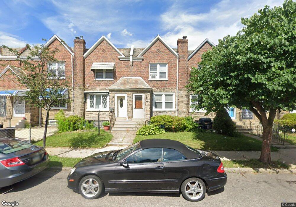
7117 Forrest Ave Philadelphia, PA 19138
West Oak Lane NeighborhoodEstimated Value: $202,000 - $297,000
3
Beds
1
Bath
1,412
Sq Ft
$169/Sq Ft
Est. Value
About This Home
This home is located at 7117 Forrest Ave, Philadelphia, PA 19138 and is currently estimated at $238,903, approximately $169 per square foot. 7117 Forrest Ave is a home located in Philadelphia County with nearby schools including William Rowen School, Gen. Louis Wagner Middle School, and Martin Luther King High School.
Ownership History
Date
Name
Owned For
Owner Type
Purchase Details
Closed on
Feb 14, 2003
Sold by
Cropper John M and Moran Alice
Bought by
Wilson Jack V and Wilson Theresa E
Current Estimated Value
Home Financials for this Owner
Home Financials are based on the most recent Mortgage that was taken out on this home.
Original Mortgage
$33,600
Outstanding Balance
$14,261
Interest Rate
5.95%
Estimated Equity
$224,642
Create a Home Valuation Report for This Property
The Home Valuation Report is an in-depth analysis detailing your home's value as well as a comparison with similar homes in the area
Home Values in the Area
Average Home Value in this Area
Purchase History
| Date | Buyer | Sale Price | Title Company |
|---|---|---|---|
| Wilson Jack V | $42,000 | -- |
Source: Public Records
Mortgage History
| Date | Status | Borrower | Loan Amount |
|---|---|---|---|
| Open | Wilson Jack V | $33,600 |
Source: Public Records
Tax History Compared to Growth
Tax History
| Year | Tax Paid | Tax Assessment Tax Assessment Total Assessment is a certain percentage of the fair market value that is determined by local assessors to be the total taxable value of land and additions on the property. | Land | Improvement |
|---|---|---|---|---|
| 2026 | $2,419 | $208,700 | $41,740 | $166,960 |
| 2025 | $2,419 | $208,700 | $41,740 | $166,960 |
| 2024 | $2,419 | $208,700 | $41,740 | $166,960 |
| 2023 | $2,419 | $172,800 | $34,560 | $138,240 |
| 2022 | $1,806 | $172,800 | $34,560 | $138,240 |
| 2021 | $1,806 | $0 | $0 | $0 |
| 2020 | $1,806 | $0 | $0 | $0 |
| 2019 | $1,886 | $0 | $0 | $0 |
| 2018 | $1,659 | $0 | $0 | $0 |
| 2017 | $1,659 | $0 | $0 | $0 |
| 2016 | $1,659 | $0 | $0 | $0 |
| 2015 | $1,588 | $0 | $0 | $0 |
| 2014 | -- | $118,500 | $10,906 | $107,594 |
| 2012 | -- | $17,056 | $2,846 | $14,210 |
Source: Public Records
Map
Nearby Homes
- 7206 Forrest Ave
- 7245 Ogontz Ave
- 7092 Forrest Ave
- 7313 Limekiln Pike
- 7159 N 20th St
- 1839 E Pastorius St
- 7321 Sommers Rd
- 7188 N Uber St
- 1996 73rd Ave
- 1821 E Tulpehocken St
- 1822 Nolan St
- 7349 E Walnut Ln
- 7016 Andrews Ave
- 1979 73rd Ave
- 1975 73rd Ave
- 7001 Limekiln Pike
- 1980 Penfield St
- 1762 Mohican St
- 1911 72nd Ave
- 6944 Cedar Park Ave
- 7119 Forrest Ave
- 7121 Forrest Ave
- 7115 Forrest Ave
- 7123 Forrest Ave
- 7113 Forrest Ave
- 1942 E Walnut Ln
- 7111 Forrest Ave
- 7125 Forrest Ave
- 7109 Forrest Ave
- 7107 Forrest Ave
- 7105 Forrest Ave
- 7103 Forrest Ave
- 7126 Forrest Ave
- 7101 Forrest Ave
- 7124 Forrest Ave
- 7172 Ogontz Ave
- 7174 Ogontz Ave
- 7122 Forrest Ave
- 7118 Forrest Ave
- 7180 Ogontz Ave