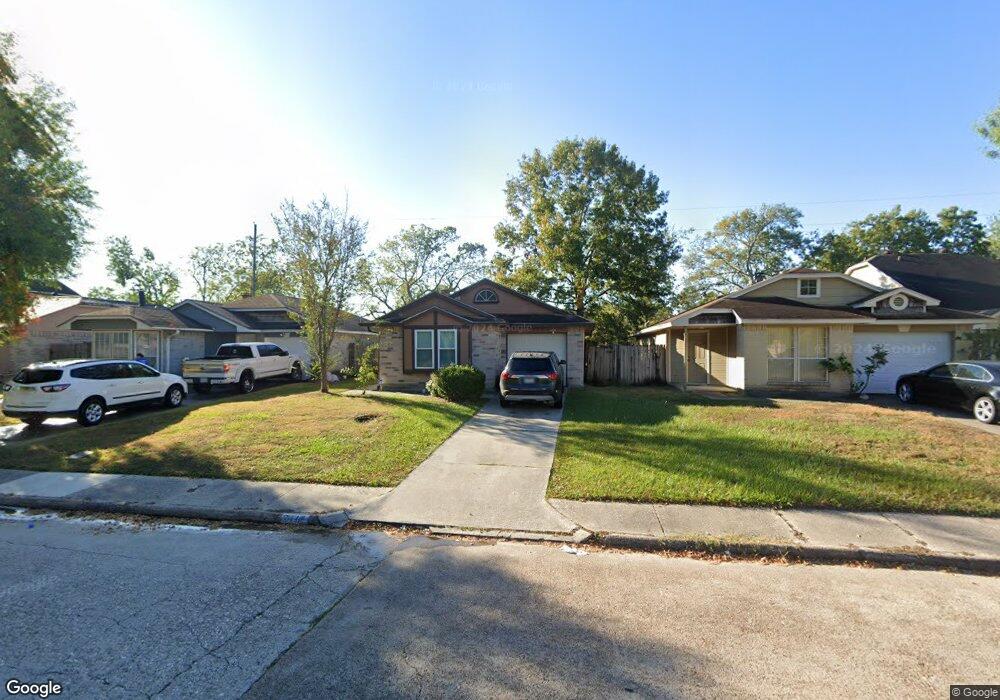
7117 Greenyard Dr Houston, TX 77086
North Houston NeighborhoodEstimated Value: $179,404 - $196,000
3
Beds
2
Baths
1,217
Sq Ft
$152/Sq Ft
Est. Value
About This Home
This home is located at 7117 Greenyard Dr, Houston, TX 77086 and is currently estimated at $185,101, approximately $152 per square foot. 7117 Greenyard Dr is a home located in Harris County with nearby schools including Kujawa EC/Pre-K/K School, Carmichael Elementary School, and Shotwell Middle School.
Ownership History
Date
Name
Owned For
Owner Type
Purchase Details
Closed on
Dec 15, 1997
Sold by
Gortney Danny R and Gortney Jennifer L
Bought by
Mccarter Kim
Current Estimated Value
Home Financials for this Owner
Home Financials are based on the most recent Mortgage that was taken out on this home.
Original Mortgage
$42,893
Outstanding Balance
$7,250
Interest Rate
7.22%
Mortgage Type
FHA
Estimated Equity
$177,851
Purchase Details
Closed on
Oct 21, 1994
Sold by
Gortney George R
Bought by
Gortney Danny R and Gortney Jennifer L
Home Financials for this Owner
Home Financials are based on the most recent Mortgage that was taken out on this home.
Original Mortgage
$18,500
Interest Rate
8.62%
Create a Home Valuation Report for This Property
The Home Valuation Report is an in-depth analysis detailing your home's value as well as a comparison with similar homes in the area
Home Values in the Area
Average Home Value in this Area
Purchase History
| Date | Buyer | Sale Price | Title Company |
|---|---|---|---|
| Mccarter Kim | -- | -- | |
| Gortney Danny R | -- | Stewart Title |
Source: Public Records
Mortgage History
| Date | Status | Borrower | Loan Amount |
|---|---|---|---|
| Open | Mccarter Kim | $42,893 | |
| Previous Owner | Gortney Danny R | $18,500 |
Source: Public Records
Tax History Compared to Growth
Tax History
| Year | Tax Paid | Tax Assessment Tax Assessment Total Assessment is a certain percentage of the fair market value that is determined by local assessors to be the total taxable value of land and additions on the property. | Land | Improvement |
|---|---|---|---|---|
| 2025 | $1,633 | $171,829 | $34,013 | $137,816 |
| 2024 | $1,633 | $167,751 | $28,476 | $139,275 |
| 2023 | $1,633 | $170,111 | $28,476 | $141,635 |
| 2022 | $2,526 | $147,787 | $21,357 | $126,430 |
| 2021 | $2,412 | $125,058 | $21,357 | $103,701 |
| 2020 | $2,334 | $120,829 | $21,357 | $99,472 |
| 2019 | $2,259 | $114,834 | $21,357 | $93,477 |
| 2018 | $785 | $90,167 | $21,357 | $68,810 |
| 2017 | $1,981 | $90,167 | $21,357 | $68,810 |
| 2016 | $1,801 | $65,821 | $21,357 | $44,464 |
| 2015 | $1,708 | $66,381 | $11,865 | $54,516 |
| 2014 | $1,708 | $68,004 | $11,865 | $56,139 |
Source: Public Records
Map
Nearby Homes
- 7222 Northleaf Dr
- 7218 Winding Trace Dr
- 7227 Greenyard Dr
- 11007 Tobasa Ct
- 7002 Sandswept Ln
- 10711 Heather Hill Dr
- 7023 Sandswept Ln
- 5010 Kale Ct
- 10614 Mackenzie Dr
- 10723 Mackenzie Dr
- 11006 Crinkleawn Dr
- 5103 Dartmoor Ridge Trail
- 6722 Winding Trace Dr
- 11021 Crenchrus Ct
- 6654 Brownie Campbell Rd
- 10307 Bammel North Houston Rd
- 11009 Panicum Ct
- 6630 Brownie Campbell Rd
- 6610 Northleaf Dr
- 6911 Silver Star Dr
- 7115 Greenyard Dr
- 7119 Greenyard Dr
- 7111 Greenyard Dr
- 7121 Greenyard Dr
- 7107 Greenyard Dr
- 7123 Greenyard Dr
- 11002 Sacaton Dr
- 7105 Greenyard Dr
- 7125 Greenyard Dr
- 11006 Sacaton Dr
- 11003 Sacaton Dr
- 7103 Greenyard Dr
- 7127 Greenyard Dr
- 11003 Maidencane Ct
- 11008 Sacaton Dr
- 11007 Sacaton Dr
- 7110 Northleaf Dr
- 11007 Maidencane Ct
- 7021 Greenyard Dr
- 7106 Northleaf Dr