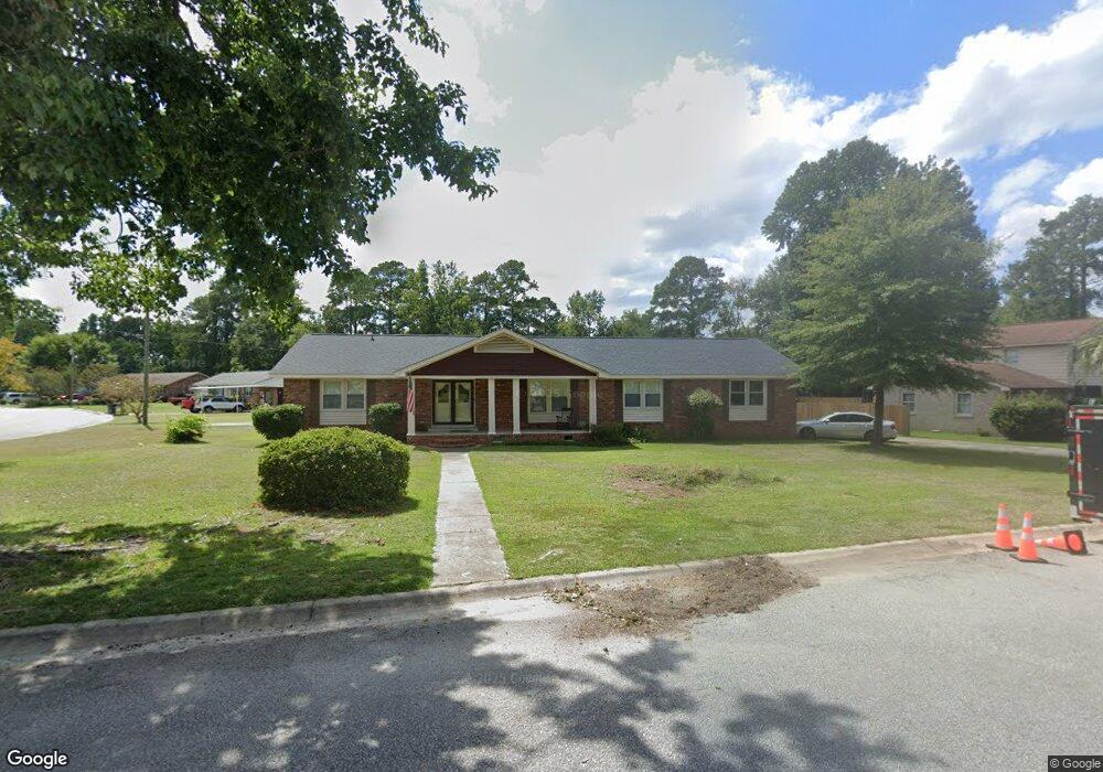
7117 Springate Dr Columbia, SC 29209
The Hamptons NeighborhoodEstimated Value: $324,000 - $371,000
3
Beds
2
Baths
2,467
Sq Ft
$142/Sq Ft
Est. Value
About This Home
This home is located at 7117 Springate Dr, Columbia, SC 29209 and is currently estimated at $349,660, approximately $141 per square foot. 7117 Springate Dr is a home located in Richland County with nearby schools including Meadowfield Elementary School, Hand Middle School, and Dreher High School.
Ownership History
Date
Name
Owned For
Owner Type
Purchase Details
Closed on
Aug 11, 2023
Sold by
Lucas Properties Inc
Bought by
Dryden Stephen Colin
Current Estimated Value
Home Financials for this Owner
Home Financials are based on the most recent Mortgage that was taken out on this home.
Original Mortgage
$284,050
Outstanding Balance
$276,313
Interest Rate
6.71%
Mortgage Type
New Conventional
Estimated Equity
$73,347
Purchase Details
Closed on
Jun 24, 2022
Sold by
Geddings Meador Dorothy Louise
Bought by
Lucas Properties Llc
Home Financials for this Owner
Home Financials are based on the most recent Mortgage that was taken out on this home.
Original Mortgage
$247,500
Interest Rate
5.09%
Mortgage Type
Construction
Purchase Details
Closed on
Apr 4, 2022
Sold by
Geddings Davis Mary
Bought by
Meador Dorothy Louise Geddi and Geddings Jeffrey Hammond
Create a Home Valuation Report for This Property
The Home Valuation Report is an in-depth analysis detailing your home's value as well as a comparison with similar homes in the area
Home Values in the Area
Average Home Value in this Area
Purchase History
| Date | Buyer | Sale Price | Title Company |
|---|---|---|---|
| Dryden Stephen Colin | $299,000 | None Listed On Document | |
| Lucas Properties Llc | $235,000 | None Listed On Document | |
| Meador Dorothy Louise Geddi | -- | None Listed On Document |
Source: Public Records
Mortgage History
| Date | Status | Borrower | Loan Amount |
|---|---|---|---|
| Open | Dryden Stephen Colin | $284,050 | |
| Previous Owner | Lucas Properties Llc | $247,500 |
Source: Public Records
Tax History
| Year | Tax Paid | Tax Assessment Tax Assessment Total Assessment is a certain percentage of the fair market value that is determined by local assessors to be the total taxable value of land and additions on the property. | Land | Improvement |
|---|---|---|---|---|
| 2024 | $2,369 | $299,000 | $49,700 | $249,300 |
| 2023 | $2,270 | $8,656 | $0 | $0 |
| 2022 | $1,446 | $216,400 | $33,700 | $182,700 |
| 2021 | $1,452 | $8,660 | $0 | $0 |
| 2020 | $1,477 | $8,660 | $0 | $0 |
| 2019 | $1,455 | $8,660 | $0 | $0 |
| 2018 | $1,244 | $7,530 | $0 | $0 |
| 2017 | $1,216 | $7,530 | $0 | $0 |
| 2016 | $1,210 | $7,530 | $0 | $0 |
| 2015 | $1,177 | $7,530 | $0 | $0 |
| 2014 | $1,141 | $188,200 | $0 | $0 |
| 2013 | -- | $7,530 | $0 | $0 |
Source: Public Records
Map
Nearby Homes
- 1006 Coatesdale Rd
- 759 Burnside Dr
- 639 Veterans Rd
- 1273 Rockwood Rd
- 6965 Shelley Rd
- 1191 Rockwood Rd
- 600 Rockwood Rd
- 6627 Christie Rd
- 423 Planters Dr
- 612 Lake Forest Rd
- 6427 Christie Rd
- 404 Hampton Forest Dr
- 411 Hampton Forest Dr
- 231 Forest Green Dr
- 833 Forest Park Rd Unit 115
- 6525 Macon Rd
- 164 Springway Dr
- 549 Old Woodlands Rd
- 11 Copperfield Ct
- 424 Chimney Hill Rd
- 7113 Springate Dr
- 907 Knollwood Dr
- 7107 Springate Dr
- 835 Knollwood Dr
- 940 Knollwood Dr
- 840 Knollwood Dr
- 913 Knollwood Dr
- 7116 Springate Dr
- 830 Walters Ln
- 836 Knollwood Dr
- 822 Walters Ln
- 7112 Springate Dr
- 840 Walters Ln
- 831 Knollwood Dr
- 853 Malibu Dr
- 7106 Springate Dr
- 917 Knollwood Dr
- 847 Malibu Dr
- 843 Malibu Dr
- 830 Knollwood Dr
Your Personal Tour Guide
Ask me questions while you tour the home.