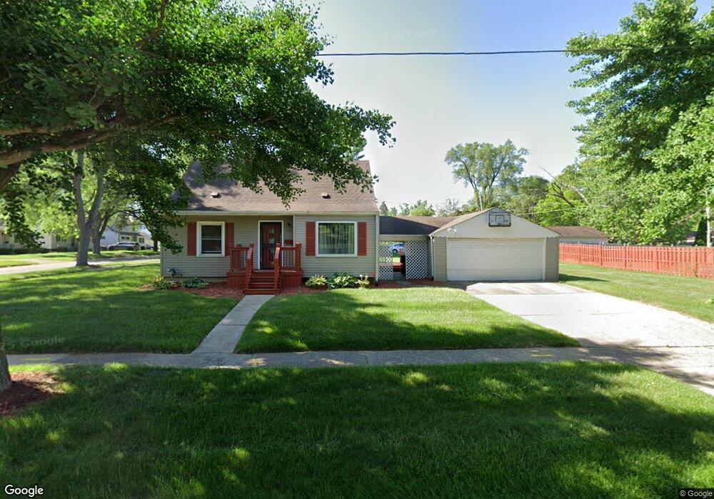
712 Eldon Baker Dr Flint, MI 48507
Circle Neighborhood NeighborhoodEstimated Value: $87,000 - $118,000
3
Beds
2
Baths
1,075
Sq Ft
$93/Sq Ft
Est. Value
About This Home
This home is located at 712 Eldon Baker Dr, Flint, MI 48507 and is currently estimated at $99,712, approximately $92 per square foot. 712 Eldon Baker Dr is a home located in Genesee County with nearby schools including Freeman Elementary School, Flint Southwestern Classical Academy, and International Academy of Flint (K-12).
Ownership History
Date
Name
Owned For
Owner Type
Purchase Details
Closed on
Jun 11, 2020
Sold by
Jackson David
Bought by
Jackson David J M and Cunningham Harry
Current Estimated Value
Purchase Details
Closed on
Feb 8, 2013
Sold by
Jackson David
Bought by
Jackson David
Purchase Details
Closed on
Mar 3, 2003
Sold by
Miles Frederick and Miles Subrina R
Bought by
Jackson David and Jackson Jennifer
Purchase Details
Closed on
Feb 1, 1999
Sold by
Miles Miles F and Miles Subrina R
Bought by
Miles Frederick and Miles Subrina R
Home Financials for this Owner
Home Financials are based on the most recent Mortgage that was taken out on this home.
Original Mortgage
$57,350
Interest Rate
6.81%
Mortgage Type
Purchase Money Mortgage
Create a Home Valuation Report for This Property
The Home Valuation Report is an in-depth analysis detailing your home's value as well as a comparison with similar homes in the area
Home Values in the Area
Average Home Value in this Area
Purchase History
| Date | Buyer | Sale Price | Title Company |
|---|---|---|---|
| Jackson David J M | -- | None Available | |
| Jackson David | -- | None Available | |
| Jackson David | $75,500 | Sargents Title Company | |
| Miles Frederick | -- | Greco Title |
Source: Public Records
Mortgage History
| Date | Status | Borrower | Loan Amount |
|---|---|---|---|
| Previous Owner | Miles Frederick | $57,350 |
Source: Public Records
Tax History
| Year | Tax Paid | Tax Assessment Tax Assessment Total Assessment is a certain percentage of the fair market value that is determined by local assessors to be the total taxable value of land and additions on the property. | Land | Improvement |
|---|---|---|---|---|
| 2025 | $1,287 | $44,300 | $0 | $0 |
| 2024 | $1,155 | $40,000 | $0 | $0 |
| 2023 | $1,129 | $32,100 | $0 | $0 |
| 2022 | $0 | $27,200 | $0 | $0 |
| 2021 | $1,180 | $26,300 | $0 | $0 |
| 2020 | $1,054 | $20,300 | $0 | $0 |
| 2019 | $1,021 | $16,300 | $0 | $0 |
| 2018 | $1,077 | $17,800 | $0 | $0 |
| 2017 | $1,045 | $0 | $0 | $0 |
| 2016 | $1,037 | $0 | $0 | $0 |
| 2015 | -- | $0 | $0 | $0 |
| 2014 | -- | $0 | $0 | $0 |
| 2012 | -- | $21,800 | $0 | $0 |
Source: Public Records
Map
Nearby Homes
- 3505 Comanche Ave
- 720 Algonquin Ave
- 3617 Circle Dr
- 2910 Shawnee Ave
- 3110 Menominee Ave
- 3009 Menominee Ave
- 630 Buckingham Ave
- 621 Burroughs Ave
- 366 E Atherton Rd
- 420 Burroughs Ave
- 4126 Circle Dr
- 352 Buckingham Ave
- 3056 Shaw St
- 4127 Custer Ave
- 3222 Chambers St
- 326 Burroughs Ave
- 617 McKeighan Ave
- 3218 Collingwood Pkwy
- 4424 Cheyenne Ave
- 3914 Red Arrow Rd
- 3314 Dearborn Ave
- 711 Eldon Baker Dr
- 3210 Dearborn Ave
- 3301 Circle Dr
- 3309 Circle Dr
- 3307 Dearborn Ave
- 3313 Dearborn Ave
- 3215 Circle Dr
- 3319 Dearborn Ave
- 3219 Dearborn Ave
- 3317 Circle Dr
- 3402 Dearborn Ave
- 3323 Dearborn Ave
- 3202 Dearborn Ave
- 3406 Dearborn Ave
- 3207 Dearborn Ave
- 3302 Comanche Ave
- 3306 Comanche Ave
- 3201 Circle Dr
- 3310 Comanche Ave
Your Personal Tour Guide
Ask me questions while you tour the home.