Estimated Value: $22,000 - $83,000
--
Bed
1
Bath
710
Sq Ft
$64/Sq Ft
Est. Value
About This Home
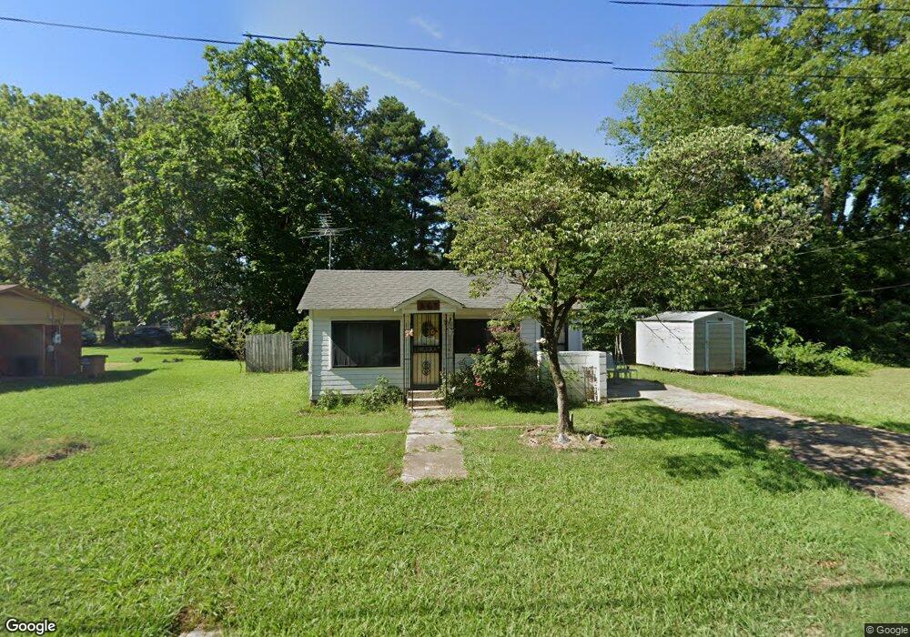
This home is located at 712 Forrest Ave W, Wynne, AR 72396 and is currently estimated at $45,333, approximately $63 per square foot. 712 Forrest Ave W is a home located in Cross County with nearby schools including Wynne Primary School, Wynne Intermediate School, and Wynne Junior High School.
Ownership History
Date
Name
Owned For
Owner Type
Purchase Details
Closed on
Oct 23, 2024
Sold by
Collins Joenell
Bought by
Collins Joenell and Collins Cindy M
Current Estimated Value
Home Financials for this Owner
Home Financials are based on the most recent Mortgage that was taken out on this home.
Original Mortgage
$21,250
Interest Rate
6.73%
Mortgage Type
Construction
Purchase Details
Closed on
Sep 13, 2024
Sold by
Collins Harold E and Collins Jean
Bought by
Collins Joenell
Home Financials for this Owner
Home Financials are based on the most recent Mortgage that was taken out on this home.
Original Mortgage
$21,250
Interest Rate
6.73%
Mortgage Type
Construction
Purchase Details
Closed on
Jul 26, 1977
Bought by
Baxter Amy
Create a Home Valuation Report for This Property
The Home Valuation Report is an in-depth analysis detailing your home's value as well as a comparison with similar homes in the area
Home Values in the Area
Average Home Value in this Area
Purchase History
| Date | Buyer | Sale Price | Title Company |
|---|---|---|---|
| Collins Joenell | -- | None Listed On Document | |
| Collins Joenell | $25,000 | Cowling Title | |
| Baxter Amy | -- | -- |
Source: Public Records
Mortgage History
| Date | Status | Borrower | Loan Amount |
|---|---|---|---|
| Previous Owner | Collins Joenell | $21,250 |
Source: Public Records
Tax History Compared to Growth
Tax History
| Year | Tax Paid | Tax Assessment Tax Assessment Total Assessment is a certain percentage of the fair market value that is determined by local assessors to be the total taxable value of land and additions on the property. | Land | Improvement |
|---|---|---|---|---|
| 2024 | $155 | $3,130 | $950 | $2,180 |
| 2023 | $155 | $3,130 | $950 | $2,180 |
| 2022 | $155 | $3,130 | $950 | $2,180 |
| 2021 | $155 | $3,130 | $950 | $2,180 |
| 2020 | $154 | $3,130 | $950 | $2,180 |
| 2019 | $140 | $2,830 | $910 | $1,920 |
| 2018 | $140 | $2,830 | $910 | $1,920 |
| 2017 | $140 | $2,830 | $910 | $1,920 |
| 2016 | $140 | $2,830 | $910 | $1,920 |
| 2015 | $140 | $2,830 | $910 | $1,920 |
| 2014 | $140 | $4,110 | $830 | $3,280 |
Source: Public Records
Map
Nearby Homes
- 0 Cr 760
- 813 Childress Dr
- 624 C St
- 1002 Brittney Cir
- 0 Brittney Cir Unit 43670
- 0 Brittney Cir Unit 25030957
- 714 Church St N
- 513 Forrest Ave E
- 514 Poplar Ave E
- 607 Bruce St N
- 411 N Bruce St
- 810 Forrest Ave E
- 704 Front St S
- 136 Matthew Addition Cove
- 106 Eldridge Ct
- 919 Hamilton Ave E
- 903 Levesque Ave E
- 1008 Languille Ave E
- 908 Block St S
- 109 Nathan Dr E