Estimated Value: $389,385 - $410,000
4
Beds
1
Bath
2,266
Sq Ft
$177/Sq Ft
Est. Value
About This Home
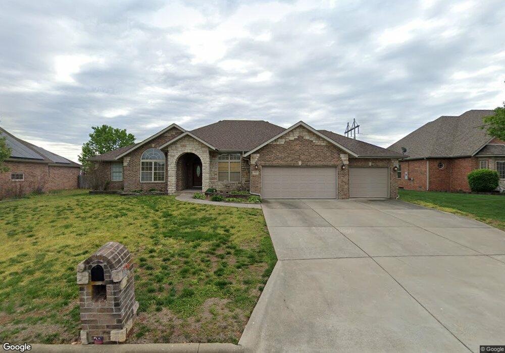
This home is located at 712 Hawthorne Ct, Nixa, MO 65714 and is currently estimated at $400,846, approximately $176 per square foot. 712 Hawthorne Ct is a home with nearby schools including Espy Elementary School, Nixa Junior High School, and Nicholas A. Inman Intermediate School.
Ownership History
Date
Name
Owned For
Owner Type
Purchase Details
Closed on
Mar 6, 2025
Sold by
Hurst Roger James
Bought by
Hurst Gail Ann
Current Estimated Value
Purchase Details
Closed on
Jun 22, 2020
Sold by
Hurst Roger James and Roger James Hurst Revocable Li
Bought by
Hurst Roger James and Qualifi Gail A
Purchase Details
Closed on
Jun 29, 2015
Sold by
Hurst Roger James
Bought by
Roger James Hurts Revocable Living Tust
Purchase Details
Closed on
Mar 21, 2005
Sold by
Wasson Development Co Inc
Bought by
Linville Franklin E and Linville Callie
Home Financials for this Owner
Home Financials are based on the most recent Mortgage that was taken out on this home.
Original Mortgage
$161,600
Interest Rate
5.71%
Mortgage Type
Construction
Create a Home Valuation Report for This Property
The Home Valuation Report is an in-depth analysis detailing your home's value as well as a comparison with similar homes in the area
Home Values in the Area
Average Home Value in this Area
Purchase History
| Date | Buyer | Sale Price | Title Company |
|---|---|---|---|
| Hurst Gail Ann | -- | None Listed On Document | |
| Hurst Gail Ann | -- | None Listed On Document | |
| Hurst Roger James | -- | None Available | |
| Roger James Hurts Revocable Living Tust | -- | None Available | |
| Linville Franklin E | -- | None Available |
Source: Public Records
Mortgage History
| Date | Status | Borrower | Loan Amount |
|---|---|---|---|
| Previous Owner | Linville Franklin E | $161,600 |
Source: Public Records
Tax History
| Year | Tax Paid | Tax Assessment Tax Assessment Total Assessment is a certain percentage of the fair market value that is determined by local assessors to be the total taxable value of land and additions on the property. | Land | Improvement |
|---|---|---|---|---|
| 2025 | $2,629 | $44,840 | -- | -- |
| 2024 | $2,629 | $42,180 | -- | -- |
| 2023 | $2,629 | $42,180 | -- | -- |
| 2022 | $2,632 | $42,180 | $0 | $0 |
| 2021 | $2,634 | $42,180 | $0 | $0 |
| 2020 | $2,542 | $38,860 | $0 | $0 |
| 2019 | $2,542 | $38,860 | $0 | $0 |
| 2018 | $2,277 | $37,370 | $0 | $0 |
| 2017 | $2,277 | $37,370 | $0 | $0 |
| 2016 | $2,242 | $37,370 | $0 | $0 |
| 2015 | $2,245 | $37,370 | $37,370 | $0 |
| 2014 | $2,189 | $37,350 | $0 | $0 |
| 2013 | $2,192 | $37,350 | $0 | $0 |
Source: Public Records
Map
Nearby Homes
- 713 Morning Glory Dr
- 717 N Milton Dr
- 805 W Briarwood Ln
- 711 Robinwood Ln
- 911 Brooke Ct
- 000 (Tbd) Highway 160 (14 8 Acres) St
- 310 Great Plains St
- 1205 W Yellowstone St
- 1334 W Mount Vernon St
- 0 Missouri -- Unit 643 6915104
- 108 W Walnut St
- 000 West St
- 416 N Prospect St
- 1404 Cody Rd
- 307 N Prospect St
- 403 S Bryant St
- 405 N Missouri Ave
- 308 N Prospect St
- 1209 W Mount Vernon St
- Tbd U S 160
- 710 W Wild Rose St
- 714 Hawthorne Ct
- 714 Hawthorne Ct
- 710 Hawthorne Ct
- 713 Hawthorne Ct
- 716 N Hawthorne Dr
- 711 Hawthorne Ct
- 715 Hawthorne Ct
- 707 N Ellen St
- 709 N Ellen St
- 716 Hawthorne Ct
- 718 Hawthorne Ct
- 704 W Wild Rose St
- 717 Hawthorne Ct
- 706 W Wild Rose St
- 708 W Wild Rose
- 718 Hawthorne Ct
- 711 N Ellen St
- 712 N Elderberry Ln
- 714 N Elderberry Ln
Your Personal Tour Guide
Ask me questions while you tour the home.