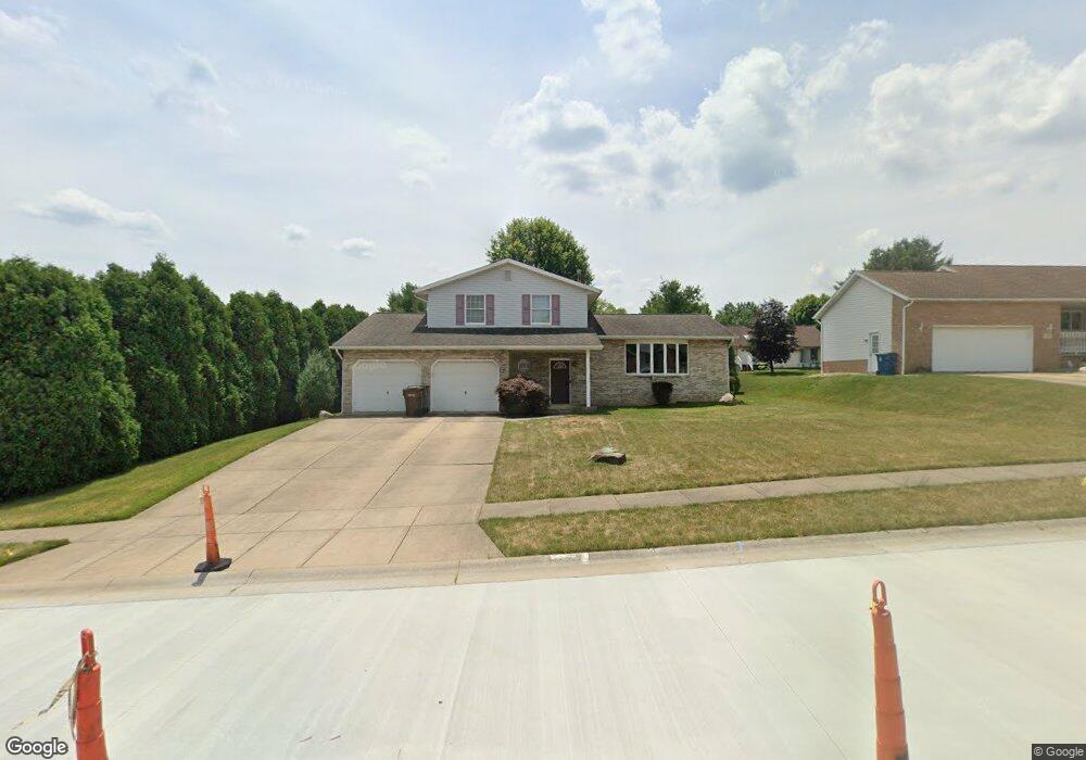
712 Joel Cir Louisville, OH 44641
Estimated Value: $283,000 - $306,000
3
Beds
3
Baths
1,816
Sq Ft
$162/Sq Ft
Est. Value
About This Home
This home is located at 712 Joel Cir, Louisville, OH 44641 and is currently estimated at $293,469, approximately $161 per square foot. 712 Joel Cir is a home located in Stark County with nearby schools including Louisville High School and St. Thomas Aquinas High School & Middle School.
Ownership History
Date
Name
Owned For
Owner Type
Purchase Details
Closed on
Dec 21, 2012
Sold by
Barker Christy D and Hafley Christy D
Bought by
Barker Christy D and Barker Jamie B
Current Estimated Value
Purchase Details
Closed on
Apr 15, 2008
Sold by
Rbs Citizens Na
Bought by
Hafley Christy D
Home Financials for this Owner
Home Financials are based on the most recent Mortgage that was taken out on this home.
Original Mortgage
$137,750
Interest Rate
6.17%
Mortgage Type
Purchase Money Mortgage
Purchase Details
Closed on
Feb 21, 2008
Sold by
Samblanet Terry G and Samblanet Theresa M
Bought by
Rbs Citizens Na
Home Financials for this Owner
Home Financials are based on the most recent Mortgage that was taken out on this home.
Original Mortgage
$137,750
Interest Rate
6.17%
Mortgage Type
Purchase Money Mortgage
Purchase Details
Closed on
Jul 1, 1996
Sold by
Constitution Dev
Bought by
Samblanet Terry G and Samblanet Theresa
Home Financials for this Owner
Home Financials are based on the most recent Mortgage that was taken out on this home.
Original Mortgage
$101,600
Interest Rate
8.13%
Mortgage Type
New Conventional
Create a Home Valuation Report for This Property
The Home Valuation Report is an in-depth analysis detailing your home's value as well as a comparison with similar homes in the area
Home Values in the Area
Average Home Value in this Area
Purchase History
| Date | Buyer | Sale Price | Title Company |
|---|---|---|---|
| Barker Christy D | -- | Patriot Title Agency Inc | |
| Hafley Christy D | $145,000 | Real Estate Title | |
| Rbs Citizens Na | $120,000 | None Available | |
| Samblanet Terry G | $24,900 | -- |
Source: Public Records
Mortgage History
| Date | Status | Borrower | Loan Amount |
|---|---|---|---|
| Previous Owner | Hafley Christy D | $137,750 | |
| Previous Owner | Samblanet Terry G | $101,600 |
Source: Public Records
Tax History Compared to Growth
Tax History
| Year | Tax Paid | Tax Assessment Tax Assessment Total Assessment is a certain percentage of the fair market value that is determined by local assessors to be the total taxable value of land and additions on the property. | Land | Improvement |
|---|---|---|---|---|
| 2025 | -- | $84,560 | $15,470 | $69,090 |
| 2024 | -- | $84,560 | $15,470 | $69,090 |
| 2023 | $2,545 | $59,220 | $12,810 | $46,410 |
| 2022 | $1,275 | $59,220 | $12,810 | $46,410 |
| 2021 | $2,558 | $59,220 | $12,810 | $46,410 |
| 2020 | $2,155 | $54,190 | $11,520 | $42,670 |
| 2019 | $2,164 | $54,190 | $11,520 | $42,670 |
| 2018 | $2,156 | $54,190 | $11,520 | $42,670 |
| 2017 | $2,062 | $50,020 | $9,660 | $40,360 |
| 2016 | $2,104 | $50,020 | $9,660 | $40,360 |
| 2015 | $2,111 | $50,020 | $9,660 | $40,360 |
| 2014 | $13 | $44,350 | $8,540 | $35,810 |
| 2013 | $1,010 | $44,350 | $8,540 | $35,810 |
Source: Public Records
Map
Nearby Homes
- 300 Kennedy St
- 1149 Sturbridge Dr
- 1175 Sturbridge Dr
- 614 Reno Dr
- 524 Glenbar St
- 428 Honeycrisp Dr NE
- 3047 Mcintosh Dr NE
- 432 Honeycrisp Dr NE
- 2962 Mcintosh Dr NE
- 2963 Mcintosh Dr NE
- 430 Honeycrisp Dr NE
- 2957 Mcintosh Dr NE
- 0 Brookridge Ave
- 0 Glenbar St
- 3580 Brookridge Ave Lot 15
- 5474 Ravenna Ave
- 316 E Reno Dr
- 325 Lincoln Ave
- 248 Menegay Rd
- 201 Indiana Ave
- 722 Joel Cir
- 702 Joel Cir
- 711 Glencarlyn Ave
- 721 Glencarlyn Ave
- 713 Joel Cir
- 723 Joel Cir
- 703 Joel Cir
- 731 Glencarlyn Ave
- 733 Joel Cir
- 802 Joel Cir
- 1078 Danielle Ave
- 1070 Danielle Ave
- 1064 Danielle Ave
- 801 Glencarlyn Ave
- 1086 Danielle Ave
- 712 Glencarlyn Ave
- 803 Joel Cir
- 722 Glencarlyn Ave
- 702 Glencarlyn Ave
- 1096 Danielle Ave