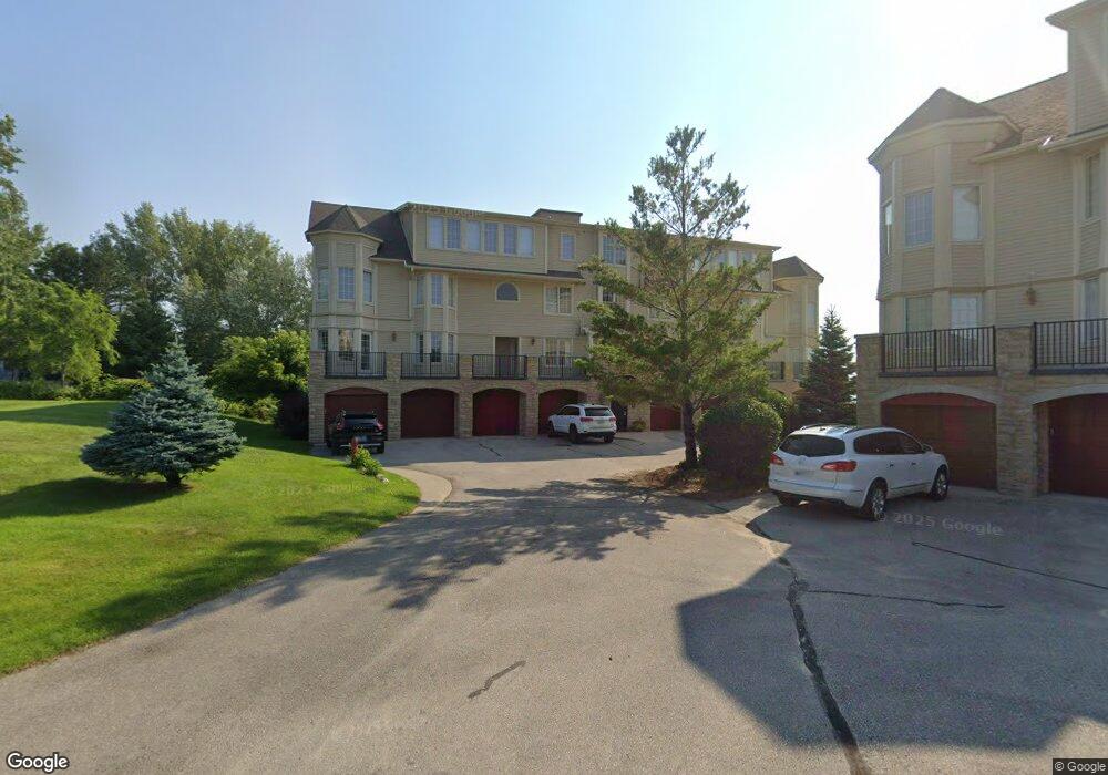
712 N Dockside Cir Suttons Bay, MI 49682
Estimated Value: $663,388 - $972,000
3
Beds
3
Baths
--
Sq Ft
436
Sq Ft Lot
About This Home
This home is located at 712 N Dockside Cir, Suttons Bay, MI 49682 and is currently estimated at $801,347. 712 N Dockside Cir is a home located in Leelanau County with nearby schools including Suttons Bay Elementary School, Suttons Bay Senior High School, and Leelanau Montessori Public School Academy.
Ownership History
Date
Name
Owned For
Owner Type
Purchase Details
Closed on
Jun 15, 2021
Sold by
Capucille Thomas N
Bought by
Bremner John C and Bremner Lee A
Current Estimated Value
Purchase Details
Closed on
Sep 18, 2019
Sold by
Garry Brewer
Bought by
Capucille Thomas N and Capucille Sonja J
Purchase Details
Closed on
Jul 27, 2018
Sold by
Larry Dean
Bought by
Capucille Thomas N and Capucille Sonja J
Purchase Details
Closed on
Oct 12, 2007
Sold by
Suttons Pointe Development Llc
Bought by
Dean Larry and Dean Linda
Create a Home Valuation Report for This Property
The Home Valuation Report is an in-depth analysis detailing your home's value as well as a comparison with similar homes in the area
Home Values in the Area
Average Home Value in this Area
Purchase History
| Date | Buyer | Sale Price | Title Company |
|---|---|---|---|
| Capucille Thomas N | $440,000 | -- | |
| Capucille Thomas N | $435,000 | -- | |
| Dean Larry | $440,000 | -- |
Source: Public Records
Tax History Compared to Growth
Tax History
| Year | Tax Paid | Tax Assessment Tax Assessment Total Assessment is a certain percentage of the fair market value that is determined by local assessors to be the total taxable value of land and additions on the property. | Land | Improvement |
|---|---|---|---|---|
| 2025 | $9,311 | $251,250 | $0 | $0 |
| 2024 | $10,011 | $251,250 | $0 | $0 |
| 2023 | $9,578 | $251,250 | $0 | $0 |
| 2022 | $10,323 | $220,000 | $0 | $0 |
| 2021 | $8,443 | $220,000 | $0 | $0 |
| 2020 | $8,397 | $217,500 | $0 | $0 |
| 2019 | $10,125 | $217,500 | $0 | $0 |
| 2018 | -- | $163,750 | $0 | $0 |
| 2017 | -- | $163,750 | $0 | $0 |
| 2016 | -- | $163,750 | $0 | $0 |
| 2015 | -- | $163,750 | $0 | $0 |
| 2014 | -- | $127,500 | $0 | $0 |
Source: Public Records
Map
Nearby Homes
- 712 N Dockside Cir Unit G-4
- 706 N Dockside Cir Unit D-2
- 762 N Deer Path Trail Unit 1
- 752 N Waypoint Cir
- 898 N Bay Cliff Dr Unit 25
- 750 N Waypoint Cir Unit 1
- 00 N West Bay Shore Dr
- 112 W Madison Ave
- 536 N West Bay Shore Dr
- 310 W Broadway
- 400 W Broadway
- 9224 E Duck Lake Rd
- 379 S Shore Dr
- 1197 S West Bay Shore Dr
- 00 Lovers Ln
- 400 S Stony Point Rd
- 0 S Donnybrook Rd Unit 4 1921928
- 00 N Blue Water Ct Unit 24
- 1912 N Blue Water Ct Unit 23
- 1919 N Blue Water Ct
- 712 N Dockside Cir Unit G-6
- 712 N Dockside Cir Unit G-4
- 712 N Dockside Cir Unit G-4(A & C)
- 712 N Dockside Cir Unit G~2
- 712 N Dockside Cir Unit G-5
- 712 N Dockside Cir
- 712 N Dockside Cir
- 712 N Dockside Cir
- 712 N Dockside Cir
- 712 N Dockside Cir
- 712 N Dockside Cir
- 712 N Dockside Cir
- 712 N Dockside Cir
- 712 N Dockside Cir
- 712 N Dockside Cir Unit G-4
- 712 N Dockside Cir Unit G-2
- 712 N Dockside Cir Unit C-1
- 710 N Dockside Cir Unit F-6
- 710 N Dockside Cir Unit F-4
- 710 N Dockside Cir Unit F-1