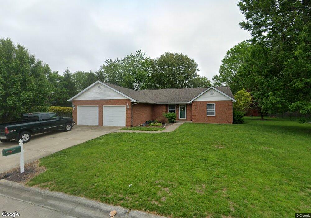
712 Oak Brook Dr Freeburg, IL 62243
Estimated Value: $271,051 - $343,000
--
Bed
--
Bath
1,626
Sq Ft
$190/Sq Ft
Est. Value
About This Home
This home is located at 712 Oak Brook Dr, Freeburg, IL 62243 and is currently estimated at $309,013, approximately $190 per square foot. 712 Oak Brook Dr is a home located in St. Clair County with nearby schools including Freeburg Elementary School, Freeburg Community High School, and St. Joseph Catholic School.
Ownership History
Date
Name
Owned For
Owner Type
Purchase Details
Closed on
Aug 5, 2008
Sold by
Jung Dawn E and Meyer Dana M
Bought by
Pruett Timothy W and Pruett Leslie C
Current Estimated Value
Home Financials for this Owner
Home Financials are based on the most recent Mortgage that was taken out on this home.
Original Mortgage
$120,000
Interest Rate
6.51%
Mortgage Type
Purchase Money Mortgage
Purchase Details
Closed on
Aug 22, 2007
Sold by
Milford John N
Bought by
Milford John N and John N Milford Revocable Trust
Purchase Details
Closed on
Sep 9, 2006
Sold by
Huschle Donald F and Huschle Pamela A
Bought by
Milford John N
Create a Home Valuation Report for This Property
The Home Valuation Report is an in-depth analysis detailing your home's value as well as a comparison with similar homes in the area
Home Values in the Area
Average Home Value in this Area
Purchase History
| Date | Buyer | Sale Price | Title Company |
|---|---|---|---|
| Pruett Timothy W | $185,000 | Fatic | |
| Milford John N | -- | None Available | |
| Milford John N | $180,000 | Fatic |
Source: Public Records
Mortgage History
| Date | Status | Borrower | Loan Amount |
|---|---|---|---|
| Closed | Pruett Timothy W | $120,000 |
Source: Public Records
Tax History Compared to Growth
Tax History
| Year | Tax Paid | Tax Assessment Tax Assessment Total Assessment is a certain percentage of the fair market value that is determined by local assessors to be the total taxable value of land and additions on the property. | Land | Improvement |
|---|---|---|---|---|
| 2024 | $6,213 | $80,306 | $17,122 | $63,184 |
| 2023 | $6,064 | $77,508 | $16,525 | $60,983 |
| 2022 | $5,774 | $72,627 | $15,484 | $57,143 |
| 2021 | $5,562 | $68,374 | $14,577 | $53,797 |
| 2020 | $5,280 | $62,203 | $13,261 | $48,942 |
| 2019 | $5,232 | $64,274 | $13,707 | $50,567 |
| 2018 | $5,138 | $63,424 | $13,526 | $49,898 |
| 2017 | $4,895 | $60,641 | $12,932 | $47,709 |
| 2016 | $4,832 | $58,119 | $12,394 | $45,725 |
| 2014 | $4,158 | $56,779 | $12,718 | $44,061 |
| 2013 | $3,998 | $56,273 | $12,605 | $43,668 |
Source: Public Records
Map
Nearby Homes
- 520 N Edison St
- 401 N Edison St
- 302 N Railroad St
- 206 N Main St
- 312 W Phillips St
- 207 N Edison St
- 106 S Vine St
- 440 Foxtail Dr
- 420 Foxtail Dr
- 433 Foxtail Dr
- 363 Sleeping Indian Dr
- 359 Sleeping Indian Dr
- 3 Park St
- 304 Torrington Ln
- 222 Alamosa Dr
- 227 Alamosa Dr
- 0 Hickory Dr
- 103 Draco Dr
- 109 Willow Dr
- 111 Willow Dr
- 623 Brook Stone Ct
- 716 Oak Brook Dr
- 708 Oak Brook Dr
- 619 Brook Stone Ct
- 711 Oak Brook Dr
- 715 Oak Brook Dr
- 627 Brook Stone Ct
- 705 Oak Brook Dr
- 618 Red Oak Dr
- 720 Oak Brook Dr
- 719 Oak Brook Dr
- 615 Brook Stone Ct
- 710 Meadow Brook Dr
- 714 Meadow Brook Dr
- 620 Brook Stone Ct
- 624 Brook Stone Ct
- 316 Dogwood Ct
- 614 Red Oak Dr
- 702 Meadow Brook Dr
- 706 Meadow Brook Dr Unit 708