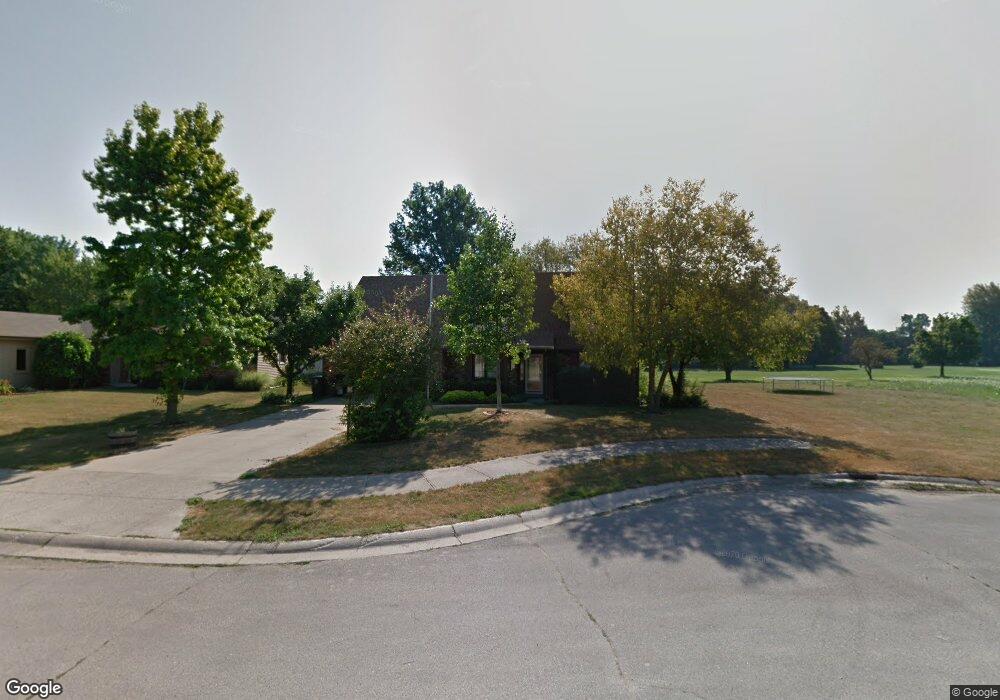
712 Pinehurst Dr Fort Wayne, IN 46815
North Anthony NeighborhoodEstimated Value: $280,000 - $293,000
3
Beds
3
Baths
2,604
Sq Ft
$109/Sq Ft
Est. Value
About This Home
This home is located at 712 Pinehurst Dr, Fort Wayne, IN 46815 and is currently estimated at $284,119, approximately $109 per square foot. 712 Pinehurst Dr is a home located in Allen County with nearby schools including New Haven Primary School, New Haven Intermediate School, and New Haven High School.
Ownership History
Date
Name
Owned For
Owner Type
Purchase Details
Closed on
Oct 7, 2005
Sold by
Sipe Carl A and Sipe Linda R
Bought by
Croteau Teresa L
Current Estimated Value
Home Financials for this Owner
Home Financials are based on the most recent Mortgage that was taken out on this home.
Original Mortgage
$108,000
Outstanding Balance
$56,959
Interest Rate
5.82%
Mortgage Type
Fannie Mae Freddie Mac
Estimated Equity
$227,160
Create a Home Valuation Report for This Property
The Home Valuation Report is an in-depth analysis detailing your home's value as well as a comparison with similar homes in the area
Home Values in the Area
Average Home Value in this Area
Purchase History
| Date | Buyer | Sale Price | Title Company |
|---|---|---|---|
| Croteau Teresa L | -- | Metropolitan Title Of In |
Source: Public Records
Mortgage History
| Date | Status | Borrower | Loan Amount |
|---|---|---|---|
| Open | Croteau Teresa L | $108,000 |
Source: Public Records
Tax History
| Year | Tax Paid | Tax Assessment Tax Assessment Total Assessment is a certain percentage of the fair market value that is determined by local assessors to be the total taxable value of land and additions on the property. | Land | Improvement |
|---|---|---|---|---|
| 2025 | $2,500 | $246,000 | $32,800 | $213,200 |
| 2024 | $2,223 | $250,000 | $12,400 | $237,600 |
| 2023 | $2,223 | $222,300 | $12,400 | $209,900 |
| 2022 | $1,909 | $190,900 | $12,400 | $178,500 |
| 2021 | $1,749 | $174,900 | $12,400 | $162,500 |
| 2020 | $1,654 | $165,400 | $12,400 | $153,000 |
| 2019 | $1,508 | $150,800 | $12,400 | $138,400 |
| 2018 | $1,497 | $149,700 | $12,400 | $137,300 |
| 2017 | $1,298 | $129,800 | $12,400 | $117,400 |
| 2016 | $1,191 | $119,100 | $12,400 | $106,700 |
| 2014 | $1,127 | $112,700 | $12,400 | $100,300 |
| 2013 | $1,077 | $107,700 | $12,400 | $95,300 |
Source: Public Records
Map
Nearby Homes
- 5708 Countess Dr
- 5817 Monarch Dr
- 1208 Fairview Ave
- 2818 1/2 Reed Rd
- 6038 Monarch Dr
- 2426 White Oak Ave
- 2412 Hobson Rd
- 1930 Bremer Rd
- 2425 White Oak Ave
- 3629 Logan Ave
- 1304 Ardsley Ct
- 2927 Woodstock Ct
- 2727 Winch St
- 2923 Inwood Dr
- 3331 New Haven Ave
- 3410 Charlotte Ave
- 3622 & 3628 Logan Ave
- 3629 (East of) Logan Ave
- 2611 Neptunes Crossing
- 2716 White Oak Ave
- 724 Pinehurst Dr
- 808 Pinehurst Dr
- 711 Pinehurst Dr
- 824 Pinehurst Dr
- 807 Pinehurst Dr
- 823 Pinehurst Dr
- 920 Pinehurst Dr
- 907 Pinehurst Dr
- 919 Pinehurst Dr
- 1006 Pinehurst Dr
- 906 Inwood Dr
- 340 Inwood Dr
- 402 Inwood Dr
- 1005 Pinehurst Dr
- 910 Inwood Dr
- 406 Inwood Dr
- 1022 Pinehurst Dr
- 412 Inwood Dr
- 1110 Pinehurst Dr
- 1109 Pinehurst Dr
Your Personal Tour Guide
Ask me questions while you tour the home.