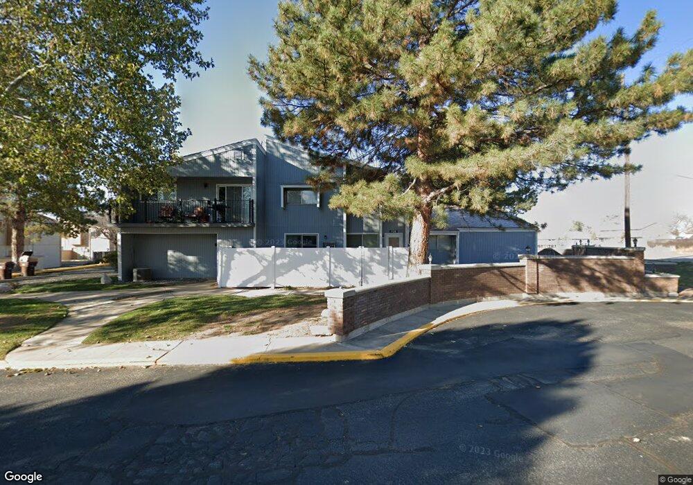
712 S 1600 E Unit A Clearfield, UT 84015
Estimated Value: $267,000 - $370,000
3
Beds
2
Baths
1,872
Sq Ft
$164/Sq Ft
Est. Value
About This Home
This home is located at 712 S 1600 E Unit A, Clearfield, UT 84015 and is currently estimated at $307,913, approximately $164 per square foot. 712 S 1600 E Unit A is a home located in Davis County with nearby schools including South Clearfield Elementary School, North Davis Junior High School, and Northridge High School.
Ownership History
Date
Name
Owned For
Owner Type
Purchase Details
Closed on
Jul 29, 2024
Sold by
Harris Julie
Bought by
Timmins Patrick and Timmins Michelle
Current Estimated Value
Home Financials for this Owner
Home Financials are based on the most recent Mortgage that was taken out on this home.
Original Mortgage
$303,975
Outstanding Balance
$300,316
Interest Rate
6.95%
Mortgage Type
New Conventional
Estimated Equity
$7,597
Purchase Details
Closed on
Mar 27, 2024
Sold by
Ttk Trust and Kuster Thomas Timothy
Bought by
Harris Julie
Purchase Details
Closed on
Jun 17, 2020
Sold by
Kuster Thomas Timothy
Bought by
Kuster Thomas Timothy and Kuster John R
Purchase Details
Closed on
Oct 15, 2019
Sold by
Kuster Thomas Timothy
Bought by
Kuster Thomas Timothy and Thomas Timothy Kuster Rlt
Home Financials for this Owner
Home Financials are based on the most recent Mortgage that was taken out on this home.
Original Mortgage
$125,000
Interest Rate
3.7%
Mortgage Type
Commercial
Purchase Details
Closed on
Aug 23, 2013
Sold by
Kuster Thomas
Bought by
Livin Thomas Timothy Kuster Ii Revocable
Purchase Details
Closed on
Dec 18, 2002
Sold by
Hud
Bought by
Kuster Ii Thomas T
Home Financials for this Owner
Home Financials are based on the most recent Mortgage that was taken out on this home.
Original Mortgage
$72,000
Interest Rate
6.03%
Mortgage Type
Purchase Money Mortgage
Purchase Details
Closed on
Sep 27, 2002
Sold by
First Nationwide Mtg Corp
Bought by
Hud
Purchase Details
Closed on
Sep 5, 2002
Sold by
Sanders John G
Bought by
First Nationwide Mtg Corp
Purchase Details
Closed on
Aug 12, 1997
Sold by
Sanders John G
Bought by
Sanders John G and Sanders Nancy J
Home Financials for this Owner
Home Financials are based on the most recent Mortgage that was taken out on this home.
Original Mortgage
$89,050
Interest Rate
7.61%
Mortgage Type
FHA
Create a Home Valuation Report for This Property
The Home Valuation Report is an in-depth analysis detailing your home's value as well as a comparison with similar homes in the area
Home Values in the Area
Average Home Value in this Area
Purchase History
| Date | Buyer | Sale Price | Title Company |
|---|---|---|---|
| Timmins Patrick | -- | Metro National Title | |
| Harris Julie | -- | Title Guarantee | |
| Kuster Thomas Timothy | -- | None Available | |
| Kuster Thomas Timothy | -- | Sutherland Title Co | |
| Kuster Thomas Timothy | -- | Sutherland Title Comp | |
| Livin Thomas Timothy Kuster Ii Revocable | -- | None Available | |
| Kuster Ii Thomas T | -- | Us Title | |
| Hud | -- | Backman Stewart Title Servic | |
| First Nationwide Mtg Corp | $98,356 | Backman Stewart Title Servic | |
| Sanders John G | -- | Mountain View Title & Escrow | |
| Sanders John G | -- | Mountain View Title & Escrow |
Source: Public Records
Mortgage History
| Date | Status | Borrower | Loan Amount |
|---|---|---|---|
| Open | Timmins Patrick | $303,975 | |
| Previous Owner | Kuster Thomas Timothy | $125,000 | |
| Previous Owner | Kuster Ii Thomas T | $72,000 | |
| Previous Owner | Sanders John G | $89,050 |
Source: Public Records
Tax History Compared to Growth
Tax History
| Year | Tax Paid | Tax Assessment Tax Assessment Total Assessment is a certain percentage of the fair market value that is determined by local assessors to be the total taxable value of land and additions on the property. | Land | Improvement |
|---|---|---|---|---|
| 2025 | $1,633 | $164,450 | $0 | $164,450 |
| 2024 | $1,633 | $147,400 | $0 | $147,400 |
| 2023 | $1,551 | $141,350 | $0 | $141,350 |
| 2022 | $1,583 | $258,000 | $55,000 | $203,000 |
| 2021 | $1,440 | $195,000 | $44,600 | $150,400 |
| 2020 | $1,257 | $169,000 | $34,500 | $134,500 |
| 2019 | $1,190 | $158,000 | $30,000 | $128,000 |
| 2018 | $1,036 | $134,000 | $30,000 | $104,000 |
| 2016 | $908 | $61,380 | $14,300 | $47,080 |
| 2015 | $837 | $53,955 | $14,300 | $39,655 |
| 2014 | $895 | $58,487 | $18,333 | $40,154 |
| 2013 | -- | $60,157 | $17,600 | $42,557 |
Source: Public Records
Map
Nearby Homes
- 712 S 1600 E Unit B
- 712 S 1600 E Unit D
- 712 S 1600 E Unit C
- 712 S 1600 E Unit A-1
- 712 S 1600 E
- 1552 E 700 S
- 1565 E 750 S
- 1565 E 750 S Unit A
- 1565 E 750 S Unit C
- 1565 E 750 S Unit D
- 1565 E 750 S Unit B
- 711 S 1600 E Unit B
- 711 S 1600 E Unit D
- 711 S 1600 E
- 711 S 1600 E Unit A
- 711 S 1600 E Unit 2C
- 711 S 1600 E Unit B2
- 1625 E 750 S
- 1625 E 750 S Unit B
- 1625 E 750 S Unit A