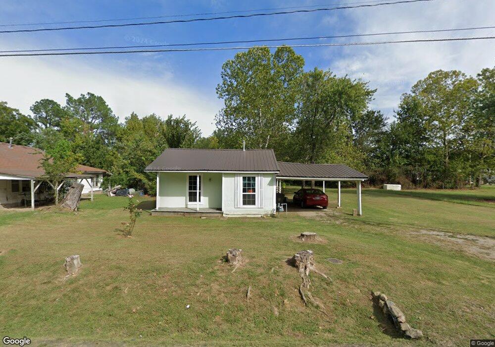
712 S Main St Sallisaw, OK 74955
Estimated Value: $88,758 - $120,000
2
Beds
1
Bath
1,250
Sq Ft
$85/Sq Ft
Est. Value
About This Home
This home is located at 712 S Main St, Sallisaw, OK 74955 and is currently estimated at $106,690, approximately $85 per square foot. 712 S Main St is a home located in Sequoyah County with nearby schools including Liberty Elementary School, Eastside Elementary School, and Sallisaw Middle School.
Ownership History
Date
Name
Owned For
Owner Type
Purchase Details
Closed on
Apr 16, 2015
Sold by
Bailey Joshua and Bailey Misty
Bought by
Bailey Joshua and Bailey Misty
Current Estimated Value
Purchase Details
Closed on
Sep 17, 2004
Sold by
Watts Juanita
Bought by
Watts Jimmy
Create a Home Valuation Report for This Property
The Home Valuation Report is an in-depth analysis detailing your home's value as well as a comparison with similar homes in the area
Home Values in the Area
Average Home Value in this Area
Purchase History
| Date | Buyer | Sale Price | Title Company |
|---|---|---|---|
| Bailey Joshua | -- | None Available | |
| Watts Jimmy | -- | -- |
Source: Public Records
Tax History
| Year | Tax Paid | Tax Assessment Tax Assessment Total Assessment is a certain percentage of the fair market value that is determined by local assessors to be the total taxable value of land and additions on the property. | Land | Improvement |
|---|---|---|---|---|
| 2025 | $393 | $4,223 | $1,155 | $3,068 |
| 2024 | $393 | $4,220 | $1,555 | $2,665 |
| 2023 | $383 | $4,019 | $1,430 | $2,589 |
| 2022 | $326 | $3,828 | $1,430 | $2,398 |
| 2021 | $326 | $3,828 | $1,430 | $2,398 |
| 2020 | $324 | $3,735 | $1,337 | $2,398 |
| 2019 | $312 | $3,557 | $1,159 | $2,398 |
| 2018 | $299 | $3,388 | $990 | $2,398 |
| 2017 | $299 | $3,388 | $990 | $2,398 |
| 2016 | $302 | $3,388 | $990 | $2,398 |
| 2015 | $308 | $3,388 | $990 | $2,398 |
| 2014 | $46 | $509 | $160 | $349 |
Source: Public Records
Map
Nearby Homes
- 718 S Cedar St
- 621 S Elm St
- 305 W Port Arthur Ave
- 506 W Port Arthur Place
- 402 S Ash St
- Tbd W Wyandotte Ave
- 0 W Wyandotte Ave
- 200 E Scott Ave
- 0000 W Ruth St
- TBD Chestnut St
- 714 W Williams Ave
- 418 S Hickory St
- 322 S Locust St
- 316 W Chickasaw Ave
- 103 N Hickory St
- 891 W Choctaw Ave
- 320 E Sarah Ave
- TBD U S 59
- 0 S Cedar St
- 706 E Delaware St
Your Personal Tour Guide
Ask me questions while you tour the home.