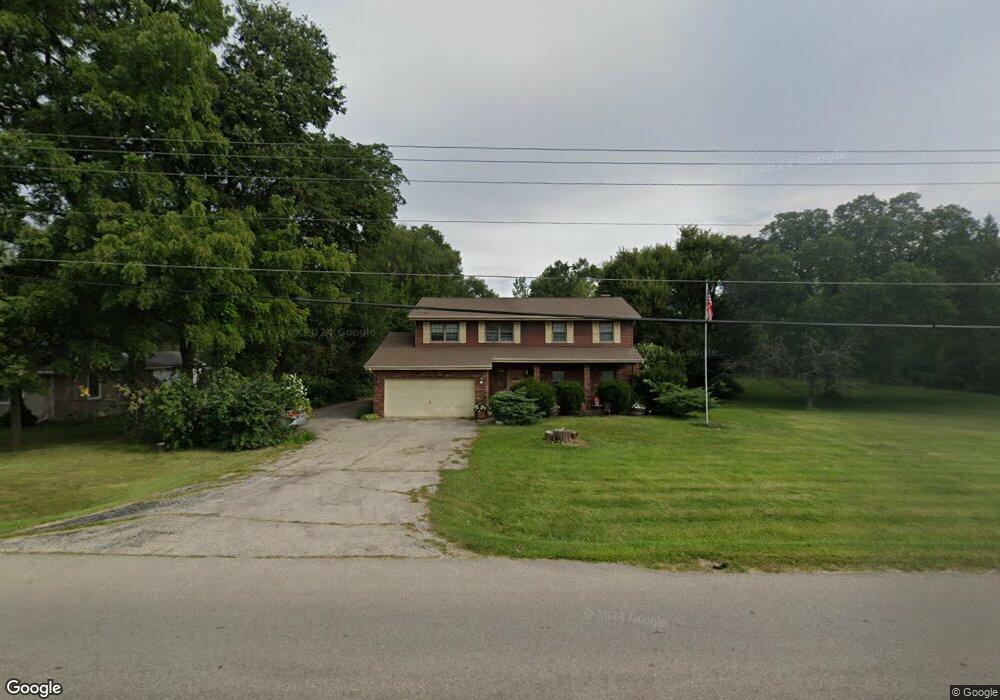
712 Thornton St Lockport, IL 60441
Estimated Value: $321,000 - $369,143
Studio
2
Baths
2,368
Sq Ft
$145/Sq Ft
Est. Value
About This Home
This home is located at 712 Thornton St, Lockport, IL 60441 and is currently estimated at $342,536, approximately $144 per square foot. 712 Thornton St is a home located in Will County with nearby schools including Walsh Elementary School, Ludwig Elementary School, and Reed Elementary School.
Ownership History
Date
Name
Owned For
Owner Type
Purchase Details
Closed on
Dec 10, 2003
Sold by
Tucker Earnest W and Tucker Joyce
Bought by
Pasderetz Anthony J and Pasderetz Robin
Current Estimated Value
Home Financials for this Owner
Home Financials are based on the most recent Mortgage that was taken out on this home.
Original Mortgage
$202,000
Outstanding Balance
$93,995
Interest Rate
5.94%
Mortgage Type
Purchase Money Mortgage
Estimated Equity
$248,541
Create a Home Valuation Report for This Property
The Home Valuation Report is an in-depth analysis detailing your home's value as well as a comparison with similar homes in the area
Home Values in the Area
Average Home Value in this Area
Purchase History
| Date | Buyer | Sale Price | Title Company |
|---|---|---|---|
| Pasderetz Anthony J | $295,000 | Chicago Title Insurance Co |
Source: Public Records
Mortgage History
| Date | Status | Borrower | Loan Amount |
|---|---|---|---|
| Open | Pasderetz Anthony J | $202,000 | |
| Closed | Pasderetz Anthony J | $51,200 |
Source: Public Records
Tax History Compared to Growth
Tax History
| Year | Tax Paid | Tax Assessment Tax Assessment Total Assessment is a certain percentage of the fair market value that is determined by local assessors to be the total taxable value of land and additions on the property. | Land | Improvement |
|---|---|---|---|---|
| 2024 | $7,412 | $113,308 | $35,574 | $77,734 |
| 2023 | $7,412 | $101,721 | $31,936 | $69,785 |
| 2022 | $7,197 | $95,825 | $30,085 | $65,740 |
| 2021 | $6,750 | $90,053 | $28,273 | $61,780 |
| 2020 | $6,570 | $87,092 | $27,343 | $59,749 |
| 2019 | $6,184 | $82,552 | $25,918 | $56,634 |
| 2018 | $6,050 | $79,377 | $24,921 | $54,456 |
| 2017 | $5,759 | $74,934 | $23,526 | $51,408 |
| 2016 | $5,447 | $70,229 | $22,049 | $48,180 |
| 2015 | $5,343 | $66,821 | $20,979 | $45,842 |
| 2014 | $5,343 | $63,639 | $19,980 | $43,659 |
| 2013 | $5,343 | $66,989 | $21,032 | $45,957 |
Source: Public Records
Map
Nearby Homes
- 927 Treeline Ct Unit A
- 605 Gloria St
- 134 S Jefferson St
- 936 Treeline Ct Unit 5B
- 613 E 3rd St
- 540 E 4th St
- 308 Macgregor Rd
- 118 N State St
- 120 N State St
- 701 E 7th St
- 501 S Hamilton St
- 814 S Washington St
- 818 E 11th St
- 502 W 7th St
- 1212 Grandview Ave
- 9.5 Acres S Archer Ave
- 1016 S State St
- 0 151st & MacGregor St Unit MRD11873272
- 0 Smith Rd South of 135th St Unit MRD12274096
- 0 N State St Unit 10995892
- 710 Thornton St
- 110 W Circle Dr
- 130 W Circle Dr
- 131 E Circle Dr
- 705 Thornton St
- 711 Thornton St
- 703 Thornton St
- 111 W Circle Dr
- 634 Thornton St
- 701 Thornton St Unit 1
- 101 Le Jeune Ave
- 126 E Circle Dr
- 132 E Circle Dr
- 803 Thornton St
- 708 E 1st St
- 704 E 1st St
- 530 Thornton St
- 710 E 1st St
- 702 E 1st St
- 805 Thornton St