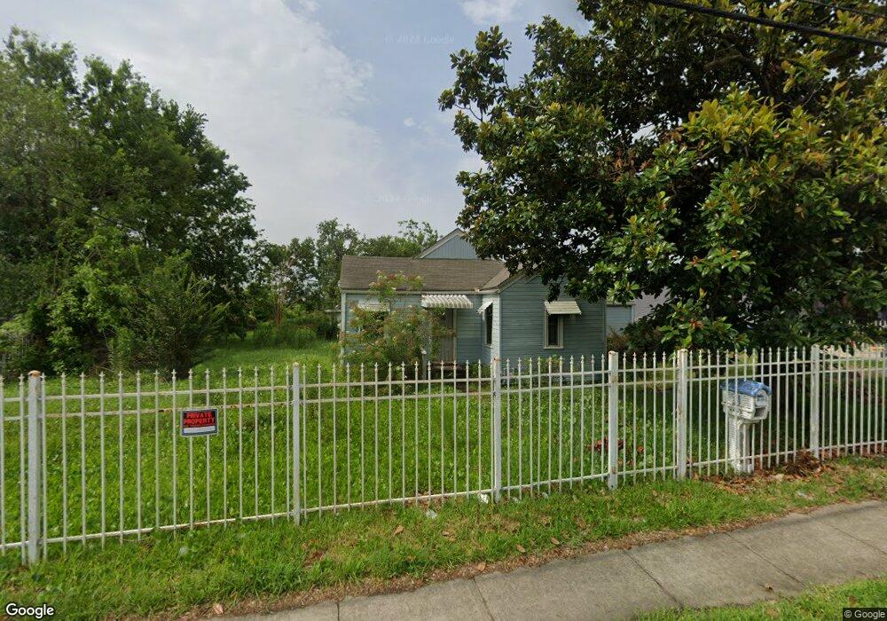
7120 Ley Rd Houston, TX 77028
Trinity-Houston Gardens NeighborhoodEstimated Value: $155,000 - $180,000
2
Beds
1
Bath
1,050
Sq Ft
$157/Sq Ft
Est. Value
About This Home
This home is located at 7120 Ley Rd, Houston, TX 77028 and is currently estimated at $164,406, approximately $156 per square foot. 7120 Ley Rd is a home located in Harris County with nearby schools including McGowen Elementary School, Key Middle, and Kashmere High School.
Ownership History
Date
Name
Owned For
Owner Type
Purchase Details
Closed on
May 22, 2003
Sold by
Roberson Bertha and Greggs Bertha
Bought by
Roberson Bertha
Current Estimated Value
Home Financials for this Owner
Home Financials are based on the most recent Mortgage that was taken out on this home.
Original Mortgage
$119,250
Interest Rate
2.7%
Mortgage Type
FHA
Create a Home Valuation Report for This Property
The Home Valuation Report is an in-depth analysis detailing your home's value as well as a comparison with similar homes in the area
Home Values in the Area
Average Home Value in this Area
Purchase History
| Date | Buyer | Sale Price | Title Company |
|---|---|---|---|
| Roberson Bertha | -- | Texas American Title |
Source: Public Records
Mortgage History
| Date | Status | Borrower | Loan Amount |
|---|---|---|---|
| Closed | Roberson Bertha | $119,250 |
Source: Public Records
Tax History Compared to Growth
Tax History
| Year | Tax Paid | Tax Assessment Tax Assessment Total Assessment is a certain percentage of the fair market value that is determined by local assessors to be the total taxable value of land and additions on the property. | Land | Improvement |
|---|---|---|---|---|
| 2025 | $2,180 | $193,607 | $104,582 | $89,025 |
| 2024 | $2,180 | $160,829 | $91,509 | $69,320 |
| 2023 | $2,180 | $158,871 | $91,509 | $67,362 |
| 2022 | $2,165 | $105,111 | $65,364 | $39,747 |
| 2021 | $2,084 | $105,111 | $65,364 | $39,747 |
| 2020 | $1,968 | $95,977 | $65,364 | $30,613 |
| 2019 | $1,870 | $73,885 | $45,755 | $28,130 |
| 2018 | $0 | $73,885 | $45,755 | $28,130 |
| 2017 | $1,868 | $73,885 | $45,755 | $28,130 |
| 2016 | $1,948 | $77,029 | $45,755 | $31,274 |
| 2015 | -- | $77,029 | $45,755 | $31,274 |
| 2014 | -- | $77,029 | $45,755 | $31,274 |
Source: Public Records
Map
Nearby Homes
- 7140 Orville St
- 6908 Larkstone St
- 7309 Orville St
- 6911 Finch St
- 6907 Finch St
- 6842 Carothers St
- 0 Kittridge
- 6838 Carothers St
- 7100 W Knoll St
- 0 Landor
- 6909 Kittridge St
- 7325 Ley Rd
- 7327 Ley Rd
- 7010 S Hall St
- 8100 Homestead Rd
- 7204 Homestead Rd
- 7002 S Hall St
- 7307 W Knoll St
- 6908 S Hall St
- 7214 Weyburn St
- 7130 Ley Rd
- 7119 Ley Rd
- 7123 Ley Rd
- 0 Ley Rd Unit 99574374
- 0 Ley Rd Unit 85364614
- 0 Ley Rd Unit 57140094
- 0 Ley Rd Unit 80802746
- 0 Ley Rd Unit 87973543
- 0 Ley Rd Unit 29331465
- 0 Ley Rd Unit 92258539
- 0 Ley Rd Unit 60262010
- 0 Ley Rd Unit 71821684
- 0 Ley Rd Unit 53323710
- 7510 Homestead Rd
- 7146 Ley Rd
- 7141 Ley Rd
- 7143 Ley Rd
- 7120 Orville St
- 7106 Ley Rd
- 7426 Homestead Rd