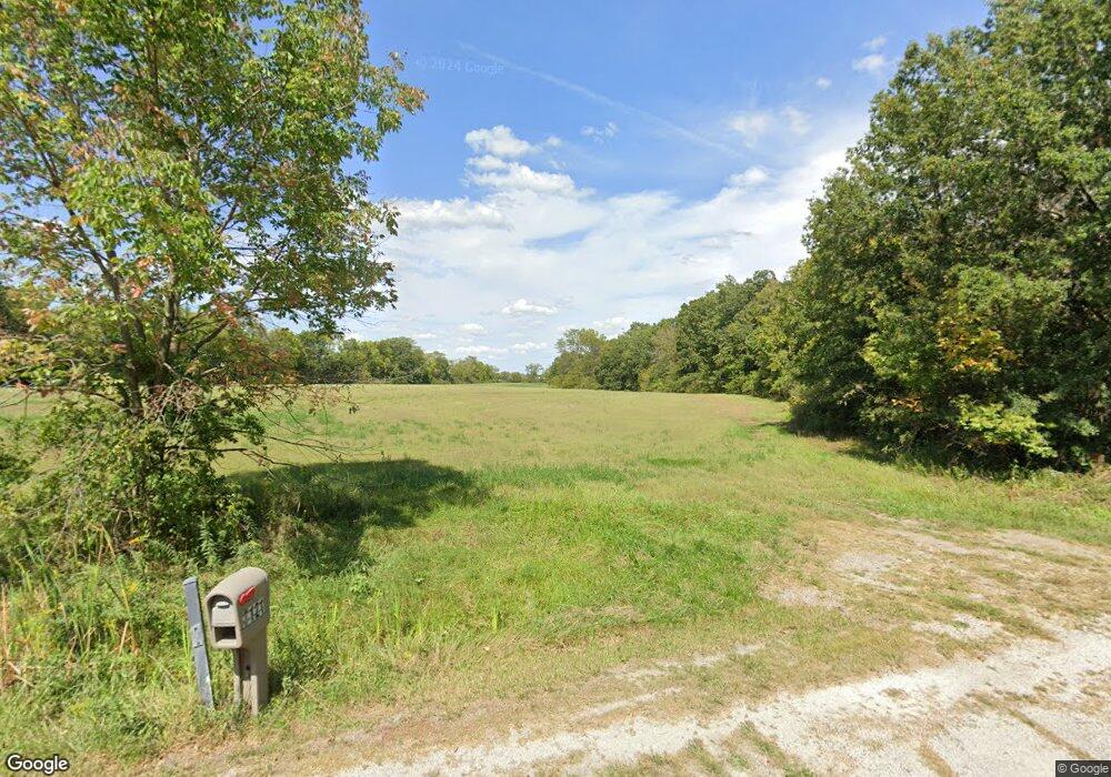
7121 W Cantrell St Decatur, IL 62522
Estimated Value: $187,000 - $374,000
3
Beds
2
Baths
2,005
Sq Ft
$127/Sq Ft
Est. Value
About This Home
This home is located at 7121 W Cantrell St, Decatur, IL 62522 and is currently estimated at $254,915, approximately $127 per square foot. 7121 W Cantrell St is a home located in Macon County.
Ownership History
Date
Name
Owned For
Owner Type
Purchase Details
Closed on
Mar 23, 2021
Sold by
Mansur Blake J and Mansur Catherine J
Bought by
Mansur Travis B
Current Estimated Value
Home Financials for this Owner
Home Financials are based on the most recent Mortgage that was taken out on this home.
Original Mortgage
$175,000
Interest Rate
3.46%
Mortgage Type
New Conventional
Purchase Details
Closed on
Apr 30, 2019
Sold by
Lincoln Land Illinois Land Trust
Bought by
Mansur Blake and Mansur Catherine J
Create a Home Valuation Report for This Property
The Home Valuation Report is an in-depth analysis detailing your home's value as well as a comparison with similar homes in the area
Home Values in the Area
Average Home Value in this Area
Purchase History
| Date | Buyer | Sale Price | Title Company |
|---|---|---|---|
| Mansur Travis B | $175,000 | Handegan Nancy M | |
| Mansur Travis B | $175,000 | None Listed On Document | |
| Mansur Blake | $92,000 | None Available |
Source: Public Records
Mortgage History
| Date | Status | Borrower | Loan Amount |
|---|---|---|---|
| Previous Owner | Mansur Travis B | $175,000 |
Source: Public Records
Tax History Compared to Growth
Tax History
| Year | Tax Paid | Tax Assessment Tax Assessment Total Assessment is a certain percentage of the fair market value that is determined by local assessors to be the total taxable value of land and additions on the property. | Land | Improvement |
|---|---|---|---|---|
| 2024 | $5,679 | $70,787 | $10,977 | $59,810 |
| 2023 | $2,854 | $37,050 | $10,613 | $26,437 |
| 2022 | $2,697 | $34,262 | $9,814 | $24,448 |
| 2021 | $2,624 | $32,544 | $9,322 | $23,222 |
| 2020 | $2,496 | $30,667 | $8,784 | $21,883 |
| 2019 | $2,496 | $30,667 | $8,784 | $21,883 |
| 2018 | $7,540 | $92,829 | $8,576 | $84,253 |
| 2017 | $7,675 | $93,220 | $8,612 | $84,608 |
| 2016 | $7,752 | $93,109 | $8,602 | $84,507 |
| 2015 | $7,418 | $90,397 | $8,351 | $82,046 |
| 2014 | $7,171 | $89,502 | $8,268 | $81,234 |
| 2013 | $7,718 | $89,502 | $8,268 | $81,234 |
Source: Public Records
Map
Nearby Homes
- 0 W Wood St
- 7450 W William St
- 275 N Camp St
- 0 W Harristown Blvd Unit 6251050
- 5180 W Cantrell St
- 3247 Nevada Rd
- 3335 Nevada Rd
- 445 S Wyckles Rd
- 468 N Megan Dr
- 3889 W Division St
- 170 S Hillcrest Blvd
- 480 N Hillcrest Blvd
- 635 N Virginia Ave
- 1720 N Sunnyside Rd
- 1650 N Sunnyside Rd
- 1135 N Moffet Ln
- 3525 W Center St
- 2529 W Alice Ln
- 345 S Westdale Ave
- 231 S Redwood Ln
- 7135 W Cantrell St
- 7091 W Cantrell St
- 7223 W Cantrell St
- 6935 W Cantrell St
- 6837 W Cantrell St
- 7002 W Cantrell St
- 996 Twin Lakes Rd
- 7136 W Hill Rd
- 6755 W Cantrell St
- 6888 W Hill Rd
- 6920 W Hill Rd
- 7280 W Hill Rd
- 6880 W Hill Rd
- 6840 W Hill Rd
- 1085 Twin Lakes Rd
- 6865 W Hill Rd
- 7179 W Hill Rd
- 153 Rr 8
- 7335 W Hill Rd
- 7345 W Hill Rd
