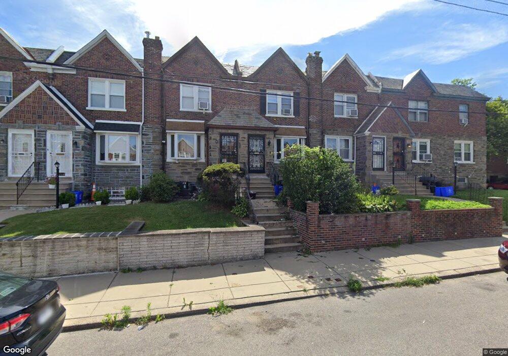
7122 Forrest Ave Philadelphia, PA 19138
West Oak Lane NeighborhoodEstimated Value: $201,000 - $293,000
3
Beds
1
Bath
1,376
Sq Ft
$172/Sq Ft
Est. Value
About This Home
This home is located at 7122 Forrest Ave, Philadelphia, PA 19138 and is currently estimated at $236,267, approximately $171 per square foot. 7122 Forrest Ave is a home located in Philadelphia County with nearby schools including William Rowen School, Gen. Louis Wagner Middle School, and Martin Luther King High School.
Ownership History
Date
Name
Owned For
Owner Type
Purchase Details
Closed on
Jul 15, 2002
Sold by
Crockett James L
Bought by
Mason Lynnette
Current Estimated Value
Home Financials for this Owner
Home Financials are based on the most recent Mortgage that was taken out on this home.
Original Mortgage
$75,900
Outstanding Balance
$31,706
Interest Rate
6.64%
Estimated Equity
$204,561
Create a Home Valuation Report for This Property
The Home Valuation Report is an in-depth analysis detailing your home's value as well as a comparison with similar homes in the area
Home Values in the Area
Average Home Value in this Area
Purchase History
| Date | Buyer | Sale Price | Title Company |
|---|---|---|---|
| Mason Lynnette | $79,900 | -- |
Source: Public Records
Mortgage History
| Date | Status | Borrower | Loan Amount |
|---|---|---|---|
| Open | Mason Lynnette | $75,900 |
Source: Public Records
Tax History Compared to Growth
Tax History
| Year | Tax Paid | Tax Assessment Tax Assessment Total Assessment is a certain percentage of the fair market value that is determined by local assessors to be the total taxable value of land and additions on the property. | Land | Improvement |
|---|---|---|---|---|
| 2026 | $2,429 | $211,000 | $42,200 | $168,800 |
| 2025 | $2,429 | $211,000 | $42,200 | $168,800 |
| 2024 | $2,429 | $211,000 | $42,200 | $168,800 |
| 2023 | $2,429 | $173,500 | $34,700 | $138,800 |
| 2022 | $1,188 | $128,500 | $34,700 | $93,800 |
| 2021 | $1,818 | $0 | $0 | $0 |
| 2020 | $1,818 | $0 | $0 | $0 |
| 2019 | $1,898 | $0 | $0 | $0 |
| 2018 | $1,232 | $0 | $0 | $0 |
| 2017 | $1,652 | $0 | $0 | $0 |
| 2016 | $1,232 | $0 | $0 | $0 |
| 2015 | $1,179 | $0 | $0 | $0 |
| 2014 | -- | $118,000 | $11,461 | $106,539 |
| 2012 | -- | $16,192 | $2,645 | $13,547 |
Source: Public Records
Map
Nearby Homes
- 7206 Forrest Ave
- 7092 Forrest Ave
- 7245 Ogontz Ave
- 1839 E Pastorius St
- 7159 N 20th St
- 7313 Limekiln Pike
- 7349 E Walnut Ln
- 7188 N Uber St
- 1821 E Tulpehocken St
- 7001 Limekiln Pike
- 1822 Nolan St
- 7016 Andrews Ave
- 7321 Sommers Rd
- 6944 Cedar Park Ave
- 1996 73rd Ave
- 1762 Mohican St
- 1979 73rd Ave
- 1975 73rd Ave
- 6908 Ogontz Ave
- 6905 Forrest Ave
- 7124 Forrest Ave
- 7118 Forrest Ave
- 7126 Forrest Ave
- 7116 Forrest Ave
- 7114 Forrest Ave
- 7112 Forrest Ave
- 7173 Cedar Park Ave
- 7110 Forrest Ave
- 7108 Forrest Ave
- 7171 Cedar Park Ave
- 7169 Cedar Park Ave
- 7106 Forrest Ave
- 7167 Cedar Park Ave
- 7200 Forrest Ave
- 7165 Cedar Park Ave
- 7104 Forrest Ave
- 7202 Forrest Ave
- 7163 Cedar Park Ave
- 7113 Forrest Ave
- 7119 Forrest Ave