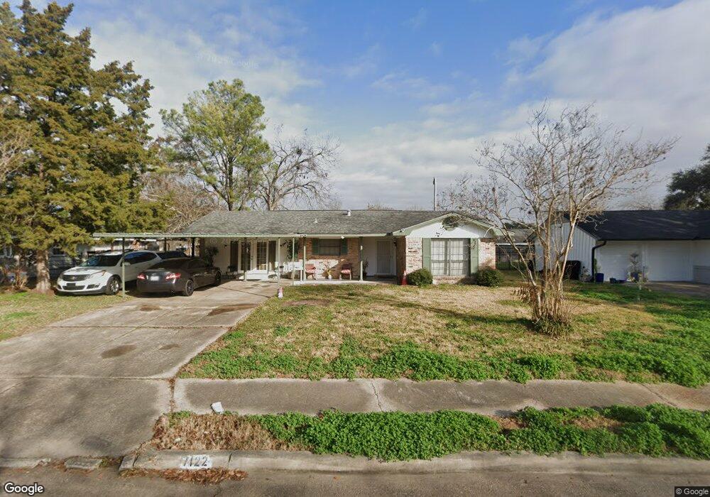
7122 Sharpview Dr Houston, TX 77074
Sharpstown NeighborhoodEstimated Value: $249,715 - $338,000
4
Beds
2
Baths
2,500
Sq Ft
$115/Sq Ft
Est. Value
About This Home
This home is located at 7122 Sharpview Dr, Houston, TX 77074 and is currently estimated at $286,929, approximately $114 per square foot. 7122 Sharpview Dr is a home located in Harris County with nearby schools including Sutton Elementary School, Long Academy, and Sharpstown High School.
Ownership History
Date
Name
Owned For
Owner Type
Purchase Details
Closed on
Jun 2, 2006
Sold by
Triple Palms 1 Llc
Bought by
Tran Kent
Current Estimated Value
Purchase Details
Closed on
Oct 17, 2005
Sold by
Triple Palms 4 Llc
Bought by
Tran Kent T
Purchase Details
Closed on
Jun 28, 2004
Sold by
Tran Kent
Bought by
Triple Palms 4 Llc
Purchase Details
Closed on
Mar 4, 2003
Sold by
Quinn William F and Quinn Emry Ann
Bought by
Wedgewood Trust
Purchase Details
Closed on
Jun 17, 1994
Sold by
Abuhamdan Majid Muhammad
Bought by
Galli Dana A
Create a Home Valuation Report for This Property
The Home Valuation Report is an in-depth analysis detailing your home's value as well as a comparison with similar homes in the area
Home Values in the Area
Average Home Value in this Area
Purchase History
| Date | Buyer | Sale Price | Title Company |
|---|---|---|---|
| Tran Kent | -- | None Available | |
| Tran Kent T | -- | -- | |
| Triple Palms 4 Llc | -- | -- | |
| Wedgewood Trust | $62,700 | -- | |
| Galli Dana A | -- | -- |
Source: Public Records
Tax History
| Year | Tax Paid | Tax Assessment Tax Assessment Total Assessment is a certain percentage of the fair market value that is determined by local assessors to be the total taxable value of land and additions on the property. | Land | Improvement |
|---|---|---|---|---|
| 2025 | $46 | $221,601 | $118,784 | $102,817 |
| 2024 | $46 | $220,161 | $118,784 | $101,377 |
| 2023 | $46 | $222,441 | $118,784 | $103,657 |
| 2022 | $4,322 | $204,561 | $94,208 | $110,353 |
| 2021 | $4,013 | $172,176 | $79,872 | $92,304 |
| 2020 | $3,923 | $156,804 | $69,632 | $87,172 |
| 2019 | $3,872 | $156,804 | $69,632 | $87,172 |
| 2018 | $274 | $137,726 | $51,200 | $86,526 |
| 2017 | $3,198 | $133,671 | $51,200 | $82,471 |
| 2016 | $2,907 | $127,303 | $51,200 | $76,103 |
| 2015 | -- | $112,007 | $51,200 | $60,807 |
| 2014 | -- | $96,069 | $30,720 | $65,349 |
Source: Public Records
Map
Nearby Homes
- 7102 Sharpview Dr
- 7031 Triola Ln
- 7022 Triola Ln
- 7043 Carvel Ln
- 7158 Sharpview Dr
- 7031 Neff St
- 7107 Leader St
- 6938 Mobud Dr
- 7014 Concho St
- 7839 Fondren Rd
- 7210 Leader St
- 7262 Roos Rd
- 6833 Concho St
- 8140 Fondren Rd Unit 8140
- 7209 Beechnut St Unit B
- 7209 Beechnut St Unit A
- 6834 Leader St
- 7213 Beechnut St Unit D
- 7226 Troulon Dr
- 6536 Sharpview Dr
- 7118 Sharpview Dr
- 7126 Sharpview Dr
- 7119 Roos Rd
- 7115 Roos Rd
- 7123 Roos Rd
- 7114 Sharpview Dr
- 7130 Sharpview Dr
- 7119 Sharpview Dr
- 7123 Sharpview Dr
- 7111 Roos Rd
- 7127 Roos Rd
- 7115 Sharpview Dr
- 7127 Sharpview Dr
- 7134 Sharpview Dr
- 7110 Sharpview Dr
- 7111 Sharpview Dr
- 7131 Sharpview Dr
- 7107 Roos Rd
- 7131 Roos Rd
- 7106 Triola Ln
Your Personal Tour Guide
Ask me questions while you tour the home.