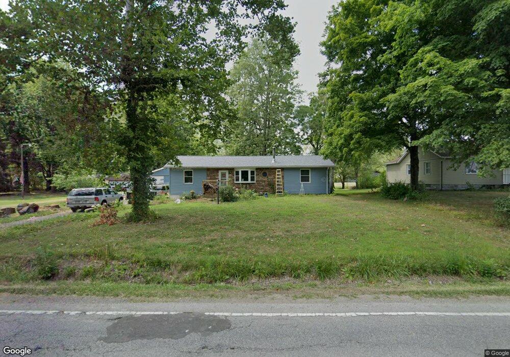
7124 Summit Rd SW Pataskala, OH 43062
Estimated Value: $170,000 - $256,000
2
Beds
1
Bath
1,158
Sq Ft
$191/Sq Ft
Est. Value
About This Home
This home is located at 7124 Summit Rd SW, Pataskala, OH 43062 and is currently estimated at $221,734, approximately $191 per square foot. 7124 Summit Rd SW is a home located in Licking County with nearby schools including Licking Heights High School and Grace Christian School.
Ownership History
Date
Name
Owned For
Owner Type
Purchase Details
Closed on
Sep 30, 2015
Sold by
Letwein Michael and Leitwein Michael
Bought by
Sifford Emmett C and Sifford Kathy H
Current Estimated Value
Home Financials for this Owner
Home Financials are based on the most recent Mortgage that was taken out on this home.
Original Mortgage
$62,742
Outstanding Balance
$25,031
Interest Rate
3.5%
Mortgage Type
FHA
Estimated Equity
$196,703
Purchase Details
Closed on
Feb 10, 2010
Sold by
Pcg Reo Holdings Llc
Bought by
Letwein Mike
Purchase Details
Closed on
Jan 26, 2010
Sold by
Rommel Eugene W
Bought by
Pcg Reo Holdings Llc
Purchase Details
Closed on
Jul 19, 1995
Sold by
Rotonda Maurine B
Bought by
Rommel Eugene W and Rommel Leisha A
Home Financials for this Owner
Home Financials are based on the most recent Mortgage that was taken out on this home.
Original Mortgage
$83,600
Interest Rate
8%
Mortgage Type
VA
Create a Home Valuation Report for This Property
The Home Valuation Report is an in-depth analysis detailing your home's value as well as a comparison with similar homes in the area
Home Values in the Area
Average Home Value in this Area
Purchase History
| Date | Buyer | Sale Price | Title Company |
|---|---|---|---|
| Sifford Emmett C | $95,850 | Gahanna Title | |
| Letwein Mike | $34,900 | Trust Titl | |
| Pcg Reo Holdings Llc | $40,000 | None Available | |
| Rommel Eugene W | $82,000 | -- |
Source: Public Records
Mortgage History
| Date | Status | Borrower | Loan Amount |
|---|---|---|---|
| Open | Sifford Emmett C | $62,742 | |
| Previous Owner | Rommel Eugene W | $83,600 |
Source: Public Records
Tax History
| Year | Tax Paid | Tax Assessment Tax Assessment Total Assessment is a certain percentage of the fair market value that is determined by local assessors to be the total taxable value of land and additions on the property. | Land | Improvement |
|---|---|---|---|---|
| 2024 | $3,076 | $60,000 | $24,610 | $35,390 |
| 2023 | $3,191 | $60,000 | $24,610 | $35,390 |
| 2022 | $2,654 | $43,050 | $13,650 | $29,400 |
| 2021 | $2,911 | $46,340 | $13,650 | $32,690 |
| 2020 | $2,878 | $46,340 | $13,650 | $32,690 |
| 2019 | $2,879 | $37,870 | $13,650 | $24,220 |
| 2018 | $2,906 | $0 | $0 | $0 |
| 2017 | $2,965 | $0 | $0 | $0 |
| 2016 | $2,777 | $0 | $0 | $0 |
| 2015 | $2,725 | $0 | $0 | $0 |
| 2014 | $1,692 | $0 | $0 | $0 |
| 2013 | $12,572 | $0 | $0 | $0 |
Source: Public Records
Map
Nearby Homes
- 805 Saddle Ave
- 49 Summit Ridge Rd S
- 634 Keltoncrest Dr
- 413 Halton Dr
- 112 Old Bay Loop
- 521 Curry Dr
- 8056 Summit Rd SW
- 13756 Cleveland Rd SW
- 13734 Cleveland Rd SW
- 156 Arbor Ln SW
- 6953 Taylor Rd SW
- 242 Monarch Dr
- 65 Daley Dr SW
- 844 Brosmer Dr
- 6725 Taylor Rd SW
- 211 Rona Blvd
- 8774 Ormiston Cir
- 8827 Firstgate Dr
- 912 Mahle Dr
- 8900 Latham Ct
- 7098 Summit Rd SW
- 7128 Summit Rd SW
- 7156 Summit Rd SW
- 7090 Summit Rd SW
- 7174 Summit Rd SW
- 7080 Summit Rd SW
- 307 Woods Edge Loop
- 305 Woods Edge Loop
- 309 Woods Edge Loop
- 303 Woods Edge Loop
- 7048 Summit Rd SW
- 7200 Summit Rd SW
- 301 Woods Edge Loop
- 311 Woods Edge Loop
- 313 Woods Edge Loop
- 202 Autumn Way
- 315 Woods Edge Loop
- 204 Autumn Way
- 312 Woods Edge Loop
- 304 Woods Edge Loop
Your Personal Tour Guide
Ask me questions while you tour the home.