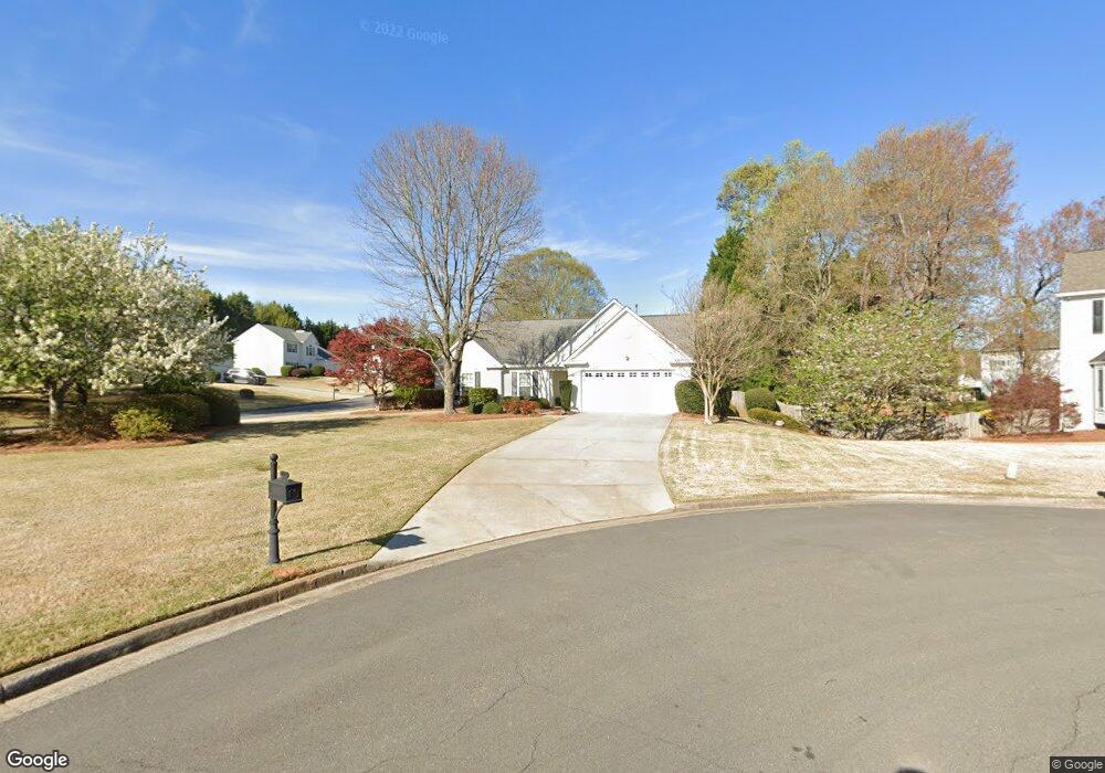
7125 Titchfield Place Cumming, GA 30041
Estimated Value: $541,000 - $567,000
3
Beds
2
Baths
1,842
Sq Ft
$300/Sq Ft
Est. Value
About This Home
This home is located at 7125 Titchfield Place, Cumming, GA 30041 and is currently estimated at $552,318, approximately $299 per square foot. 7125 Titchfield Place is a home located in Forsyth County with nearby schools including Brookwood Elementary School, South Forsyth Middle School, and Lambert High School.
Ownership History
Date
Name
Owned For
Owner Type
Purchase Details
Closed on
Nov 16, 2005
Sold by
Mcgee Brian E and Mcgee Laurie B
Bought by
Vonzweck Ortwin and Von Zweck Ann
Current Estimated Value
Home Financials for this Owner
Home Financials are based on the most recent Mortgage that was taken out on this home.
Original Mortgage
$170,400
Outstanding Balance
$93,707
Interest Rate
6.1%
Mortgage Type
New Conventional
Estimated Equity
$458,611
Purchase Details
Closed on
May 19, 2004
Sold by
Mock Kerry D and Mock Kristin
Bought by
Mcgee Brian E and Mcgee Laurie
Purchase Details
Closed on
May 16, 1997
Sold by
Pulte Home Corp
Bought by
Mock Kerry D and Mock Kristen J
Home Financials for this Owner
Home Financials are based on the most recent Mortgage that was taken out on this home.
Original Mortgage
$105,750
Interest Rate
7.97%
Mortgage Type
New Conventional
Create a Home Valuation Report for This Property
The Home Valuation Report is an in-depth analysis detailing your home's value as well as a comparison with similar homes in the area
Home Values in the Area
Average Home Value in this Area
Purchase History
| Date | Buyer | Sale Price | Title Company |
|---|---|---|---|
| Vonzweck Ortwin | $213,000 | -- | |
| Mcgee Brian E | $195,000 | -- | |
| Mock Kerry D | $141,100 | -- |
Source: Public Records
Mortgage History
| Date | Status | Borrower | Loan Amount |
|---|---|---|---|
| Open | Vonzweck Ortwin | $170,400 | |
| Previous Owner | Mock Kerry D | $105,750 |
Source: Public Records
Tax History Compared to Growth
Tax History
| Year | Tax Paid | Tax Assessment Tax Assessment Total Assessment is a certain percentage of the fair market value that is determined by local assessors to be the total taxable value of land and additions on the property. | Land | Improvement |
|---|---|---|---|---|
| 2025 | $589 | $203,364 | $78,000 | $125,364 |
| 2024 | $589 | $200,480 | $68,000 | $132,480 |
| 2023 | $489 | $179,392 | $60,000 | $119,392 |
| 2022 | $585 | $117,516 | $40,000 | $77,516 |
| 2021 | $557 | $117,516 | $40,000 | $77,516 |
| 2020 | $556 | $116,940 | $40,000 | $76,940 |
| 2019 | $560 | $116,360 | $40,000 | $76,360 |
| 2018 | $548 | $92,820 | $30,000 | $62,820 |
| 2017 | $549 | $87,360 | $30,000 | $57,360 |
| 2016 | $549 | $87,360 | $30,000 | $57,360 |
| 2015 | $542 | $82,680 | $30,000 | $52,680 |
| 2014 | $501 | $74,264 | $26,000 | $48,264 |
Source: Public Records
Map
Nearby Homes
- 7045 Harlech Trace
- 7335 Lytham Trace
- 7170 Collingsworth Place
- 7105 Brookwood Way
- 110 W Meadows Ct
- 7260 Fawn Lake Dr
- 7530 Newstead Dr
- 3585 Lakeheath Dr
- 3730 Lakeheath Dr
- 3715 Lakeheath Dr
- 4020 Bridle Ridge Dr
- 5735 Sunset Maple Dr
- 5650 Preserve Cir
- 680 Evening Pine Ln
- 11915 Carriage Park Ln
- 595 Barsham Way
- 3820 Ridge Point Dr
- 7135 Titchfield Place
- 7120 Brassfield Dr Unit 11
- 0 Brassfield Dr Unit 8368855
- 0 Brassfield Dr Unit 8585167
- 7105 Brassfield Dr
- 0 Titchfield Place Unit 7432346
- 0 Titchfield Place
- 7115 Brassfield Dr
- 7265 Treyburn Dr Unit II
- 7140 Titchfield Place Unit 11
- 7130 Titchfield Place
- 7110 Titchfield Place
- 7130 Brassfield Dr
- 7285 Treyburn Dr
- 7045 Brassfield Dr
- 7255 Treyburn Dr
- 7120 Titchfield Place Unit 11
- 7125 Brassfield Dr
- 7245 Treyburn Dr
- 7345 Braelocke Ct Unit III