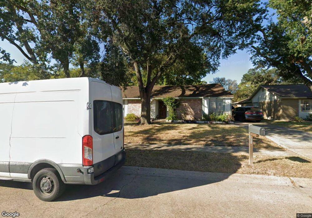
7126 Brook Stone Dr Houston, TX 77040
Greater Inwood NeighborhoodEstimated Value: $236,450 - $247,000
3
Beds
2
Baths
1,751
Sq Ft
$138/Sq Ft
Est. Value
About This Home
This home is located at 7126 Brook Stone Dr, Houston, TX 77040 and is currently estimated at $241,113, approximately $137 per square foot. 7126 Brook Stone Dr is a home located in Harris County with nearby schools including Holbrook Elementary School, Dean Middle School, and Jersey Village High School.
Ownership History
Date
Name
Owned For
Owner Type
Purchase Details
Closed on
Feb 23, 2015
Sold by
The Oliver F Stork And Rose Marie Nelius
Bought by
Montalvo Ashly Melannie
Current Estimated Value
Home Financials for this Owner
Home Financials are based on the most recent Mortgage that was taken out on this home.
Original Mortgage
$124,160
Outstanding Balance
$94,816
Interest Rate
3.68%
Mortgage Type
New Conventional
Estimated Equity
$146,297
Create a Home Valuation Report for This Property
The Home Valuation Report is an in-depth analysis detailing your home's value as well as a comparison with similar homes in the area
Home Values in the Area
Average Home Value in this Area
Purchase History
| Date | Buyer | Sale Price | Title Company |
|---|---|---|---|
| Montalvo Ashly Melannie | -- | Capital Title |
Source: Public Records
Mortgage History
| Date | Status | Borrower | Loan Amount |
|---|---|---|---|
| Open | Montalvo Ashly Melannie | $124,160 |
Source: Public Records
Tax History Compared to Growth
Tax History
| Year | Tax Paid | Tax Assessment Tax Assessment Total Assessment is a certain percentage of the fair market value that is determined by local assessors to be the total taxable value of land and additions on the property. | Land | Improvement |
|---|---|---|---|---|
| 2025 | $2,817 | $204,989 | $60,906 | $144,083 |
| 2024 | $2,817 | $214,962 | $60,906 | $154,056 |
| 2023 | $2,817 | $213,164 | $60,906 | $152,258 |
| 2022 | $4,263 | $191,258 | $50,863 | $140,395 |
| 2021 | $4,052 | $156,790 | $50,863 | $105,927 |
| 2020 | $3,964 | $161,528 | $35,772 | $125,756 |
| 2019 | $3,751 | $141,296 | $21,463 | $119,833 |
| 2018 | $1,772 | $123,038 | $21,463 | $101,575 |
| 2017 | $3,407 | $123,038 | $21,463 | $101,575 |
| 2016 | $3,407 | $123,038 | $21,463 | $101,575 |
| 2015 | $2,546 | $114,711 | $17,886 | $96,825 |
| 2014 | $2,546 | $90,425 | $17,886 | $72,539 |
Source: Public Records
Map
Nearby Homes
- 7218 Stonegate Dr
- 8615 Black Tern Ln
- 7259 Shady Arbor Ln
- 6902 Anson Point Ln
- 8610 Twillingate Ln
- 7318 Shady Grove Ln
- 9350 Guywood St
- 6407 Deirdre Anne Dr
- 9331 Deanwood St
- 6310 Silver Chalice Dr
- 7718 Breezeway St
- 6338 Maple Hill Dr
- 9523 Vanwood St
- 7051 Majestic Oaks Dr
- 9207 Loren Ln
- 6430 Pirtlewood Cir
- 7218 Jadewood Dr Unit 770
- 8007 E Oakwood Ct
- 9214 Woodland Oaks Dr
- 7219 Ridge Oak Dr
- 7122 Brook Stone Dr
- 7130 Brook Stone Dr
- 8814 Arbor Wood Dr
- 8810 Arbor Wood Dr
- 7118 Brook Stone Dr
- 7134 Brook Stone Dr
- 7127 Brook Stone Dr
- 8806 Arbor Wood Dr
- 7131 Brook Stone Dr
- 7114 Brook Stone Dr
- 7138 Brook Stone Dr
- 8807 Stone Brook Ln
- 7119 Brook Stone Dr
- 7135 Brook Stone Dr
- 8802 Arbor Wood Dr
- 8811 Stone Brook Ln
- 7115 Brook Stone Dr
- 7139 Brook Stone Dr
- 8822 Arbor Wood Dr
- 8815 Stone Brook Ln