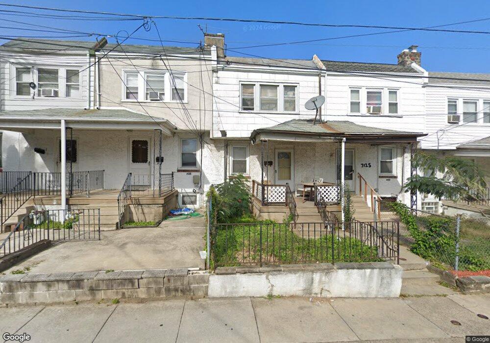
7127 Emerson Ave Upper Darby, PA 19082
Estimated Value: $96,000 - $420,631
2
Beds
2
Baths
992
Sq Ft
$195/Sq Ft
Est. Value
About This Home
This home is located at 7127 Emerson Ave, Upper Darby, PA 19082 and is currently estimated at $193,158, approximately $194 per square foot. 7127 Emerson Ave is a home located in Delaware County with nearby schools including Upper Darby Kdg Center, Upper Darby High School, and Vision Academy Charter School.
Ownership History
Date
Name
Owned For
Owner Type
Purchase Details
Closed on
Jun 30, 2021
Sold by
Lxr Rs X Llc
Bought by
Lxr Lpp 9 Llc
Current Estimated Value
Purchase Details
Closed on
Jun 3, 2019
Sold by
Friel Daniel and Vitali Louis
Bought by
Lxr Rs X Llc
Purchase Details
Closed on
Nov 22, 2006
Sold by
Hud
Bought by
Friel Daniel and Vitali Louis
Purchase Details
Closed on
Feb 3, 2006
Sold by
Aurora Loan Services Inc
Bought by
Hud
Purchase Details
Closed on
Jan 11, 2006
Sold by
Deangelis Anthony and Mortgage Electronic Registrati
Bought by
Aurora Loan Services Inc
Create a Home Valuation Report for This Property
The Home Valuation Report is an in-depth analysis detailing your home's value as well as a comparison with similar homes in the area
Home Values in the Area
Average Home Value in this Area
Purchase History
| Date | Buyer | Sale Price | Title Company |
|---|---|---|---|
| Lxr Lpp 9 Llc | -- | None Available | |
| Lxr Rs X Llc | $34,000 | None Available | |
| Friel Daniel | $38,000 | None Available | |
| Hud | -- | None Available | |
| Aurora Loan Services Inc | $5,000 | None Available |
Source: Public Records
Tax History
| Year | Tax Paid | Tax Assessment Tax Assessment Total Assessment is a certain percentage of the fair market value that is determined by local assessors to be the total taxable value of land and additions on the property. | Land | Improvement |
|---|---|---|---|---|
| 2025 | $1,438 | $34,000 | $13,330 | $20,670 |
| 2024 | $1,438 | $34,000 | $13,330 | $20,670 |
| 2023 | $1,424 | $34,000 | $13,330 | $20,670 |
| 2022 | $1,386 | $34,000 | $13,330 | $20,670 |
| 2021 | $1,869 | $34,000 | $13,330 | $20,670 |
| 2020 | $2,007 | $31,020 | $12,120 | $18,900 |
| 2019 | $2,512 | $39,530 | $12,120 | $27,410 |
| 2018 | $2,483 | $39,530 | $0 | $0 |
| 2017 | $2,419 | $39,530 | $0 | $0 |
| 2016 | $217 | $39,530 | $0 | $0 |
| 2015 | $217 | $39,530 | $0 | $0 |
| 2014 | $217 | $39,530 | $0 | $0 |
Source: Public Records
Map
Nearby Homes
- 7117 Atlantic Ave
- 7010 Atlantic Ave
- 7160 Clover Ln
- 104 Oak Ave
- 7000 Greenwood Ave
- 120 Lewis Ave
- 7042 Clinton Rd
- 7043 Radbourne Rd
- 7218 Radbourne Rd
- 6866 Clover Ln
- 7056 Aberdeen Rd
- 614 Littlecroft Rd
- 109 Lexington Ave
- 6993 Guilford Rd
- 6997 Guilford Rd
- 7023 Guilford Rd
- 57 Lexington Ave
- 135 Hirst Ave
- 0 Hirst Ave
- 535 Wiltshire Rd
- 7125 Emerson Ave
- 7129 Emerson Ave
- 7123 Emerson Ave
- 7131 Emerson Ave
- 7121 Emerson Ave
- 7128 Seaford Rd
- 7119 Emerson Ave
- 7126 Seaford Rd
- 7130 Seaford Rd
- 7132 Seaford Rd
- 7122 Seaford Rd
- 7134 Seaford Rd
- 7117 Emerson Ave
- 7120 Seaford Rd
- 7136 Seaford Rd
- 7122 Emerson Ave
- 7118 Seaford Rd
- 7124 Seaford Ave
- 7115 Emerson Ave
- 7116 Seaford Rd
Your Personal Tour Guide
Ask me questions while you tour the home.