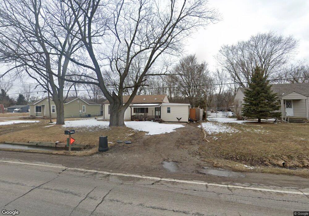
7127 Lapeer Rd Unit Bldg-Unit Davison, MI 48423
Estimated Value: $161,000 - $204,000
Studio
2
Baths
1,280
Sq Ft
$143/Sq Ft
Est. Value
About This Home
This home is located at 7127 Lapeer Rd Unit Bldg-Unit, Davison, MI 48423 and is currently estimated at $183,443, approximately $143 per square foot. 7127 Lapeer Rd Unit Bldg-Unit is a home located in Genesee County with nearby schools including Thomson Elementary School, Gates Elementary School, and Hill Elementary School.
Ownership History
Date
Name
Owned For
Owner Type
Purchase Details
Closed on
Oct 10, 2022
Sold by
Storm Monica A
Bought by
Williams Lilian Rene
Current Estimated Value
Home Financials for this Owner
Home Financials are based on the most recent Mortgage that was taken out on this home.
Original Mortgage
$128,200
Outstanding Balance
$123,032
Interest Rate
5.66%
Mortgage Type
New Conventional
Estimated Equity
$60,411
Purchase Details
Closed on
Sep 5, 2018
Sold by
Batson Jennifer and Batson Matt
Bought by
Storm Monica A
Home Financials for this Owner
Home Financials are based on the most recent Mortgage that was taken out on this home.
Original Mortgage
$95,454
Interest Rate
4.5%
Mortgage Type
Purchase Money Mortgage
Purchase Details
Closed on
Aug 30, 2018
Sold by
Tree Summit Ridge Holding
Bought by
Batson Jennider and Batson Matt
Home Financials for this Owner
Home Financials are based on the most recent Mortgage that was taken out on this home.
Original Mortgage
$95,454
Interest Rate
4.5%
Mortgage Type
Purchase Money Mortgage
Purchase Details
Closed on
Jan 3, 2017
Sold by
Batson Jennay and Batson Matthew C
Bought by
Summit Ridge Holding Tree
Purchase Details
Closed on
Jun 11, 2015
Sold by
Summit Ridge Holding Tree
Bought by
Batson Jennay and Batson Matthew C
Purchase Details
Closed on
Oct 6, 2014
Sold by
Genesee County Treasurer
Bought by
Summit Ridge Holding Tree
Purchase Details
Closed on
Mar 19, 2009
Sold by
Sini Marwan Abou and Sini Mario Abou
Bought by
Sini Marwan Abou and Hatoum Sermin Abou
Purchase Details
Closed on
Mar 8, 2006
Sold by
Brock Patrick
Bought by
Hsbc Bank Usa Na
Purchase Details
Closed on
Jan 6, 2005
Sold by
Brock Donald
Bought by
Brock Patrick
Home Financials for this Owner
Home Financials are based on the most recent Mortgage that was taken out on this home.
Original Mortgage
$82,400
Interest Rate
9.12%
Mortgage Type
Purchase Money Mortgage
Purchase Details
Closed on
Sep 3, 2003
Sold by
Christensen Thomas J and Christensen Andrea
Bought by
Brock Donald J
Create a Home Valuation Report for This Property
The Home Valuation Report is an in-depth analysis detailing your home's value as well as a comparison with similar homes in the area
Home Values in the Area
Average Home Value in this Area
Purchase History
| Date | Buyer | Sale Price | Title Company |
|---|---|---|---|
| Williams Lilian Rene | $136,900 | -- | |
| Storm Monica A | $92,000 | None Available | |
| Batson Jennider | $57,585 | Sun Title Agency Of Michigan | |
| Summit Ridge Holding Tree | -- | None Available | |
| Batson Jennay | -- | Attorney | |
| Summit Ridge Holding Tree | $15,000 | None Available | |
| Sini Marwan Abou | -- | None Available | |
| Hsbc Bank Usa Na | $92,756 | None Available | |
| Brock Patrick | $103,000 | Philip R Seaver Title Co Inc | |
| Brock Donald J | $72,000 | Cislo Title Company |
Source: Public Records
Mortgage History
| Date | Status | Borrower | Loan Amount |
|---|---|---|---|
| Open | Williams Lilian Rene | $128,200 | |
| Previous Owner | Storm Monica A | $95,454 | |
| Previous Owner | Brock Patrick | $82,400 | |
| Closed | Williams Lilian Rene | $10,000 |
Source: Public Records
Tax History
| Year | Tax Paid | Tax Assessment Tax Assessment Total Assessment is a certain percentage of the fair market value that is determined by local assessors to be the total taxable value of land and additions on the property. | Land | Improvement |
|---|---|---|---|---|
| 2025 | $2,472 | $68,400 | $0 | $0 |
| 2024 | $679 | $64,300 | $0 | $0 |
| 2023 | $648 | $56,300 | $0 | $0 |
| 2022 | $2,018 | $51,100 | $0 | $0 |
| 2021 | $2,002 | $48,900 | $0 | $0 |
| 2020 | $523 | $48,700 | $0 | $0 |
| 2019 | $514 | $44,300 | $0 | $0 |
| 2018 | $2,192 | $38,800 | $0 | $0 |
| 2017 | $2,118 | $38,800 | $0 | $0 |
| 2016 | $1,291 | $32,100 | $0 | $0 |
| 2015 | -- | $30,300 | $0 | $0 |
| 2012 | -- | $29,700 | $29,700 | $0 |
Source: Public Records
Map
Nearby Homes
- 7120 Lapeer Rd
- 7079 Houghton Dr
- 1388 Transue Ave
- 0 Schoolcraft Dr
- 6259 Mercury Ave
- 7244 Schoolcraft Dr
- 0 E Court St
- 1234 E Court St
- 1207 Kettering St
- 2031 Woodland Pass
- 7046 Donelson Trail
- 6123 Lapeer Rd
- 1029 Adams Rd
- 2238 Antrim Ct
- 6054 Lapeer Rd
- 1056 Adams Rd
- 2223 Antrim Dr
- Lot 80 Antrim Dr
- 2231 Antrim Dr
- 0 N Irish Rd Unit 50197028
- 7127 Lapeer Rd
- 7143 Lapeer Rd
- 7121 Lapeer Rd
- 7099 Lapeer Rd
- 7093 Lapeer Rd
- 7153 Lapeer Rd
- 7135 Lapeer Rd
- 7130 Lapeer Rd
- 7087 Lapeer Rd Unit Bldg-Unit
- 7113 Lapeer Rd
- 7082 Lapeer Rd
- 7081 Lapeer Rd
- 0 Lapeer Unit 4955596
- 0 Lapeer
- 0 Lapeer Unit R213044587
- 0 Lapeer Unit G20375345
- 0 Lapeer Unit R214008163
- 0 Lapeer Unit G20426907
- 0 Lapeer Unit G21255598
- 7070 Lapeer Rd
Your Personal Tour Guide
Ask me questions while you tour the home.