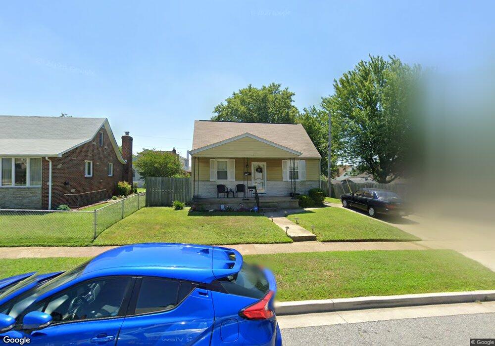
7127 Railway Ave Dundalk, MD 21222
Estimated Value: $193,000 - $253,000
Studio
1
Bath
1,224
Sq Ft
$185/Sq Ft
Est. Value
About This Home
This home is located at 7127 Railway Ave, Dundalk, MD 21222 and is currently estimated at $226,717, approximately $185 per square foot. 7127 Railway Ave is a home located in Baltimore County with nearby schools including Norwood Elementary School, Holabird Middle School, and Dundalk High School.
Ownership History
Date
Name
Owned For
Owner Type
Purchase Details
Closed on
Aug 31, 2023
Sold by
Sealover Lorraine Lee
Bought by
Kirby Chad
Current Estimated Value
Home Financials for this Owner
Home Financials are based on the most recent Mortgage that was taken out on this home.
Original Mortgage
$164,900
Outstanding Balance
$159,029
Interest Rate
5%
Mortgage Type
New Conventional
Estimated Equity
$67,688
Purchase Details
Closed on
May 11, 2016
Sold by
Sealover Lorraine L and Sealover Kimberly S
Bought by
Sealover Lorraine L
Purchase Details
Closed on
Jan 24, 2003
Sold by
Sealover Lorraine L
Bought by
Sealover Lorraine L
Purchase Details
Closed on
Oct 12, 2000
Sold by
Sealover Edward H
Bought by
Sealover Lorraine L
Create a Home Valuation Report for This Property
The Home Valuation Report is an in-depth analysis detailing your home's value as well as a comparison with similar homes in the area
Home Values in the Area
Average Home Value in this Area
Purchase History
| Date | Buyer | Sale Price | Title Company |
|---|---|---|---|
| Kirby Chad | $170,000 | Goldstar Title | |
| Sealover Lorraine L | -- | Attorney | |
| Sealover Lorraine L | -- | -- | |
| Sealover Lorraine L | -- | -- |
Source: Public Records
Mortgage History
| Date | Status | Borrower | Loan Amount |
|---|---|---|---|
| Open | Kirby Chad | $164,900 |
Source: Public Records
Tax History
| Year | Tax Paid | Tax Assessment Tax Assessment Total Assessment is a certain percentage of the fair market value that is determined by local assessors to be the total taxable value of land and additions on the property. | Land | Improvement |
|---|---|---|---|---|
| 2025 | $2,446 | $171,400 | -- | -- |
| 2024 | $2,446 | $159,900 | $0 | $0 |
| 2023 | $1,151 | $148,400 | $60,500 | $87,900 |
| 2022 | $2,215 | $145,467 | $0 | $0 |
| 2021 | $1,442 | $142,533 | $0 | $0 |
| 2020 | $1,692 | $139,600 | $60,500 | $79,100 |
| 2019 | $1,658 | $136,833 | $0 | $0 |
| 2018 | $641 | $134,067 | $0 | $0 |
| 2017 | $695 | $131,300 | $0 | $0 |
| 2016 | $598 | $125,767 | $0 | $0 |
| 2015 | $598 | $120,233 | $0 | $0 |
| 2014 | $598 | $114,700 | $0 | $0 |
Source: Public Records
Map
Nearby Homes
- 1823 Walnut Ave
- 1703 Bethlehem Ave
- 1914 Snyder Ave
- 1214 S 48th St
- 6817 Duluth Ave
- 1708 Rita Rd
- 1305 Delvale Ave
- 1900 Monumental Rd
- 6826 Boston Ave
- 1220 Hillshire Rd
- 1802 Portship Rd
- 0 Hillshire Rd
- 1242 Delbert Ave
- 6904 Homeway
- 1502 Vesper Ave
- 138 Highshire Ct
- 1627 Malvern St
- 1849 Portship Rd
- 1116 Dundalk Ave
- 511 47th St
- 7129 Railway Ave
- 1504 Leslie Rd
- 1701 Brookview Rd
- 1703 Brookview Rd
- 1705 Brookview Rd
- 1506 Leslie Rd
- 1707 Brookview Rd
- 7131 Railway Ave
- 7128 Railway Ave
- 7126 Railway Ave
- 7130 Railway Ave
- 1508 Leslie Rd
- 7124 Railway Ave
- 1709 Brookview Rd
- 7132 Railway Ave
- 1505 Leslie Rd
- 7133 Railway Ave
- 7122 Railway Ave
- 1507 Leslie Rd
- 1510 Leslie Rd
Your Personal Tour Guide
Ask me questions while you tour the home.