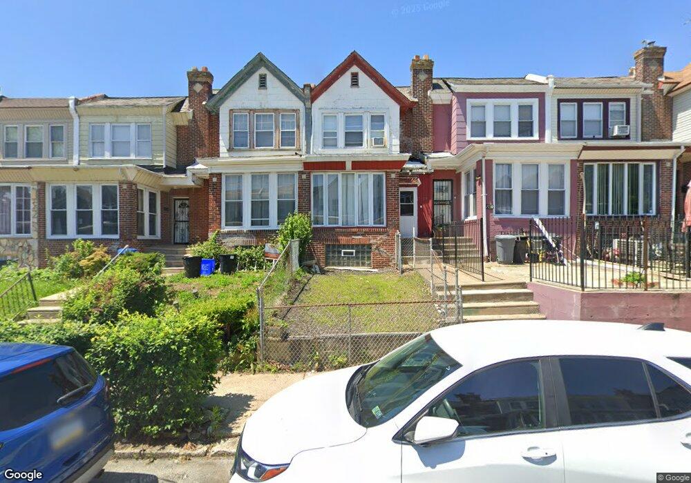
7128 Louise Rd Philadelphia, PA 19138
West Oak Lane NeighborhoodEstimated Value: $209,000 - $290,000
3
Beds
1
Bath
1,388
Sq Ft
$170/Sq Ft
Est. Value
About This Home
This home is located at 7128 Louise Rd, Philadelphia, PA 19138 and is currently estimated at $235,873, approximately $169 per square foot. 7128 Louise Rd is a home located in Philadelphia County with nearby schools including Pennypacker Samuel School, Martin Luther King High School, and West Oak Lane Charter School.
Ownership History
Date
Name
Owned For
Owner Type
Purchase Details
Closed on
Feb 27, 2002
Sold by
Lucas Arlene
Bought by
Turner William E
Current Estimated Value
Home Financials for this Owner
Home Financials are based on the most recent Mortgage that was taken out on this home.
Original Mortgage
$40,092
Outstanding Balance
$16,349
Interest Rate
7.01%
Estimated Equity
$219,525
Create a Home Valuation Report for This Property
The Home Valuation Report is an in-depth analysis detailing your home's value as well as a comparison with similar homes in the area
Home Values in the Area
Average Home Value in this Area
Purchase History
| Date | Buyer | Sale Price | Title Company |
|---|---|---|---|
| Turner William E | $40,000 | Fidelity National Title Ins |
Source: Public Records
Mortgage History
| Date | Status | Borrower | Loan Amount |
|---|---|---|---|
| Open | Turner William E | $40,092 |
Source: Public Records
Tax History Compared to Growth
Tax History
| Year | Tax Paid | Tax Assessment Tax Assessment Total Assessment is a certain percentage of the fair market value that is determined by local assessors to be the total taxable value of land and additions on the property. | Land | Improvement |
|---|---|---|---|---|
| 2026 | $2,412 | $208,900 | $41,780 | $167,120 |
| 2025 | $2,412 | $208,900 | $41,780 | $167,120 |
| 2024 | $2,412 | $208,900 | $41,780 | $167,120 |
| 2023 | $2,412 | $172,300 | $34,460 | $137,840 |
| 2022 | $1,202 | $127,300 | $34,460 | $92,840 |
| 2021 | $1,832 | $0 | $0 | $0 |
| 2020 | $1,832 | $0 | $0 | $0 |
| 2019 | $1,914 | $0 | $0 | $0 |
| 2018 | $1,657 | $0 | $0 | $0 |
| 2017 | $1,657 | $0 | $0 | $0 |
| 2016 | $1,237 | $0 | $0 | $0 |
| 2015 | $1,185 | $0 | $0 | $0 |
| 2014 | -- | $118,400 | $10,368 | $108,032 |
| 2012 | -- | $14,592 | $2,961 | $11,631 |
Source: Public Records
Map
Nearby Homes
- 7349 E Walnut Ln
- 1623 Middleton St
- 1839 E Pastorius St
- 7001 Limekiln Pike
- 7092 Forrest Ave
- 1821 E Tulpehocken St
- 7206 Forrest Ave
- 1822 Nolan St
- 1544 Beverly Rd
- 1762 Mohican St
- 6944 Cedar Park Ave
- 1559 E Pastorius St
- 1521 E Walnut Ln
- 1537 Beverly Rd
- 1544 E Tulpehocken St
- 1759 E Mayland St
- 2070 E Haines St
- 6635 Hollis St
- 7245 Ogontz Ave
- 6905 Forrest Ave
- 7126 Louise Rd
- 7130 Louise Rd
- 7132 Louise Rd
- 7124 Louise Rd
- 7122 Louise Rd
- 7134 Louise Rd
- 7120 Louise Rd
- 7131 Woolston Ave
- 7118 Louise Rd
- 7116 Louise Rd
- 7129 Woolston Ave
- 7125 Woolston Ave
- 7114 Louise Rd
- 7123 Woolston Ave
- 7121 Woolston Ave
- 7112 Louise Rd
- 7129 Louise Rd
- 7127 Louise Rd
- 7119 Woolston Ave
- 7133 Louise Rd