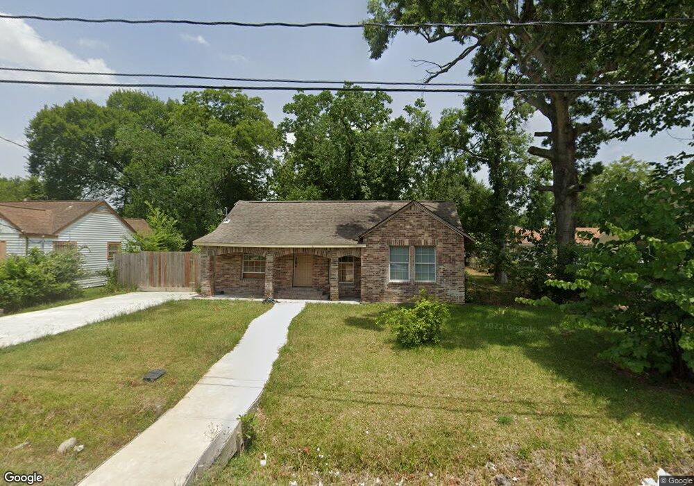
7129 Goforth St Houston, TX 77021
OST-South Union NeighborhoodEstimated Value: $171,352 - $206,000
3
Beds
1
Bath
1,114
Sq Ft
$166/Sq Ft
Est. Value
About This Home
This home is located at 7129 Goforth St, Houston, TX 77021 and is currently estimated at $184,838, approximately $165 per square foot. 7129 Goforth St is a home located in Harris County with nearby schools including Marcellus Elliot Foster Elementary, Cullen Middle School, and Yates High School.
Ownership History
Date
Name
Owned For
Owner Type
Purchase Details
Closed on
Jan 16, 2025
Sold by
Saharat Ltd
Bought by
Alsatar International
Current Estimated Value
Purchase Details
Closed on
Jul 3, 2015
Sold by
Koronfel Sarah Niazy Amin
Bought by
Saharat Ltd
Purchase Details
Closed on
May 7, 2013
Sold by
Antoine Lodie and Antoine Sandra Dee
Bought by
Harris County and City Of Houston Houston Independent Scho
Create a Home Valuation Report for This Property
The Home Valuation Report is an in-depth analysis detailing your home's value as well as a comparison with similar homes in the area
Home Values in the Area
Average Home Value in this Area
Purchase History
| Date | Buyer | Sale Price | Title Company |
|---|---|---|---|
| Alsatar International | -- | None Listed On Document | |
| Saharat Ltd | -- | None Available | |
| Harris County | -- | None Available |
Source: Public Records
Tax History Compared to Growth
Tax History
| Year | Tax Paid | Tax Assessment Tax Assessment Total Assessment is a certain percentage of the fair market value that is determined by local assessors to be the total taxable value of land and additions on the property. | Land | Improvement |
|---|---|---|---|---|
| 2025 | $3,174 | $159,799 | $128,750 | $31,049 |
| 2024 | $3,174 | $151,715 | $128,750 | $22,965 |
| 2023 | $3,057 | $151,715 | $115,875 | $35,840 |
| 2022 | $2,805 | $98,000 | $90,125 | $7,875 |
| 2021 | $1,533 | $65,767 | $57,938 | $7,829 |
| 2020 | $2,050 | $84,640 | $38,625 | $46,015 |
| 2019 | $2,148 | $84,883 | $32,188 | $52,695 |
| 2018 | $799 | $31,583 | $22,531 | $9,052 |
| 2017 | $506 | $40,926 | $16,094 | $24,832 |
| 2016 | $999 | $39,506 | $16,094 | $23,412 |
| 2015 | -- | $16,194 | $16,094 | $100 |
| 2014 | -- | $29,514 | $16,094 | $13,420 |
Source: Public Records
Map
Nearby Homes
- 7129 Foster St
- 7107 Foster St Unit A
- 7130 Eastwood St
- 7127 England St
- 7117 England St Unit C
- 7117 England St Unit A
- 7117 England St Unit B
- 7125 England St
- 7115 England St Unit A
- 7129 England St
- 7131 Eastwood St Unit A
- 7131 Eastwood St Unit C
- 7210 England St
- 7226 England St
- 7117 Saint Augustine St
- 7109 Saint Augustine St
- 7241 England St
- 4407 Alice St
- 7016 Conley St
- 7301 Conley St
- 7125 Goforth St
- 7131 Goforth St
- 7128 Foster St
- 7124 Foster St
- 7132 Foster St
- 7123 Goforth St
- 7135 Goforth St
- 7118 Foster St
- 7124 Goforth St
- 7120 Goforth St
- 7128 Goforth St
- 7136 Foster St
- 7121 Goforth St
- 7136 Goforth St
- 7116 Goforth St
- 7119 Goforth St
- 7116 Foster St
- 7117 Goforth St
- 7121 Sidney St
- 7123 Foster St