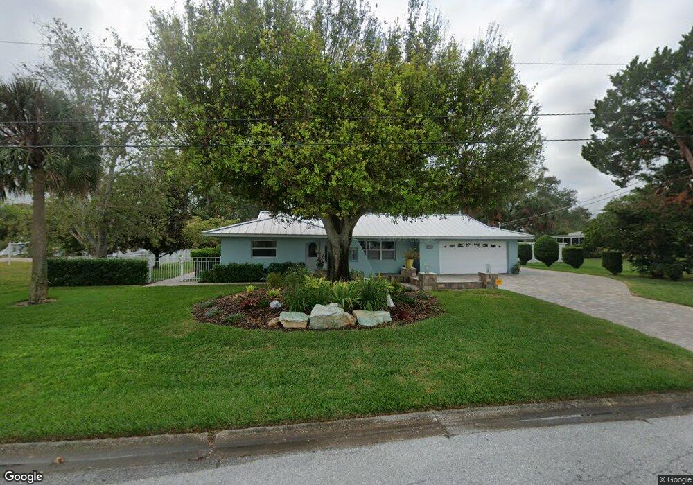
7129 Westmoreland Dr Sarasota, FL 34243
Estimated Value: $603,125 - $1,006,000
3
Beds
2
Baths
1,862
Sq Ft
$391/Sq Ft
Est. Value
About This Home
This home is located at 7129 Westmoreland Dr, Sarasota, FL 34243 and is currently estimated at $727,531, approximately $390 per square foot. 7129 Westmoreland Dr is a home located in Manatee County with nearby schools including Florine J. Abel Elementary School, Electa Lee Magnet Middle School, and Bayshore High School.
Ownership History
Date
Name
Owned For
Owner Type
Purchase Details
Closed on
Jun 22, 2020
Sold by
Hovis Allen W and Matarese Marnie E
Bought by
Hovis Allen W and Matarese Marnie E
Current Estimated Value
Purchase Details
Closed on
Mar 24, 1998
Sold by
Sarasota Manatee Airport Authority
Bought by
Hovis Allen W and Hovis Warren A
Purchase Details
Closed on
Nov 18, 1997
Sold by
Anderson Helen F
Bought by
Sarasota Manatee Airport Authority
Purchase Details
Closed on
Mar 8, 1995
Sold by
Anderson Helen F
Bought by
Anderson Helen F
Create a Home Valuation Report for This Property
The Home Valuation Report is an in-depth analysis detailing your home's value as well as a comparison with similar homes in the area
Home Values in the Area
Average Home Value in this Area
Purchase History
| Date | Buyer | Sale Price | Title Company |
|---|---|---|---|
| Hovis Allen W | -- | Attorney | |
| Hovis Allen W | $165,000 | -- | |
| Sarasota Manatee Airport Authority | $182,000 | -- | |
| Anderson Helen F | -- | -- |
Source: Public Records
Tax History Compared to Growth
Tax History
| Year | Tax Paid | Tax Assessment Tax Assessment Total Assessment is a certain percentage of the fair market value that is determined by local assessors to be the total taxable value of land and additions on the property. | Land | Improvement |
|---|---|---|---|---|
| 2025 | $4,052 | $305,587 | -- | -- |
| 2024 | $4,052 | $296,975 | -- | -- |
| 2023 | $3,990 | $288,325 | $0 | $0 |
| 2022 | $3,879 | $279,927 | $0 | $0 |
| 2021 | $3,712 | $271,774 | $0 | $0 |
| 2020 | $3,825 | $268,022 | $0 | $0 |
| 2019 | $3,760 | $261,996 | $0 | $0 |
| 2018 | $3,720 | $257,111 | $0 | $0 |
| 2017 | $3,460 | $251,823 | $0 | $0 |
| 2016 | $3,447 | $246,643 | $0 | $0 |
| 2015 | $3,440 | $242,496 | $0 | $0 |
| 2014 | $3,440 | $240,571 | $0 | $0 |
| 2013 | $3,369 | $237,016 | $0 | $0 |
Source: Public Records
Map
Nearby Homes
- 7125 Westmoreland Dr
- 7118 Westmoreland Dr
- 139 Adair Ave
- 147 Adair Ave
- 7314 Westmoreland Dr
- 138 Pearl Ave
- 7324 Phillips St
- 7118 Hawks Harbor Cir
- 7150 N Tamiami Trail Unit S-512
- 7150 N Tamiami Trail Unit S-623
- 7150 N Tamiami Trail Unit C-133
- 7150 N Tamiami Trail Unit S-510
- 7150 N Tamiami Trail Unit S-615
- 7150 N Tamiami Trail Unit C 128
- 7150 N Tamiami Trail Unit S-600
- 7056 Hawks Harbor Cir
- 7418 Westmoreland Dr
- 7326 Shepherd St
- Lot 14 Phillips St
- 7142 Hawks Harbor Cir
- 117 Holly Cir
- 7133 Westmoreland Dr
- 7203 Broughton St
- 7122 Westmoreland Dr
- 7121 Westmoreland Dr
- 7126 Westmoreland Dr
- 7207 Broughton St
- 7134 Westmoreland Dr
- 7211 Broughton St
- 7116 Westmoreland Dr
- 7113 Westmoreland Dr
- 7215 Broughton St
- 121 Holly Ave
- 7137 Westmoreland Dr
- 7206 Broughton St
- 7138 Westmoreland Dr
- 7114 Westmoreland Dr
- 125 Holly Ave
- 7210 Broughton St
- 7214 Broughton St