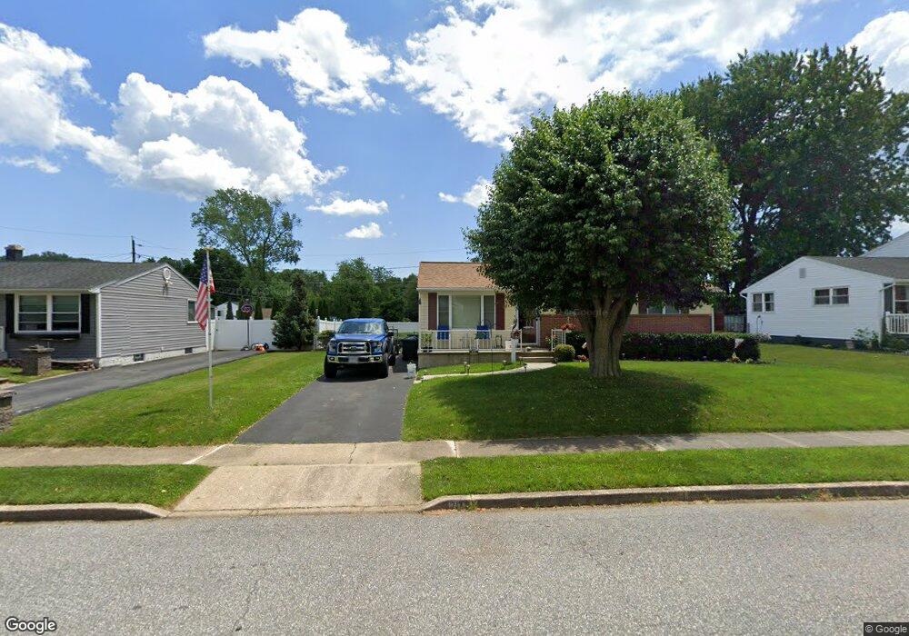
713 Cambridge Ave Aberdeen, MD 21001
Estimated Value: $273,053 - $309,000
3
Beds
2
Baths
1,040
Sq Ft
$276/Sq Ft
Est. Value
About This Home
This home is located at 713 Cambridge Ave, Aberdeen, MD 21001 and is currently estimated at $287,013, approximately $275 per square foot. 713 Cambridge Ave is a home located in Harford County with nearby schools including G. Lisby Elementary At Hillsdale, Aberdeen Middle School, and Aberdeen High School.
Ownership History
Date
Name
Owned For
Owner Type
Purchase Details
Closed on
May 6, 2009
Sold by
Edwards Deborah A
Bought by
Ponter Kimberley
Current Estimated Value
Purchase Details
Closed on
Sep 18, 1998
Sold by
Edwards Loren W
Bought by
Edwards Deborah A
Purchase Details
Closed on
Dec 20, 1994
Sold by
Hanratty Virginia C
Bought by
Edwards Loren N
Home Financials for this Owner
Home Financials are based on the most recent Mortgage that was taken out on this home.
Original Mortgage
$76,000
Interest Rate
9.03%
Create a Home Valuation Report for This Property
The Home Valuation Report is an in-depth analysis detailing your home's value as well as a comparison with similar homes in the area
Home Values in the Area
Average Home Value in this Area
Purchase History
| Date | Buyer | Sale Price | Title Company |
|---|---|---|---|
| Ponter Kimberley | $208,000 | -- | |
| Edwards Deborah A | -- | -- | |
| Edwards Loren N | $80,000 | -- |
Source: Public Records
Mortgage History
| Date | Status | Borrower | Loan Amount |
|---|---|---|---|
| Previous Owner | Edwards Loren N | $76,000 | |
| Closed | Ponter Kimberley | -- |
Source: Public Records
Tax History Compared to Growth
Tax History
| Year | Tax Paid | Tax Assessment Tax Assessment Total Assessment is a certain percentage of the fair market value that is determined by local assessors to be the total taxable value of land and additions on the property. | Land | Improvement |
|---|---|---|---|---|
| 2025 | $1,647 | $183,600 | $0 | $0 |
| 2024 | $1,647 | $172,800 | $0 | $0 |
| 2023 | $1,544 | $162,000 | $52,800 | $109,200 |
| 2022 | $1,516 | $159,067 | $0 | $0 |
| 2021 | $1,541 | $156,133 | $0 | $0 |
| 2020 | $1,541 | $153,200 | $52,800 | $100,400 |
| 2019 | $1,516 | $150,733 | $0 | $0 |
| 2018 | $1,478 | $148,267 | $0 | $0 |
| 2017 | $1,453 | $145,800 | $0 | $0 |
| 2016 | -- | $145,800 | $0 | $0 |
| 2015 | $1,734 | $145,800 | $0 | $0 |
| 2014 | $1,734 | $157,700 | $0 | $0 |
Source: Public Records
Map
Nearby Homes
- 648 S Rogers St
- 363 Stratford Ave
- 615 Pinehurst St
- 609 S Rogers St
- 426 Washington St
- 515 S Law St
- 435 Edmund St
- 458 Bonnett St
- 519 S Parke St
- 414 S Parke St
- 0 Harford St Unit MDHR2039982
- 0 S Philadelphia Blvd
- 722 Bur Oak Ct Unit 77
- 406 Ford St
- 444 Chestnut St
- 180 Old Post Rd
- 647 Elm St
- 74 Smith Ave
- 176 Darlington Ave
- 754 Custis St
- 709 Cambridge Ave
- 717 Cambridge Ave
- 705 Cambridge Ave
- 721 Cambridge Ave
- 714 Nottingham Dr
- 728 Cambridge Ave
- 732 Cambridge Ave
- 368 Walker St
- 724 Cambridge Ave
- 364 Walker St
- 718 Nottingham Dr
- 725 Cambridge Ave
- 701 Cambridge Ave
- 720 Cambridge Ave
- 710 Nottingham Dr
- 706 Nottingham Dr
- 360 Walker St
- 736 Cambridge Ave
- 722 Nottingham Dr
- 716 Cambridge Ave