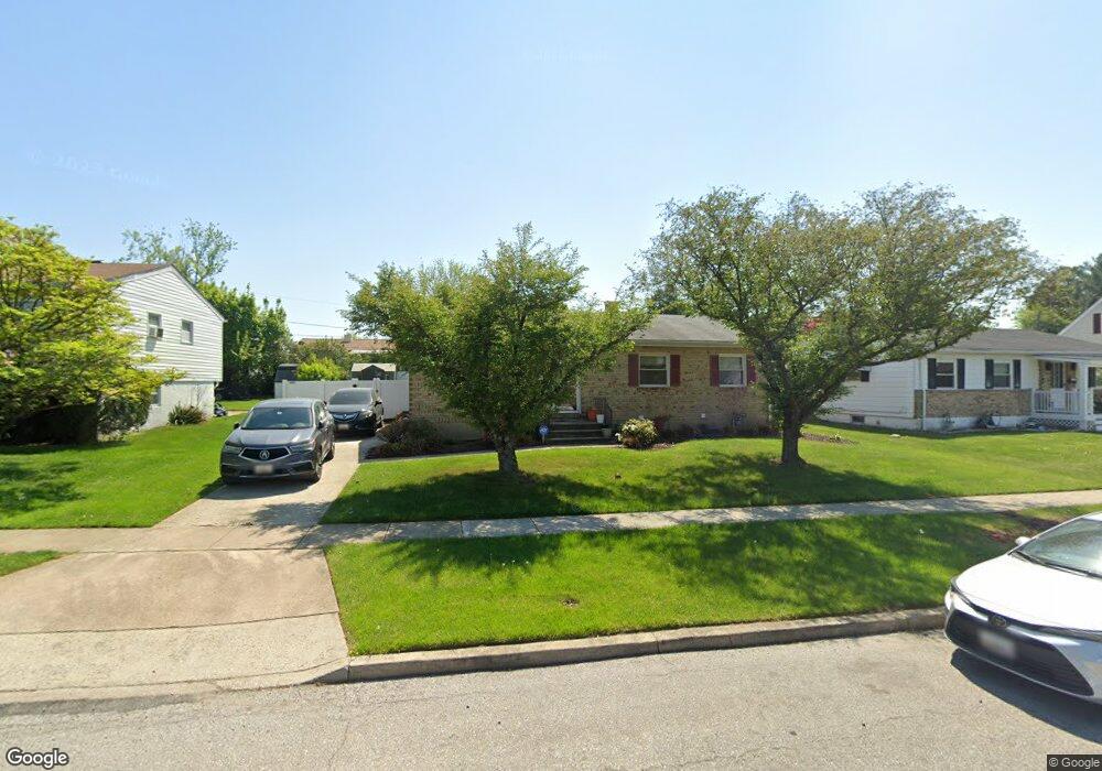
713 Crosby Rd Catonsville, MD 21228
Estimated Value: $360,000 - $412,000
3
Beds
2
Baths
1,161
Sq Ft
$332/Sq Ft
Est. Value
About This Home
This home is located at 713 Crosby Rd, Catonsville, MD 21228 and is currently estimated at $385,522, approximately $332 per square foot. 713 Crosby Rd is a home located in Baltimore County with nearby schools including Woodbridge Elementary School, Southwest Academy, and Woodlawn High School.
Ownership History
Date
Name
Owned For
Owner Type
Purchase Details
Closed on
Jun 9, 2009
Sold by
Bayholdings Inc
Bought by
Pinkney Lucille
Current Estimated Value
Purchase Details
Closed on
Feb 17, 2009
Sold by
Edwards Elwin
Bought by
Bayholdings Inc
Purchase Details
Closed on
Oct 20, 2005
Sold by
Erdmanis Ansis
Bought by
Edwards Elwin and Balram Angelena
Purchase Details
Closed on
Aug 16, 2005
Sold by
Erdmanis Ansis
Bought by
Edwards Elwin and Balram Angelena
Create a Home Valuation Report for This Property
The Home Valuation Report is an in-depth analysis detailing your home's value as well as a comparison with similar homes in the area
Home Values in the Area
Average Home Value in this Area
Purchase History
| Date | Buyer | Sale Price | Title Company |
|---|---|---|---|
| Pinkney Lucille | $205,000 | -- | |
| Bayholdings Inc | $275,000 | -- | |
| Edwards Elwin | $275,000 | -- | |
| Edwards Elwin | $275,000 | -- |
Source: Public Records
Tax History Compared to Growth
Tax History
| Year | Tax Paid | Tax Assessment Tax Assessment Total Assessment is a certain percentage of the fair market value that is determined by local assessors to be the total taxable value of land and additions on the property. | Land | Improvement |
|---|---|---|---|---|
| 2025 | $3,943 | $268,767 | -- | -- |
| 2024 | $3,943 | $241,100 | $78,200 | $162,900 |
| 2023 | $1,910 | $235,267 | $0 | $0 |
| 2022 | $3,696 | $229,433 | $0 | $0 |
| 2021 | $3,034 | $223,600 | $78,200 | $145,400 |
| 2020 | $3,034 | $216,233 | $0 | $0 |
| 2019 | $2,944 | $208,867 | $0 | $0 |
| 2018 | $2,826 | $201,500 | $64,700 | $136,800 |
| 2017 | $2,613 | $191,333 | $0 | $0 |
| 2016 | $2,849 | $181,167 | $0 | $0 |
| 2015 | $2,849 | $171,000 | $0 | $0 |
| 2014 | $2,849 | $171,000 | $0 | $0 |
Source: Public Records
Map
Nearby Homes
- 1418 Harberson Rd
- 800 Crosby Rd
- 6031 Burnt Oak Rd
- 6200 Gilston Park Rd
- 1009 Rowe Ln
- 6028 Moorehead Rd
- 3 Mcgrady Square
- 1503 Woodcliff Ave
- 6263 Gilston Park Rd
- 67 Walden Mill Way
- 1007 Kent Ave
- 1111 Cummings Ave
- 908 Vanderwood Rd
- 930 Sedgley Rd
- 6011 Johnnycake Rd
- 920 Vanderwood Rd
- 14 Madison Mills Ct
- 6001 Johnnycake Rd
- 1019 Cummings Ave
- 1013 Cummings Ave
- 711 Crosby Rd
- 715 Crosby Rd
- 6108 Wheatland Rd
- 6106 Wheatland Rd
- 709 Crosby Rd
- 717 Crosby Rd
- 6110 Wheatland Rd
- 6104 Wheatland Rd
- 1401 Harberson Rd
- 707 Crosby Rd
- 6112 Wheatland Rd
- 719 Crosby Rd
- 1400 Harberson Rd
- 6102 Wheatland Rd
- 712 Crosby Rd
- 706 Crosby Rd
- 6107 Wheatland Rd
- 6114 Wheatland Rd
- 705 Crosby Rd
- 714 Crosby Rd