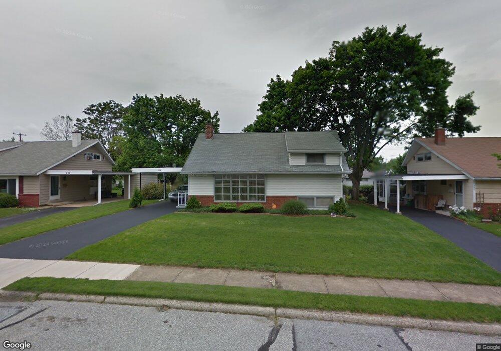
713 Gunnison Rd York, PA 17404
Devers NeighborhoodEstimated Value: $185,000 - $205,658
3
Beds
2
Baths
1,042
Sq Ft
$188/Sq Ft
Est. Value
About This Home
This home is located at 713 Gunnison Rd, York, PA 17404 and is currently estimated at $195,415, approximately $187 per square foot. 713 Gunnison Rd is a home located in York County with nearby schools including Jacob L. Devers School, William Penn Senior High School, and York Academy Regional Charter Lower School.
Ownership History
Date
Name
Owned For
Owner Type
Purchase Details
Closed on
Jul 9, 2020
Sold by
Garrett Thomas R
Bought by
Garrett Thomas R
Current Estimated Value
Home Financials for this Owner
Home Financials are based on the most recent Mortgage that was taken out on this home.
Original Mortgage
$63,940
Interest Rate
3.1%
Mortgage Type
New Conventional
Purchase Details
Closed on
Jun 22, 2020
Sold by
Garrett Thomas R and Estate Of Audrey R Garrett
Bought by
Garrett Thomas R
Home Financials for this Owner
Home Financials are based on the most recent Mortgage that was taken out on this home.
Original Mortgage
$63,940
Interest Rate
3.1%
Mortgage Type
New Conventional
Create a Home Valuation Report for This Property
The Home Valuation Report is an in-depth analysis detailing your home's value as well as a comparison with similar homes in the area
Home Values in the Area
Average Home Value in this Area
Purchase History
| Date | Buyer | Sale Price | Title Company |
|---|---|---|---|
| Garrett Thomas R | $59,224 | None Listed On Document | |
| Garrett Thomas R | -- | None Available |
Source: Public Records
Mortgage History
| Date | Status | Borrower | Loan Amount |
|---|---|---|---|
| Previous Owner | Garrett Thomas R | $63,940 |
Source: Public Records
Tax History Compared to Growth
Tax History
| Year | Tax Paid | Tax Assessment Tax Assessment Total Assessment is a certain percentage of the fair market value that is determined by local assessors to be the total taxable value of land and additions on the property. | Land | Improvement |
|---|---|---|---|---|
| 2025 | $4,954 | $78,410 | $21,020 | $57,390 |
| 2024 | $4,868 | $78,410 | $21,020 | $57,390 |
| 2023 | $4,868 | $78,410 | $21,020 | $57,390 |
| 2022 | $4,840 | $78,410 | $21,020 | $57,390 |
| 2021 | $4,706 | $78,410 | $21,020 | $57,390 |
| 2020 | $4,595 | $78,410 | $21,020 | $57,390 |
| 2019 | $4,587 | $78,410 | $21,020 | $57,390 |
| 2018 | $4,587 | $78,410 | $21,020 | $57,390 |
| 2017 | $4,649 | $78,410 | $21,020 | $57,390 |
| 2016 | -- | $78,410 | $21,020 | $57,390 |
| 2015 | $4,078 | $78,410 | $21,020 | $57,390 |
| 2014 | $4,078 | $78,410 | $21,020 | $57,390 |
Source: Public Records
Map
Nearby Homes
- 856 Gunnison Rd
- 1327 Ben Hogan Way
- 1355 Ben Hogan Way
- 1116 Burgard St
- 820 Gunnison Rd
- 857 859 Tioga St
- 1416 Dartmouth Rd
- 806 Pacific Ave
- 745 Oatman St
- 619 Colony Dr Unit 32F
- 1618 Devers Rd Unit 7C
- 1750 Devers Rd Unit 2F
- 1360 Breezeview Dr
- 383 Maryland Ave
- 827 Roosevelt Ave
- 1118 N George St
- 540 N Pershing Ave
- 538 N Pershing Ave
- 600 N Hartley St Unit 204
- 436 Linden Ave
- 709 Gunnison Rd
- 717 Gunnison Rd
- 736 Fireside Rd
- 721 Gunnison Rd
- 705 Gunnison Rd
- 732 Fireside Rd
- 740 Fireside Rd
- 716 Gunnison Rd
- 712 Gunnison Rd
- 728 Fireside Rd
- 720 Gunnison Rd
- 725 Gunnison Rd
- 708 Gunnison Rd
- 744 Fireside Rd
- 1120 Continental Rd
- 724 Gunnison Rd
- 724 Fireside Rd
- 704 Gunnison Rd
- 748 Fireside Rd
- 729 Gunnison Rd